Regional Maps
These maps contain data for the entire regional, some broken out into counties or census tracts. You may find more detailed information on each county at the links below the maps. You can download the Distance to Services Maps and the Regional Data Maps in PDF.
Distance to Services Maps
These maps contain information on where residents travel to for certain necessities.
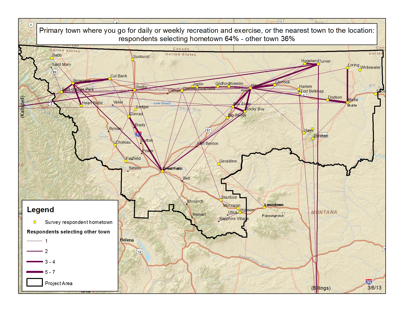
Recreation
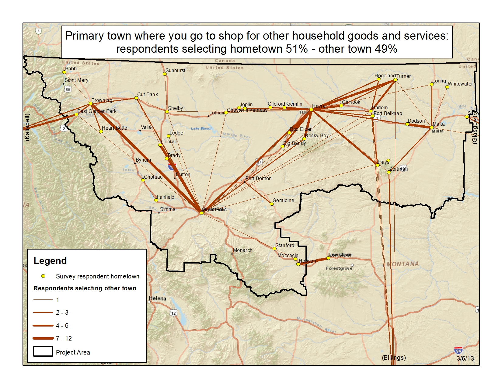
Household Goods

Groceries
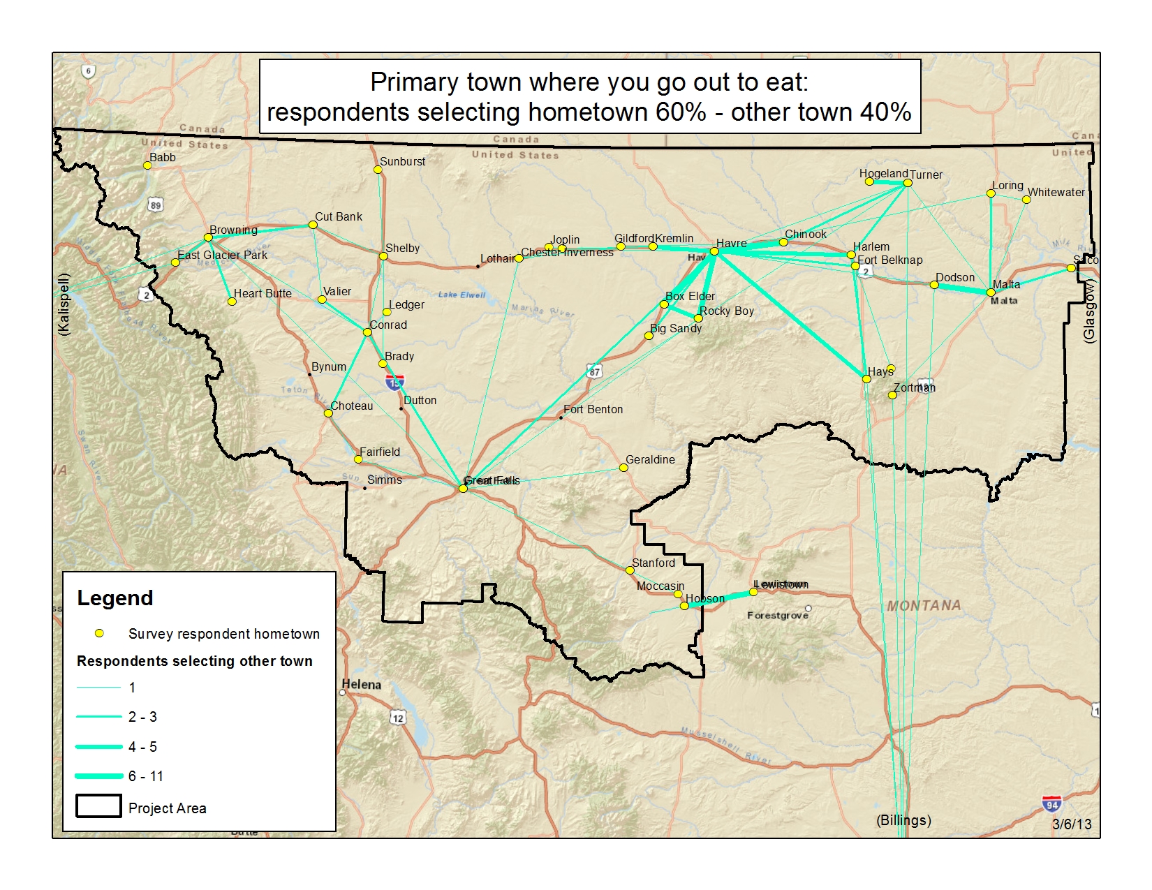
Out to Eat
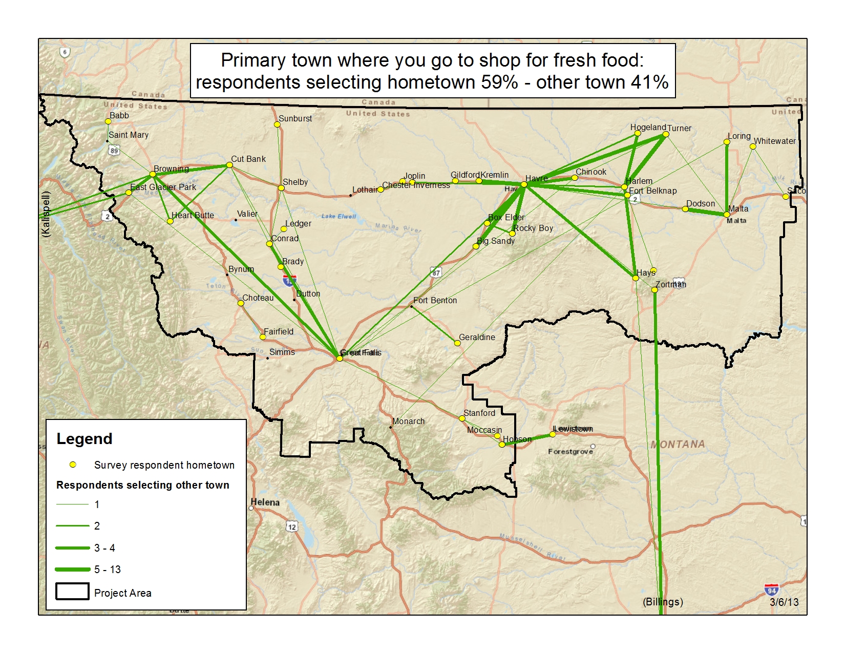
Fresh Foods
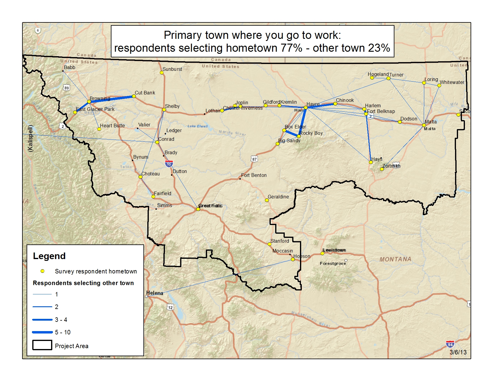
Employment
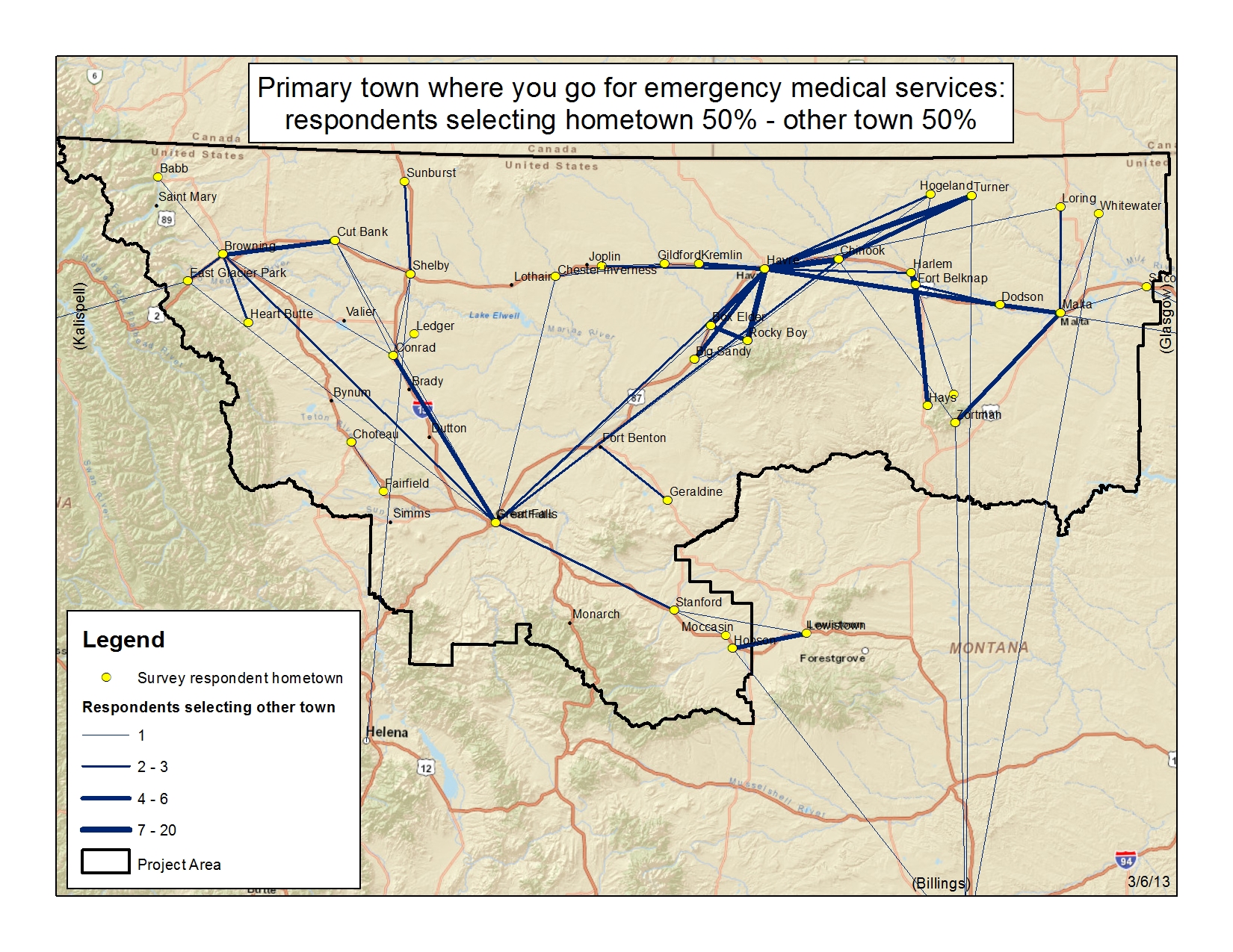
Emergency Medical
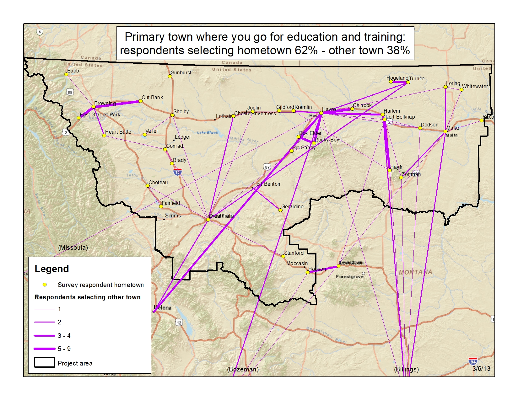
Education and Training

Auto repairs and Fuel
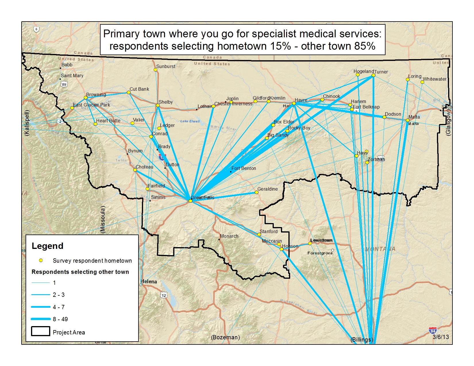
Specialty MEdicine
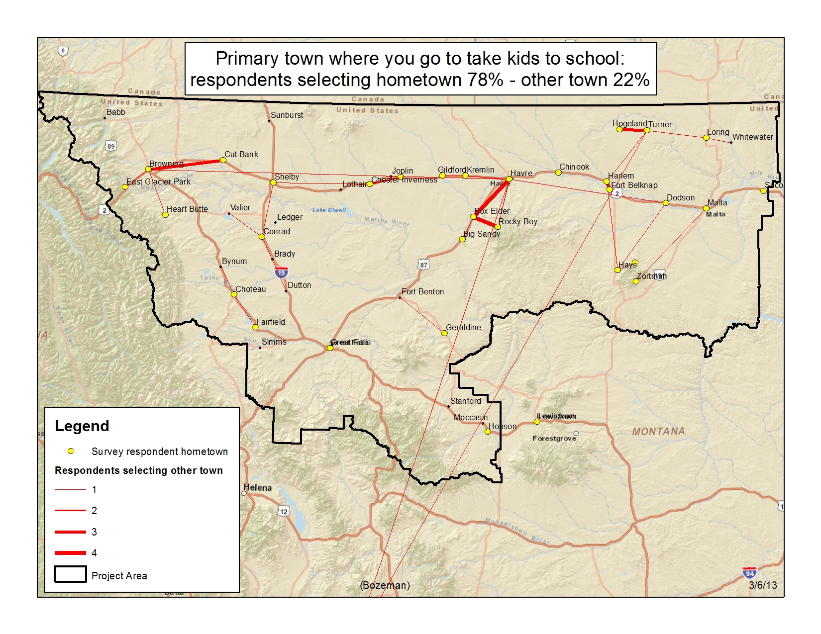
K-12 schools
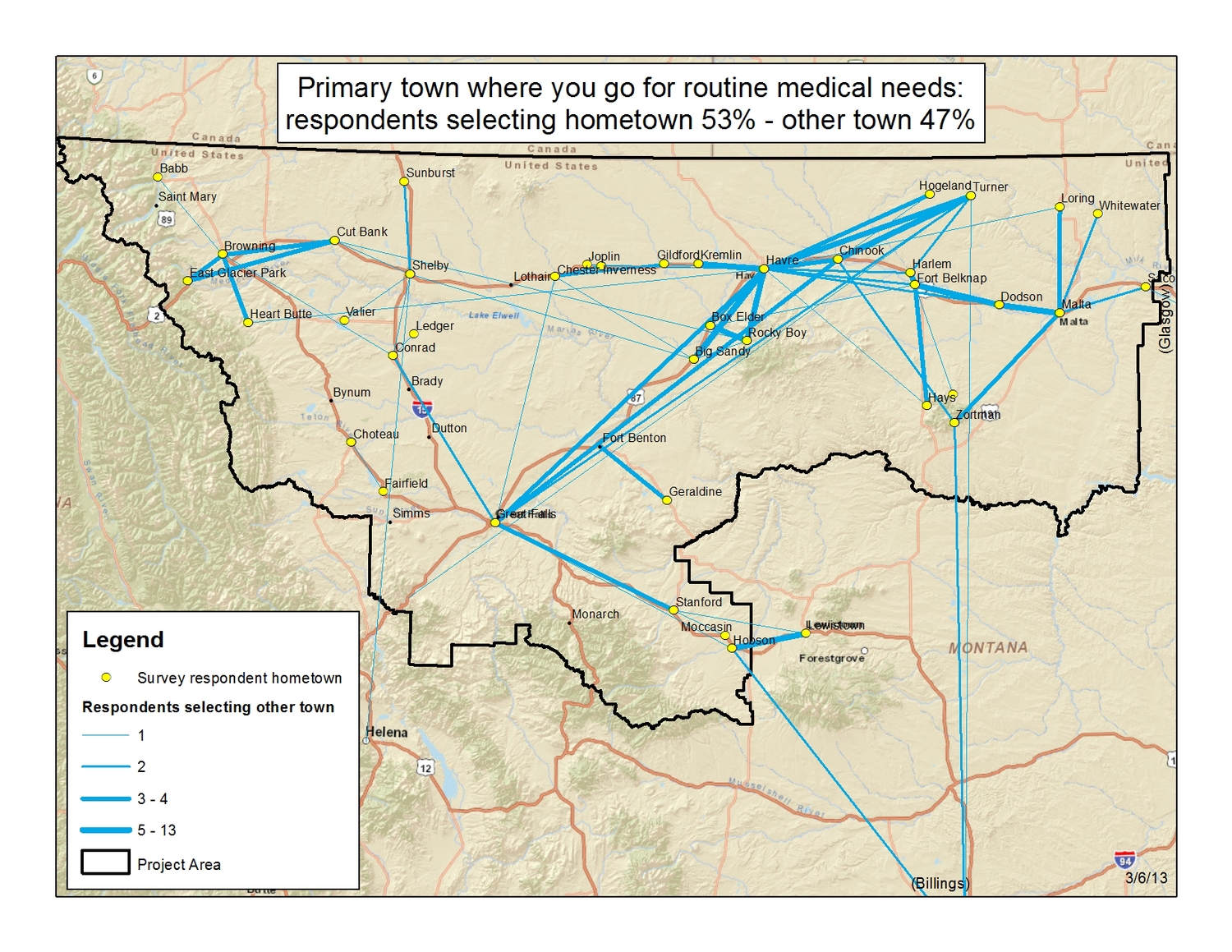
Routine Medical Care
Regional Data Maps

Airports And Train Stations
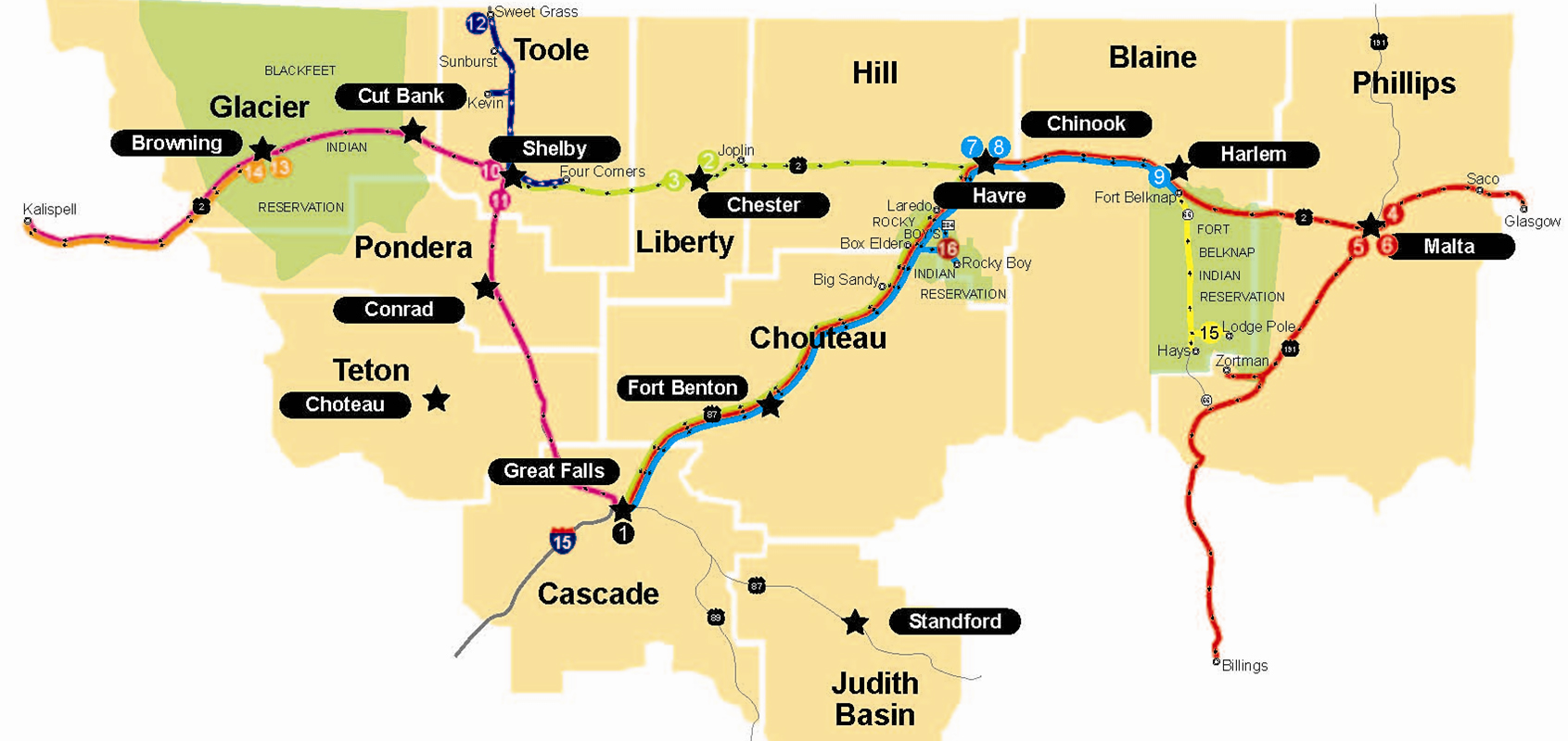
Bus Routes
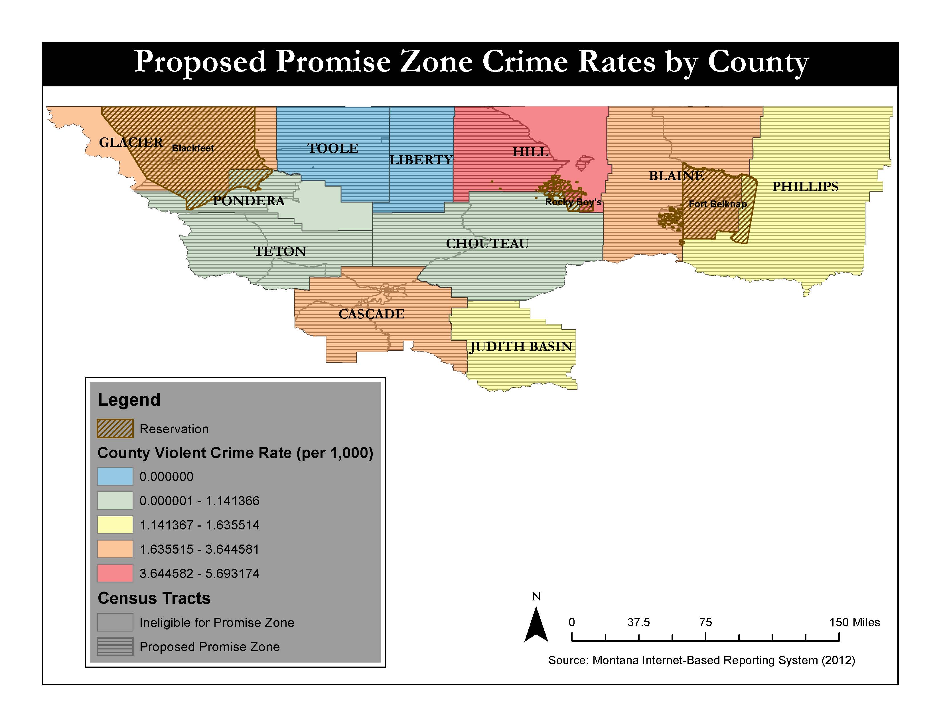
Crime Rate By County

Diabetes By County
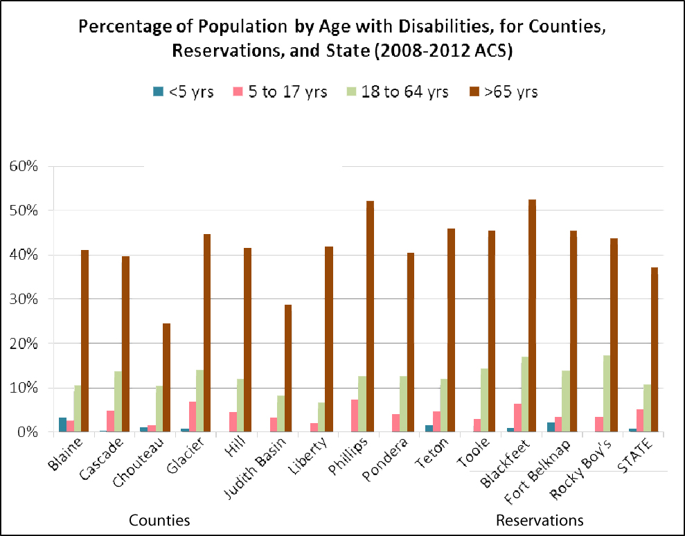
Disability Population By Age
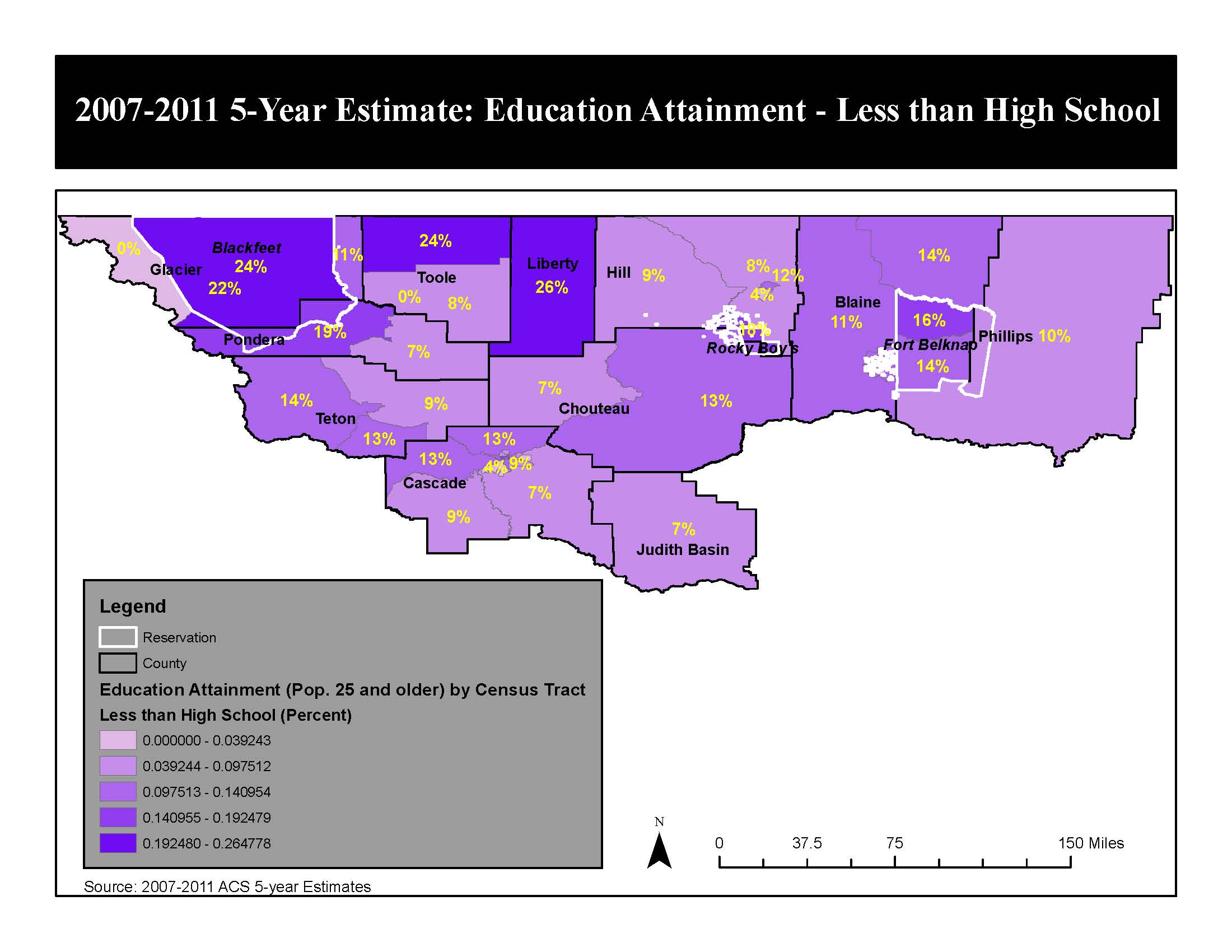
Educational Attainment Less Than High School
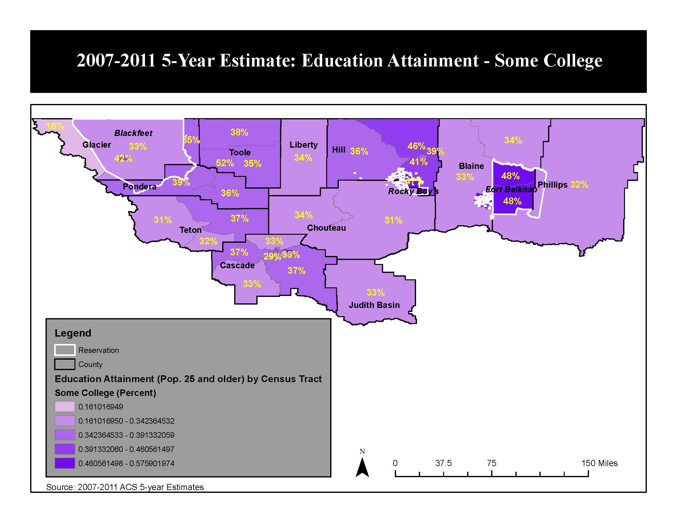
Educational Attainment Some College
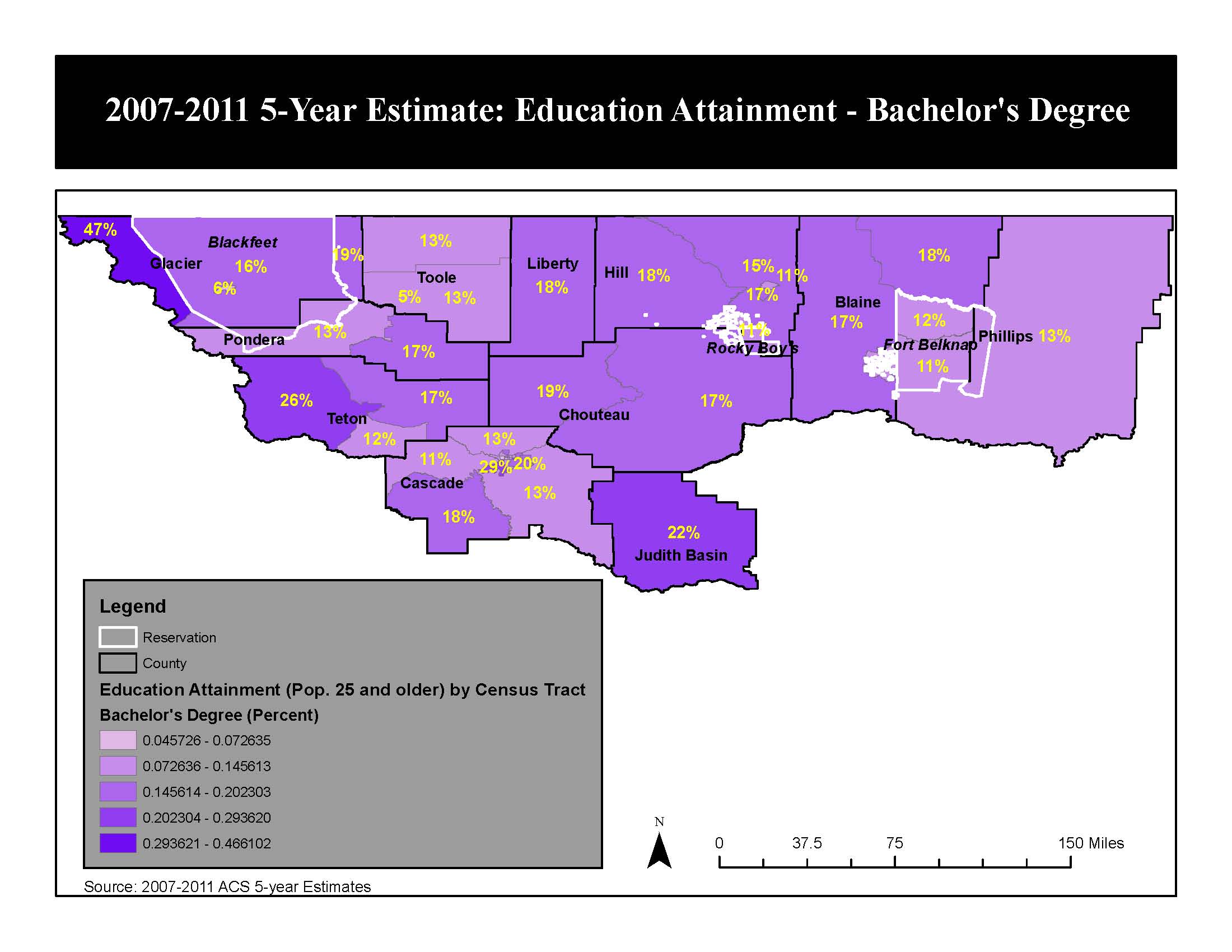
Educational Attainment Bachelor's Degree
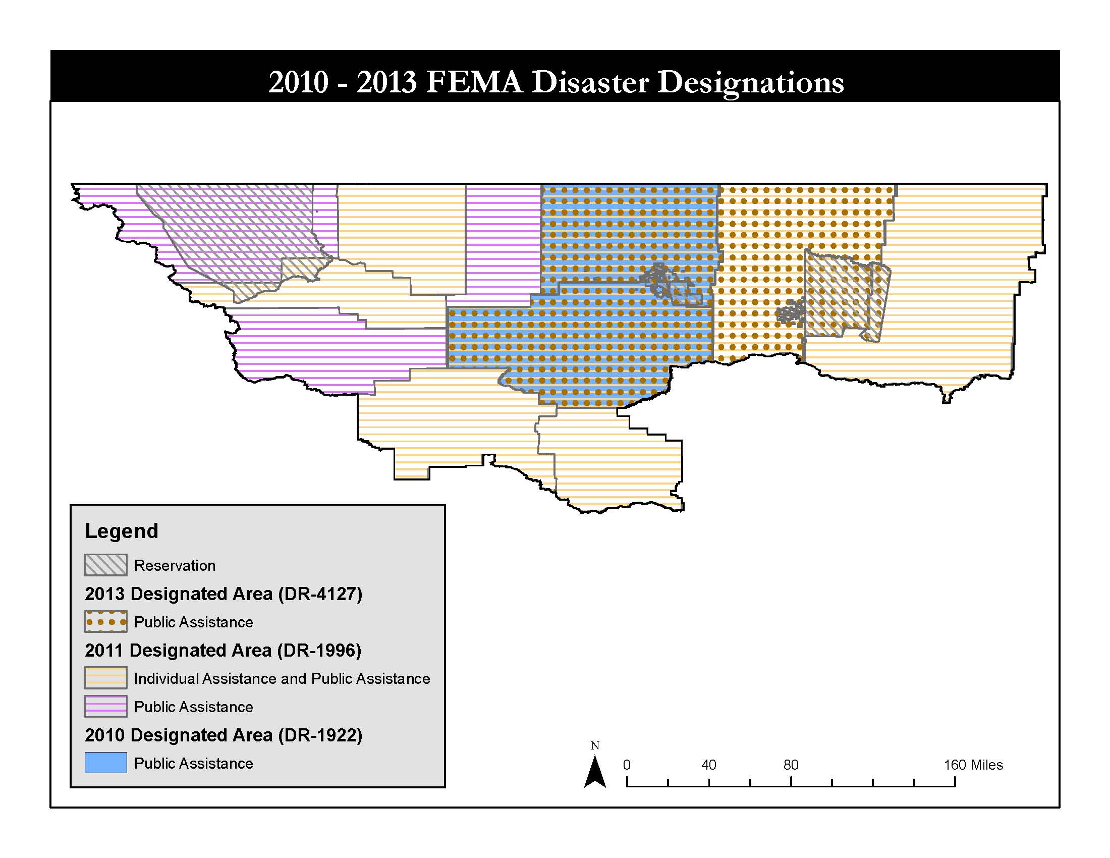
FEMA Disaster Map
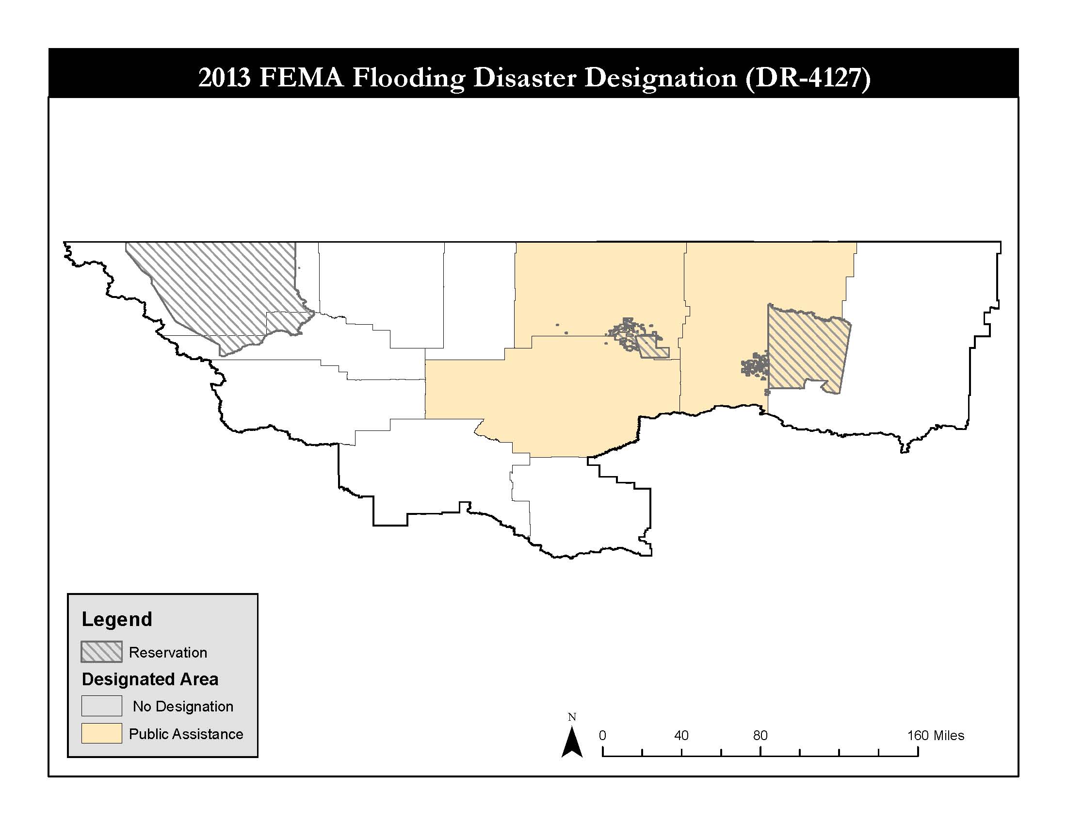
FEMA Designation 2013
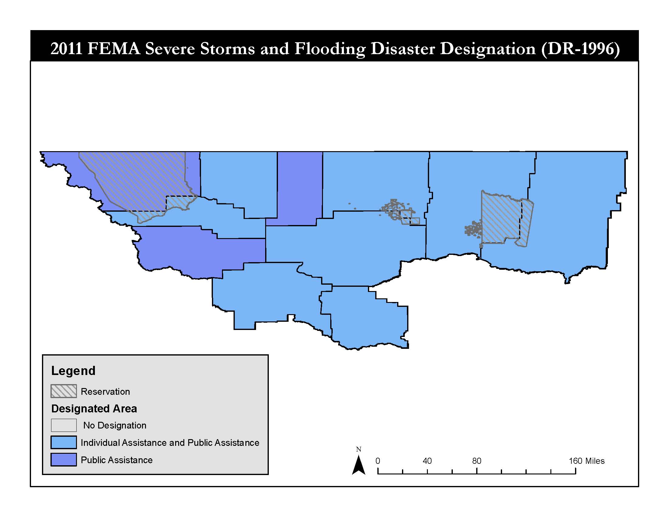
FEMA Designation 2011
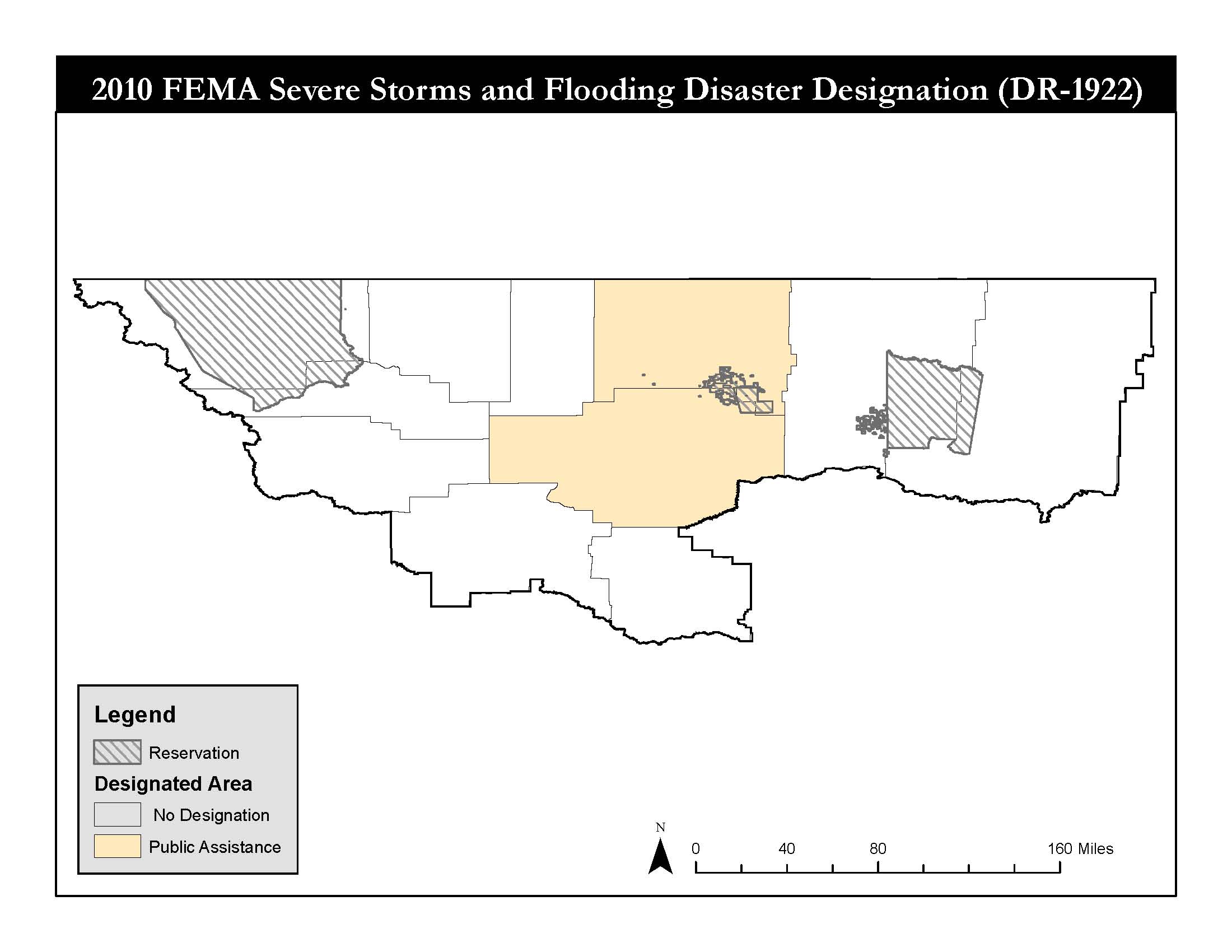
FEMA Designation 2010
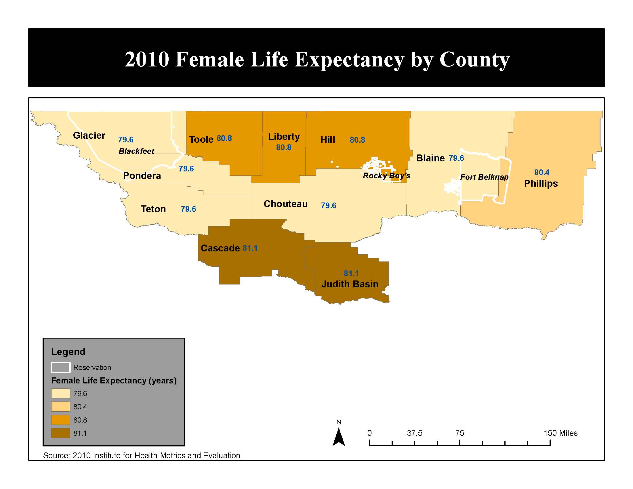
Female Life Expectancy

High School Graduates
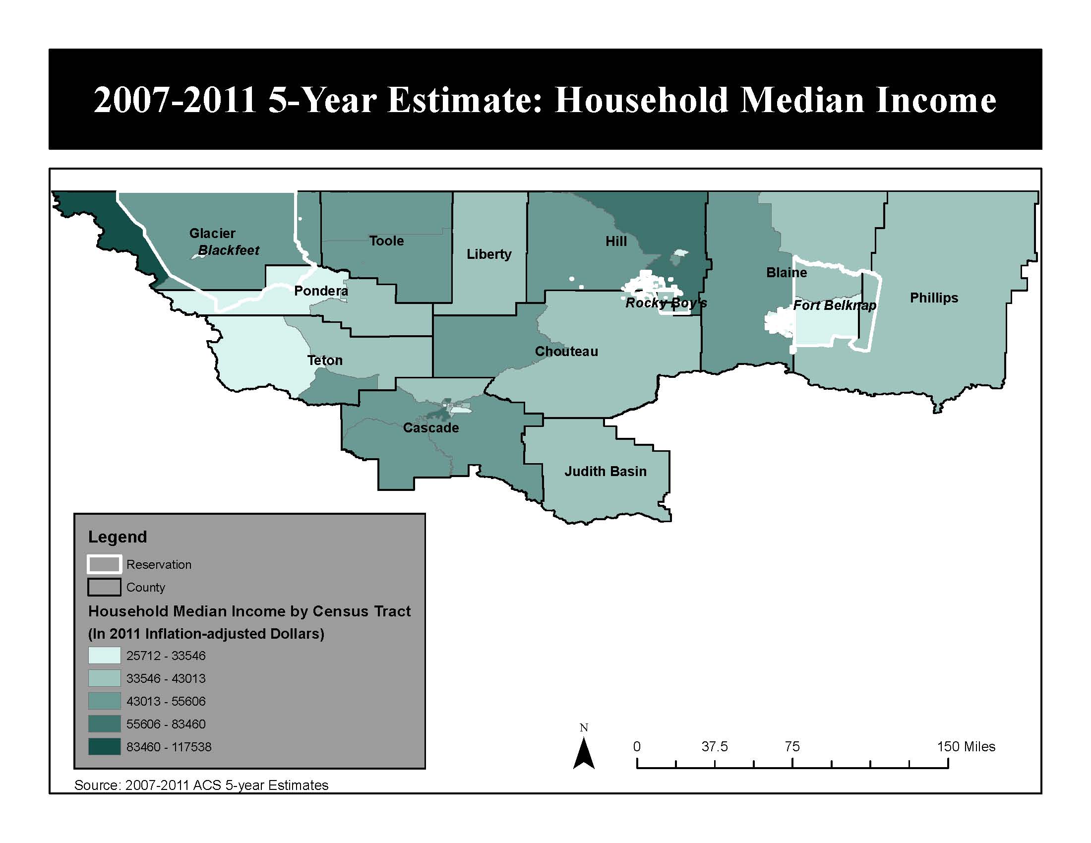
Household Median Income

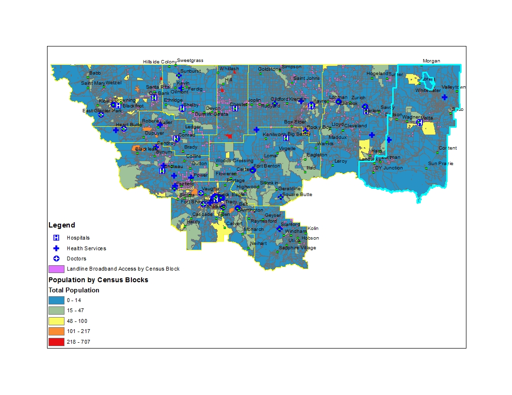
Hospitals And Health Services
Incorporated Towns
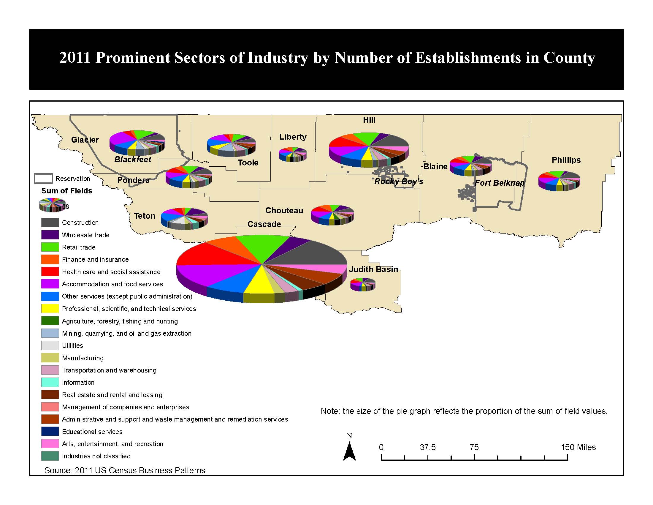
Industry By County
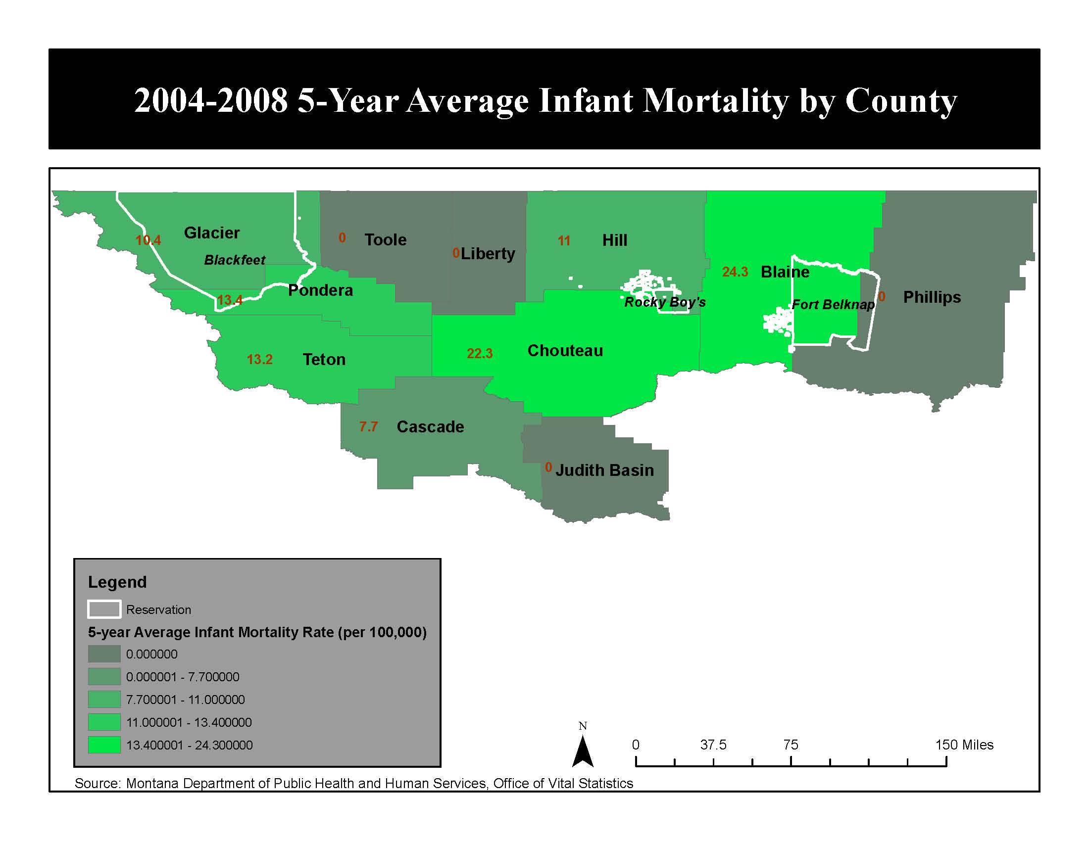
Infant Mortality
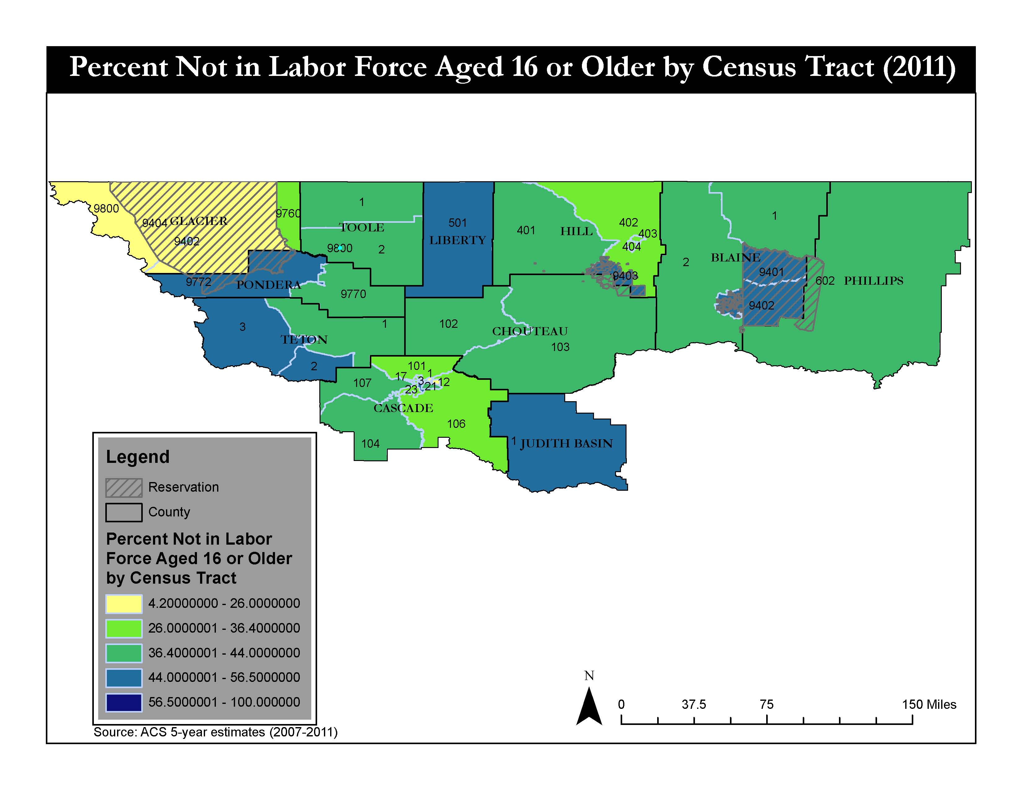
Labor Force Map
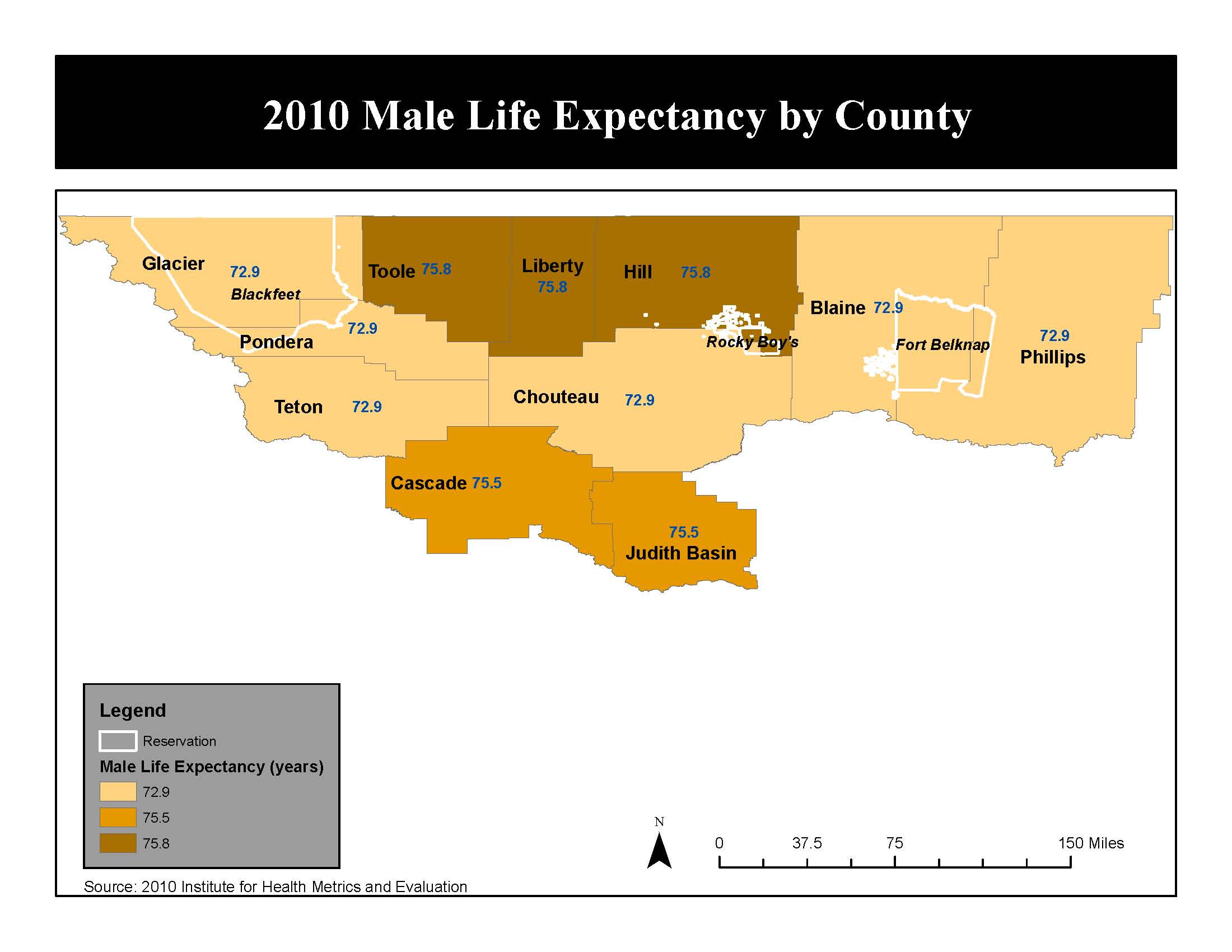
Male Life Expectancy
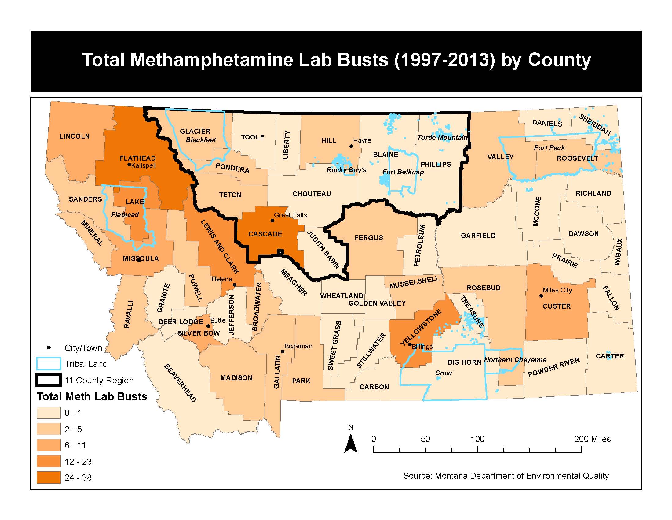
Meth Lab Busts
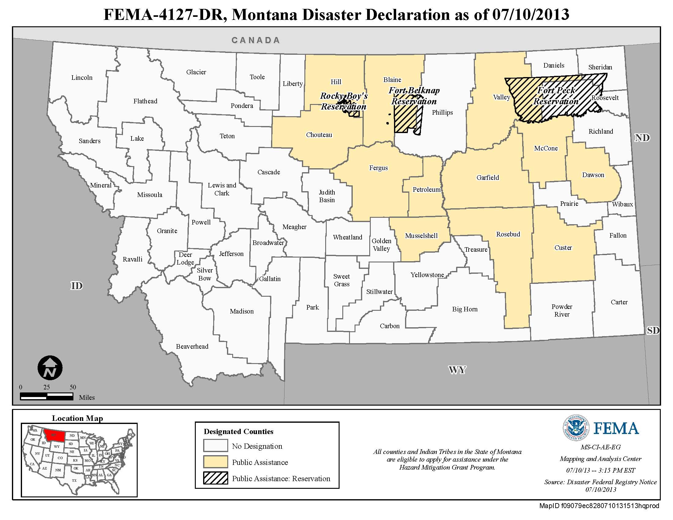
Montana Disaster Declaration 2013
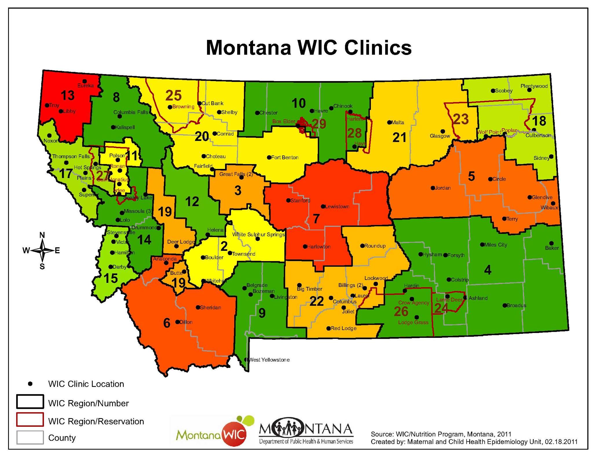
Montana WIC Map
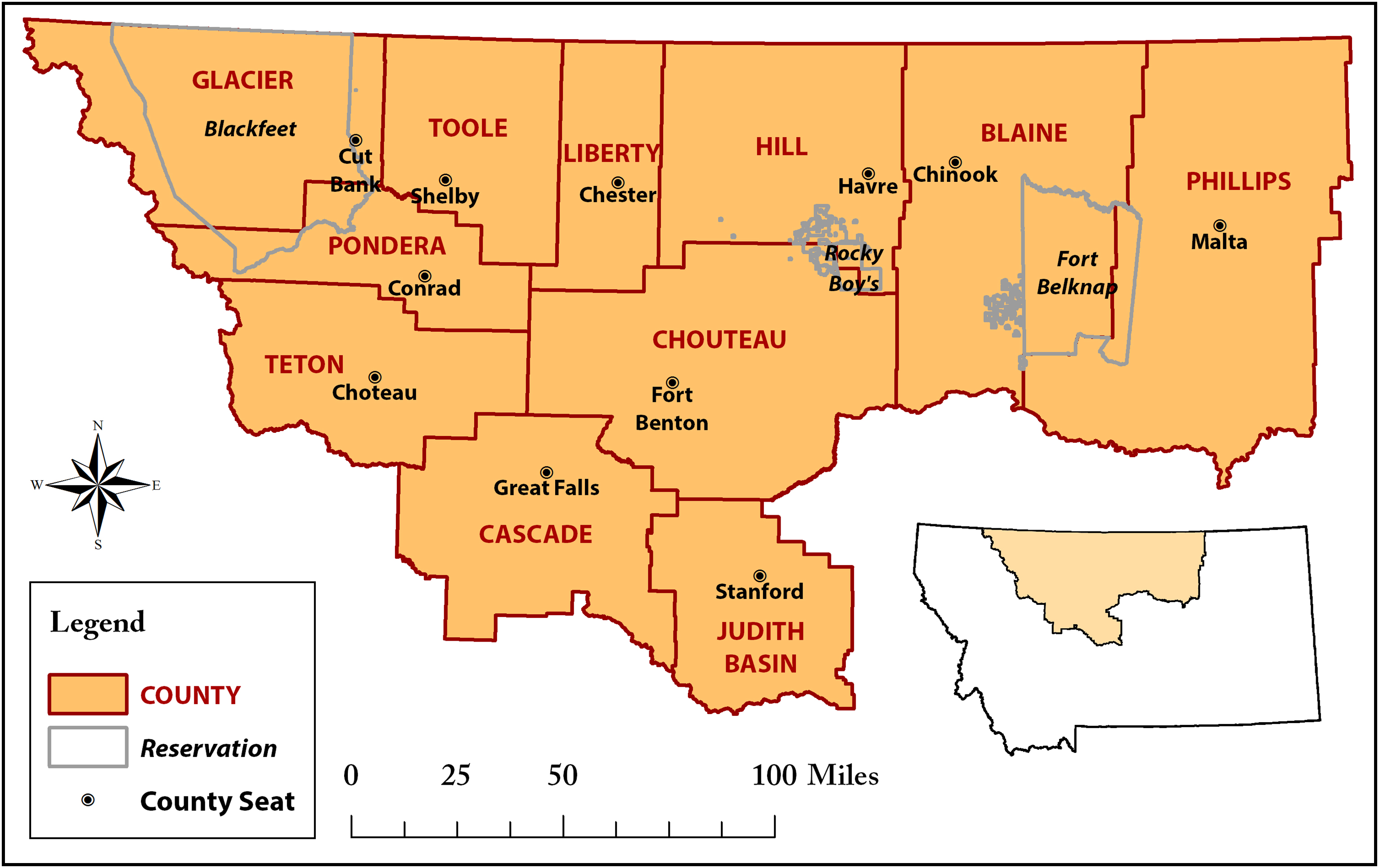
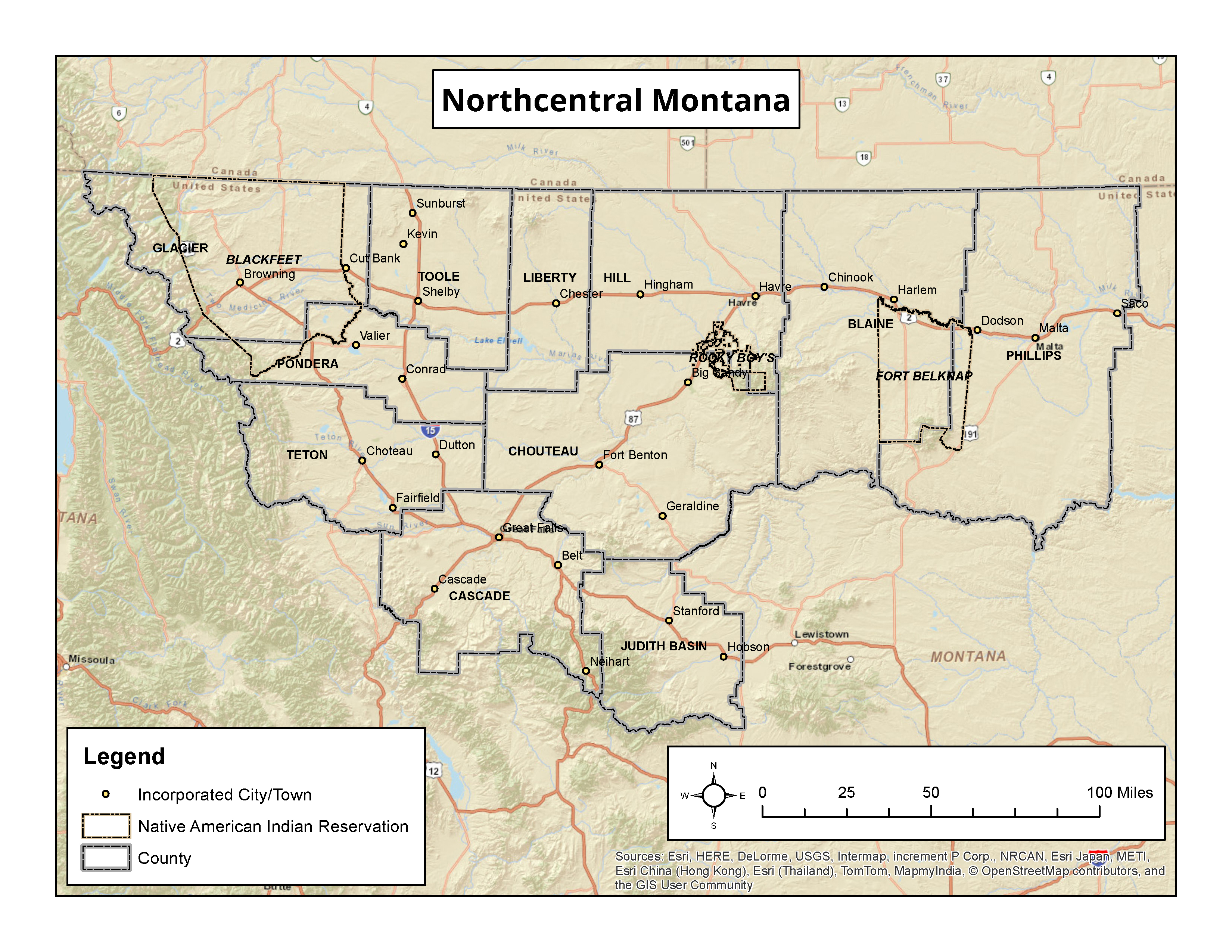
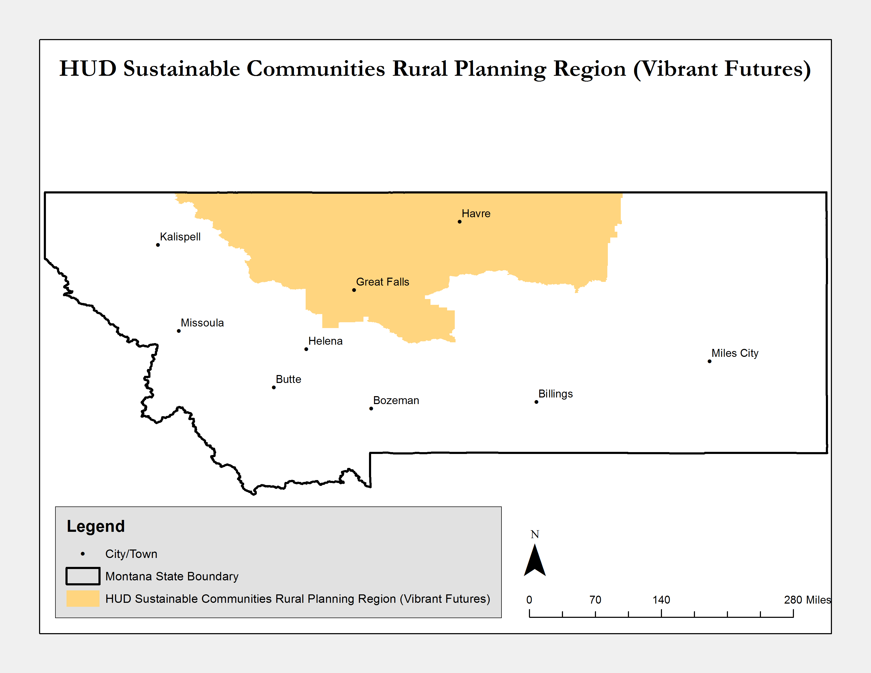
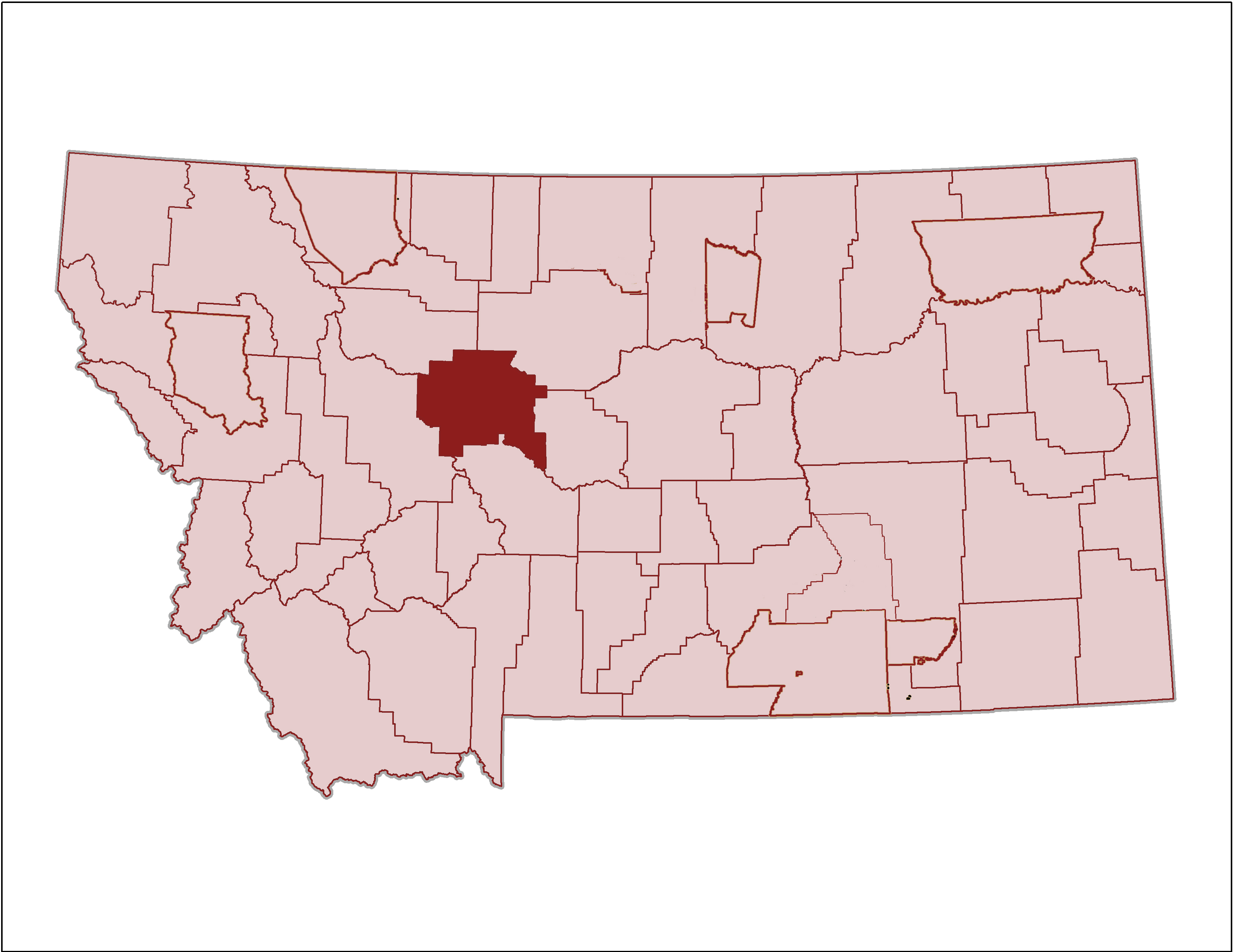
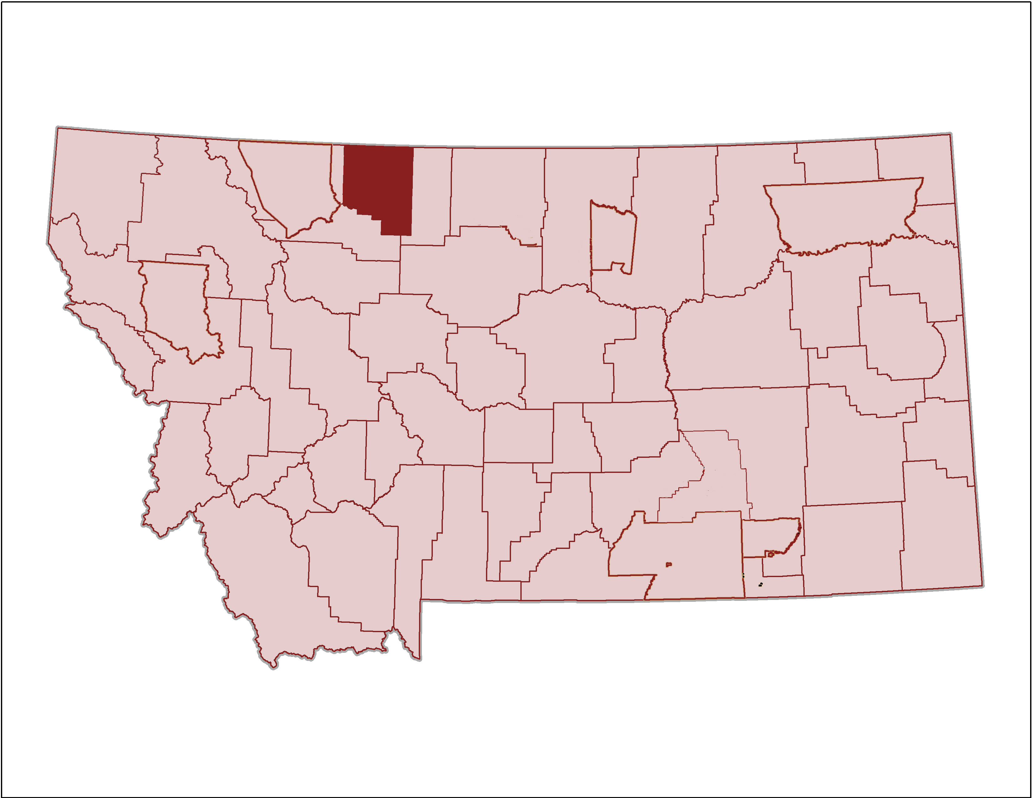
Northcentral Montana Region
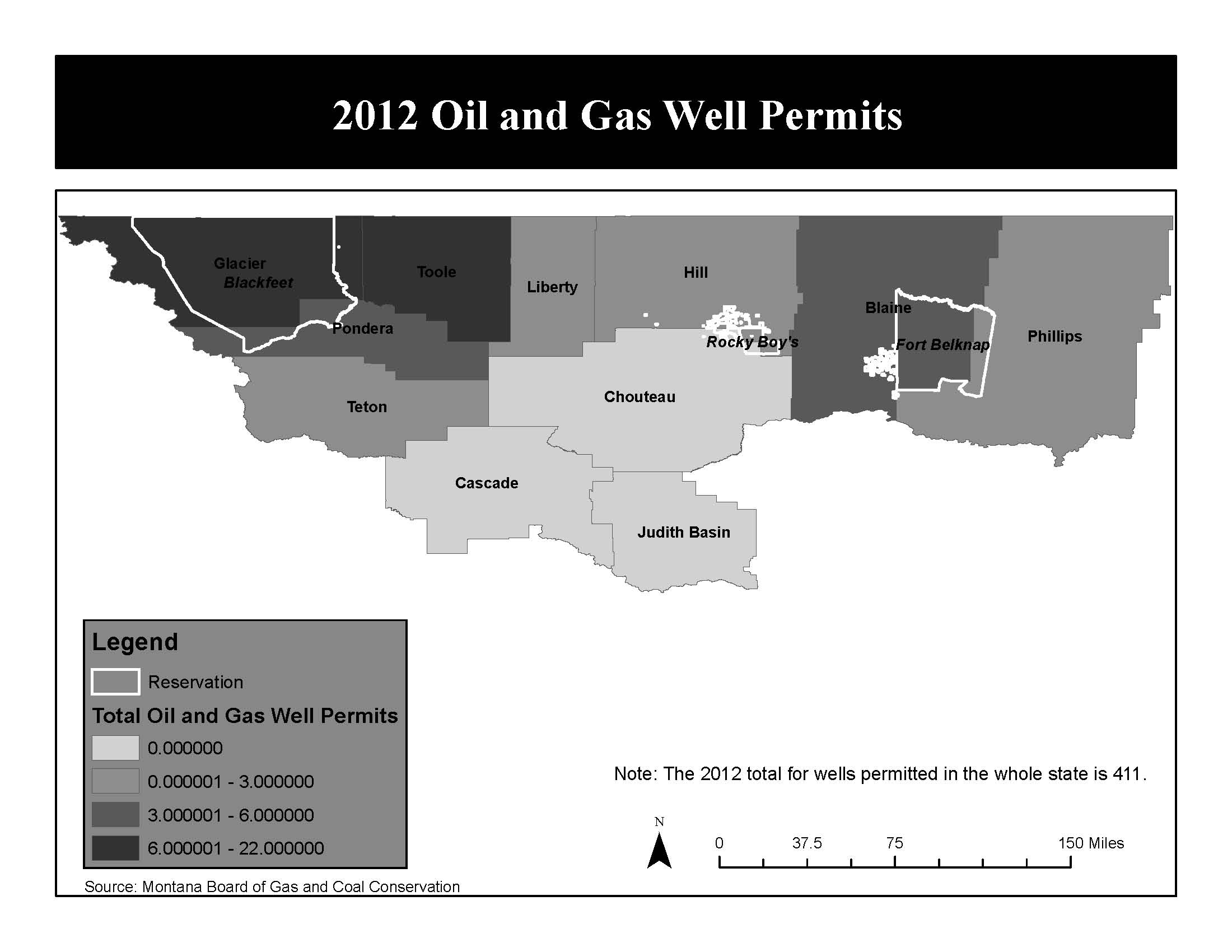
Oil & Gas Permits 2012
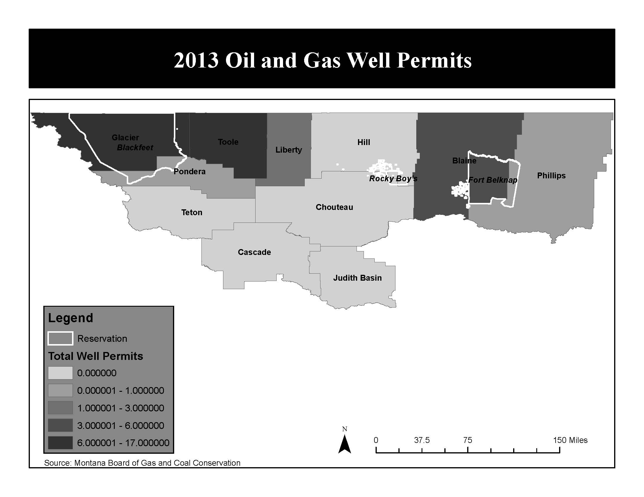
Oil & Gas Permits 2013

Oil And Gas Scenario Planning
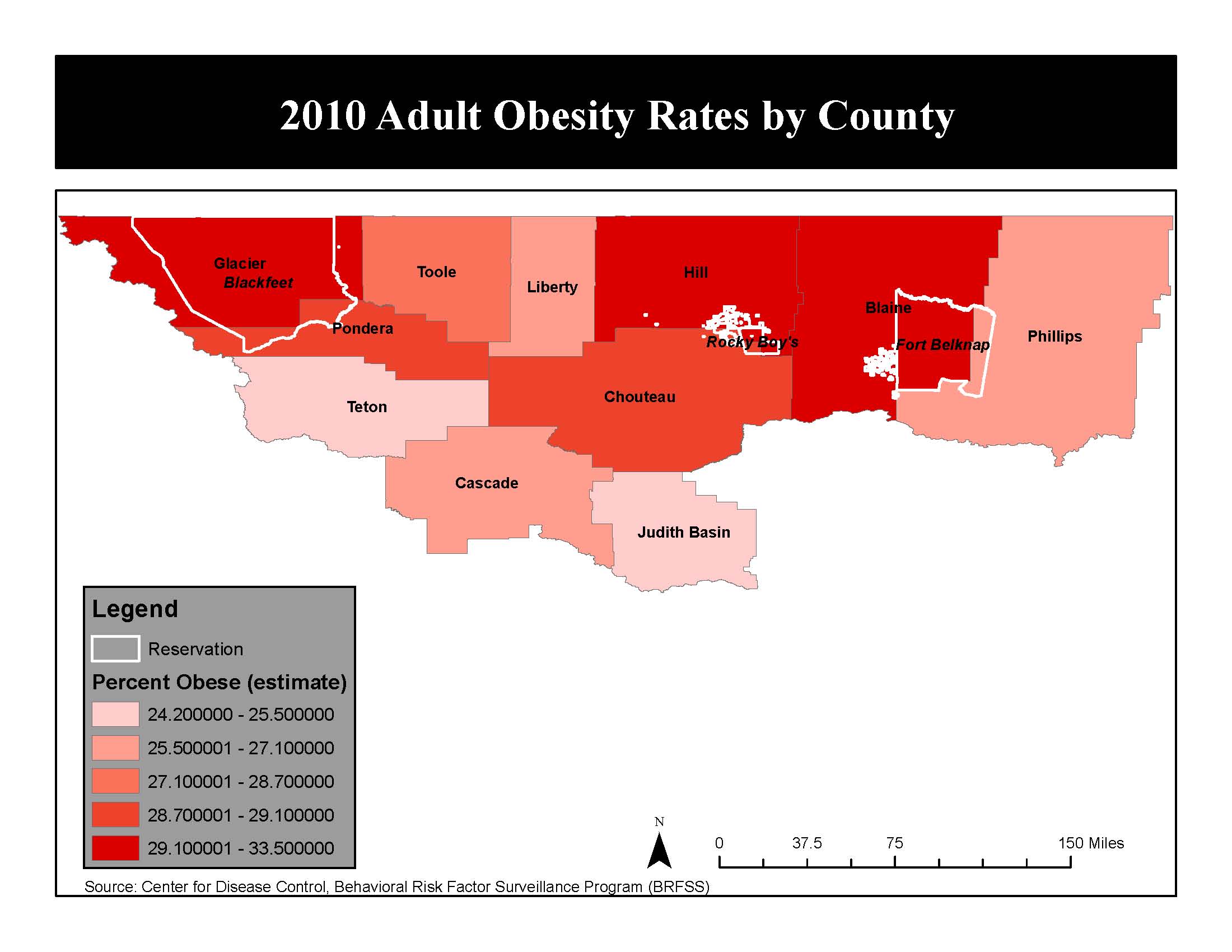
Obesity By County
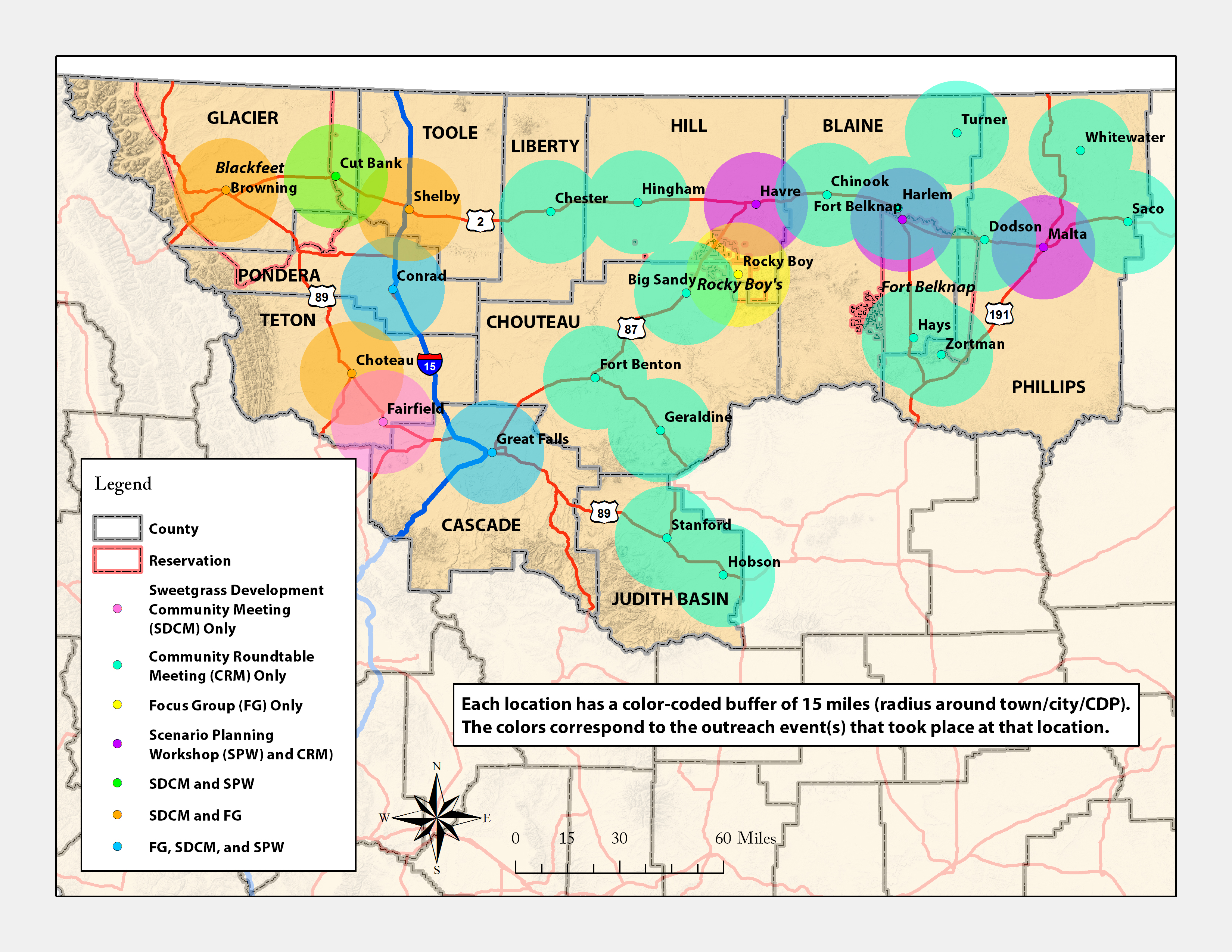
Outreach Map
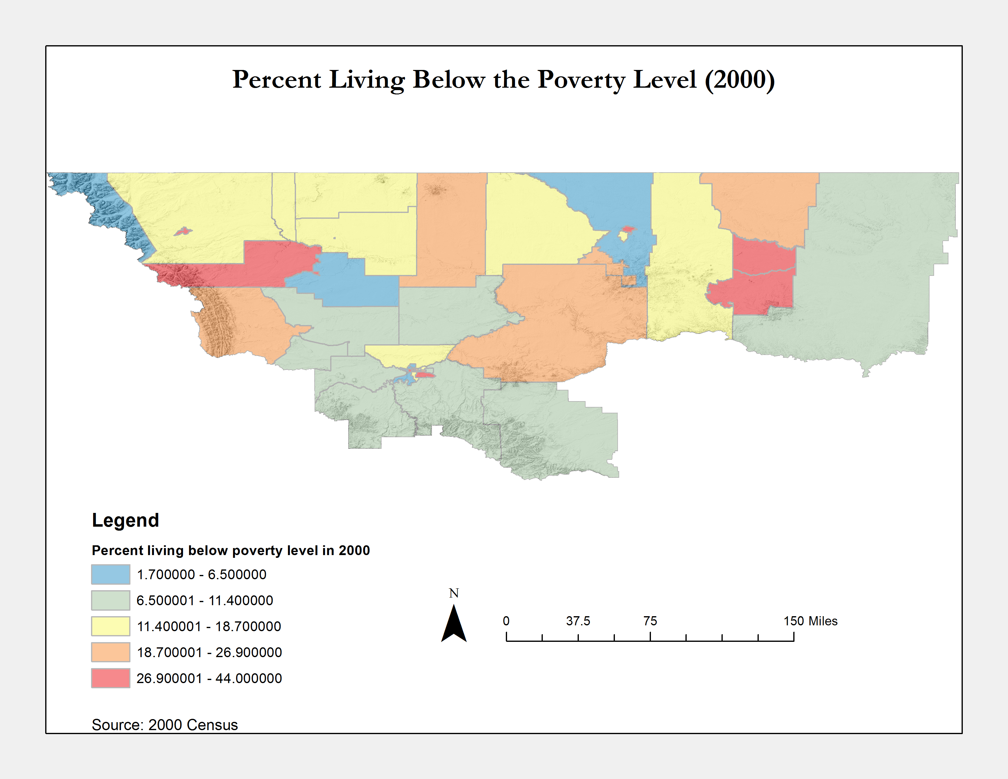
Percent Living Below Poverty Level 2000
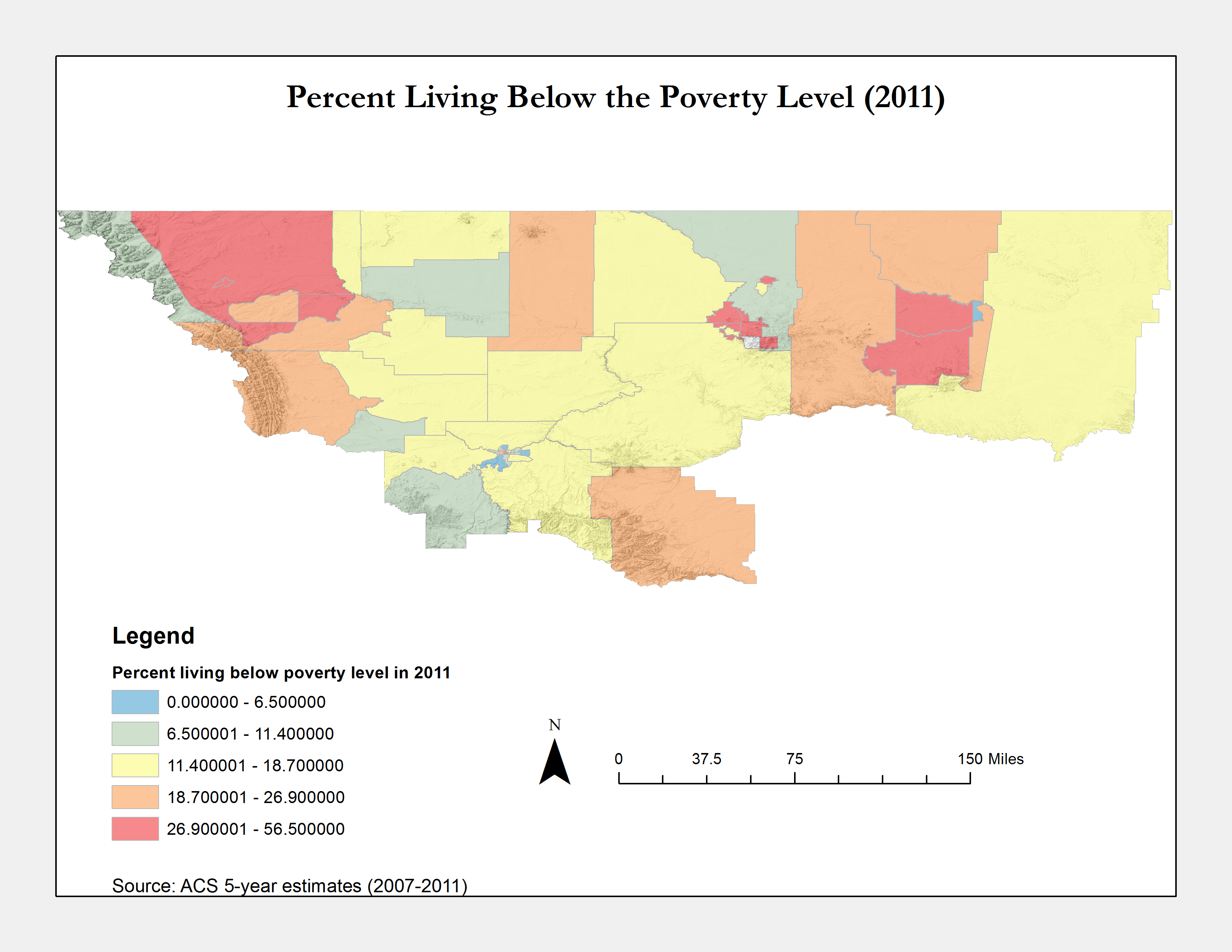
Percent Living Below Poverty Level 2011

Poverty Indexes 2010
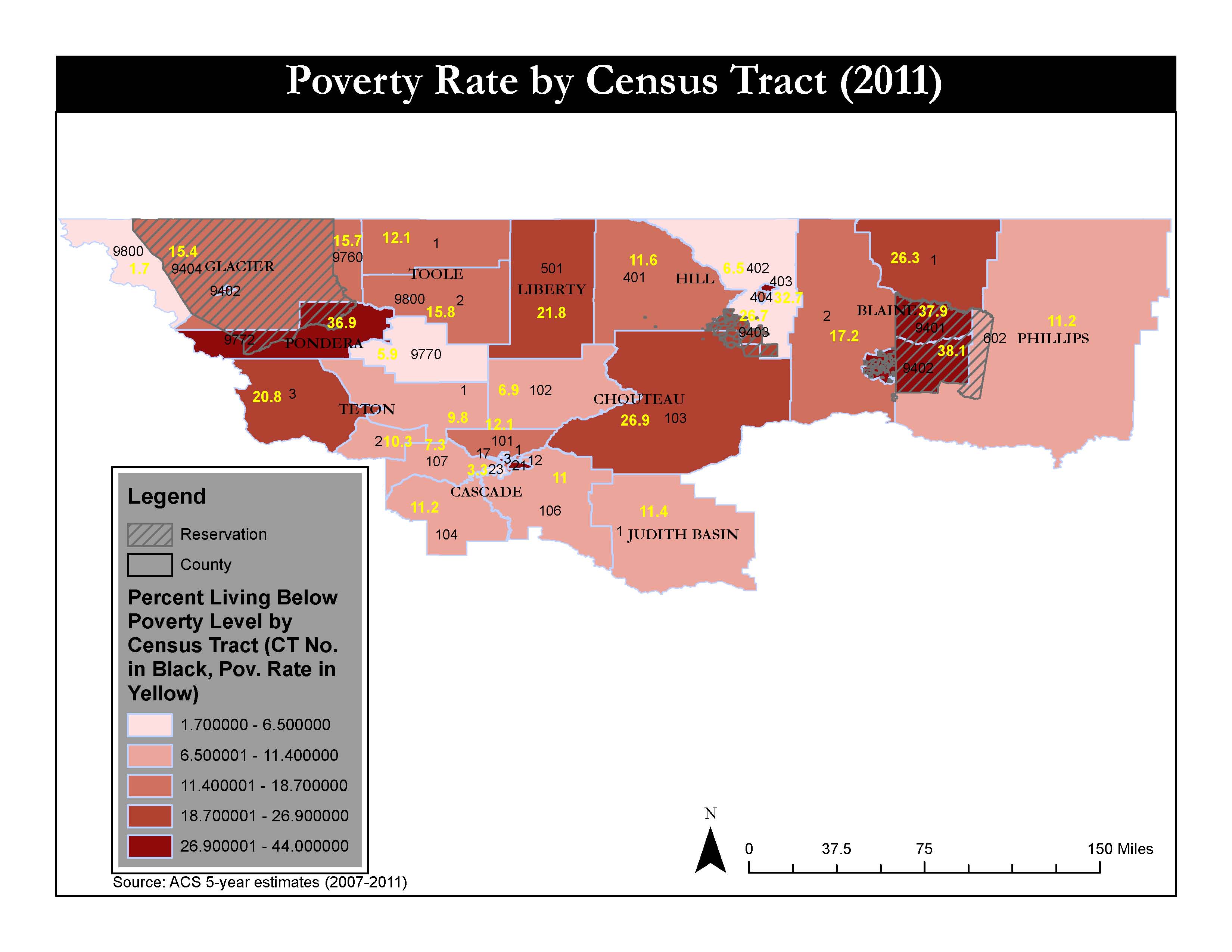
Poverty Rate
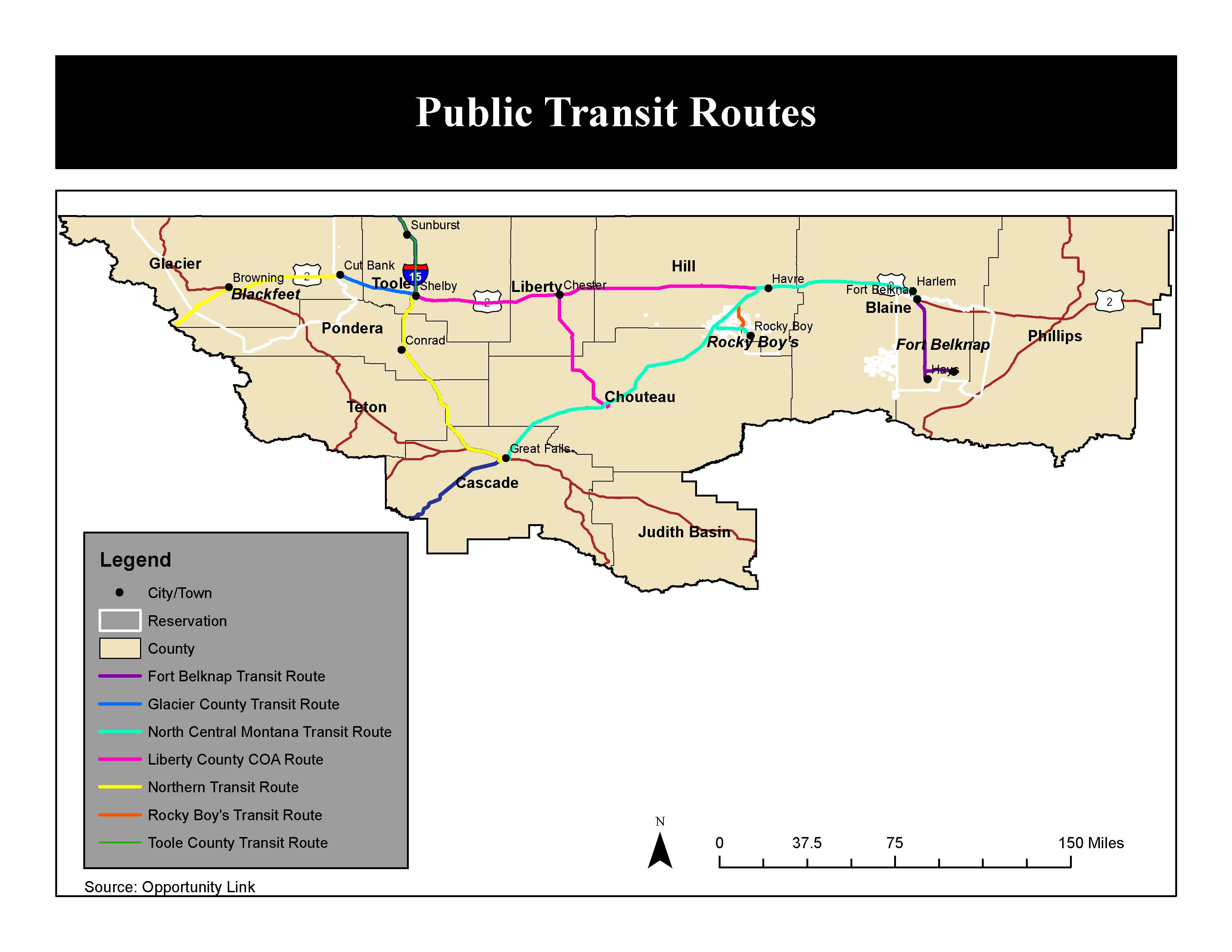
Public Transit Routes
Region With Major Cities

Regional Road And Waterways
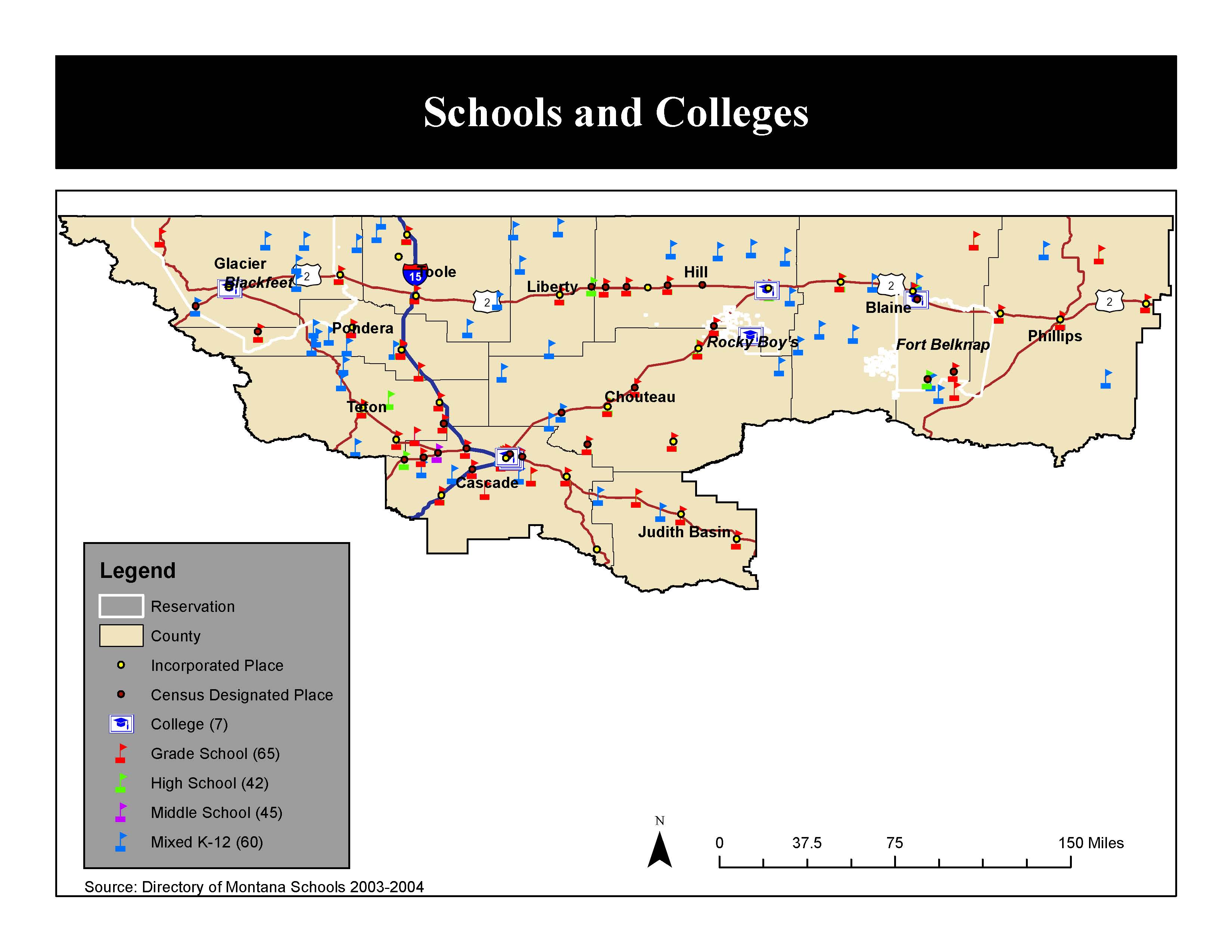
Schools And Colleges

Sector Employment
Steady Growth
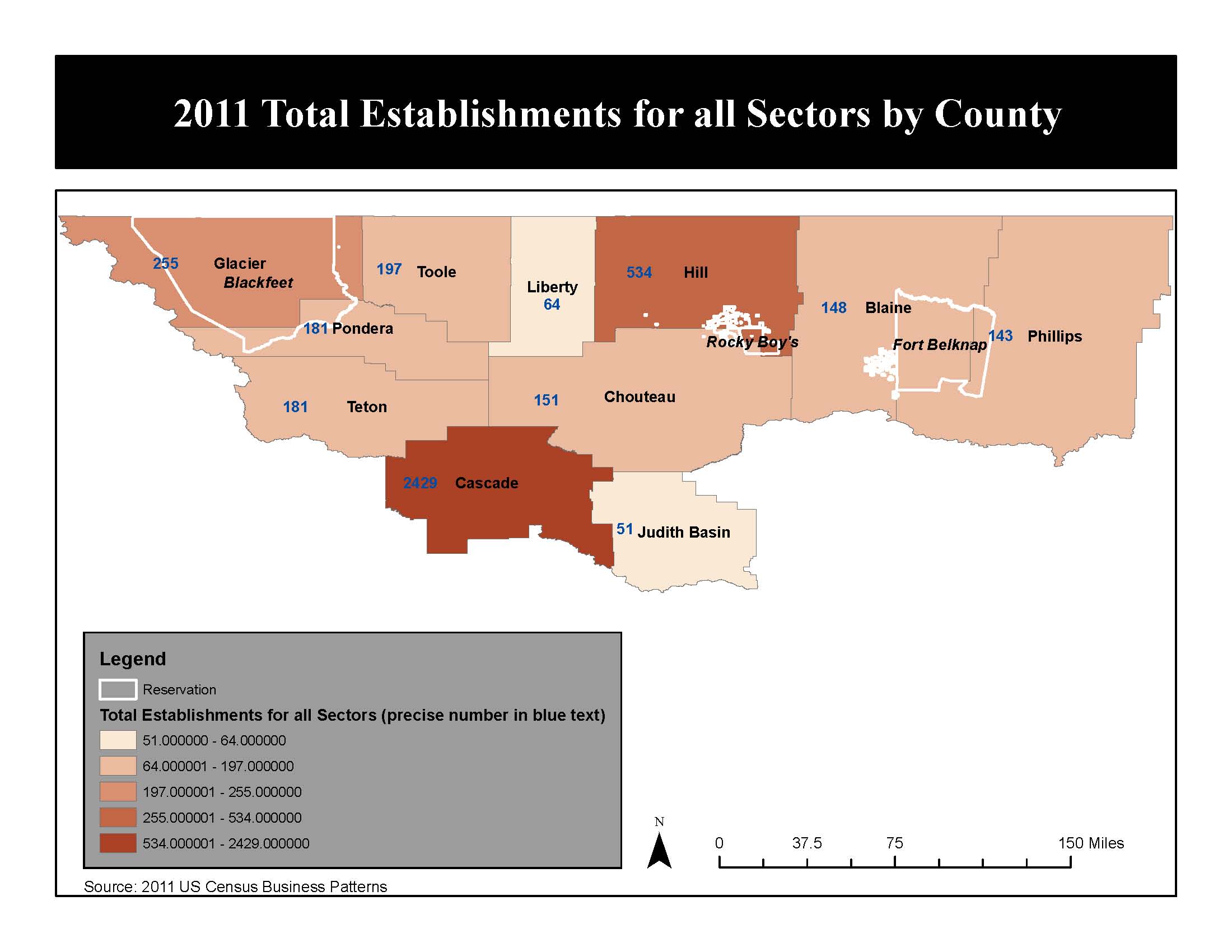
Total Establishments All Sectors
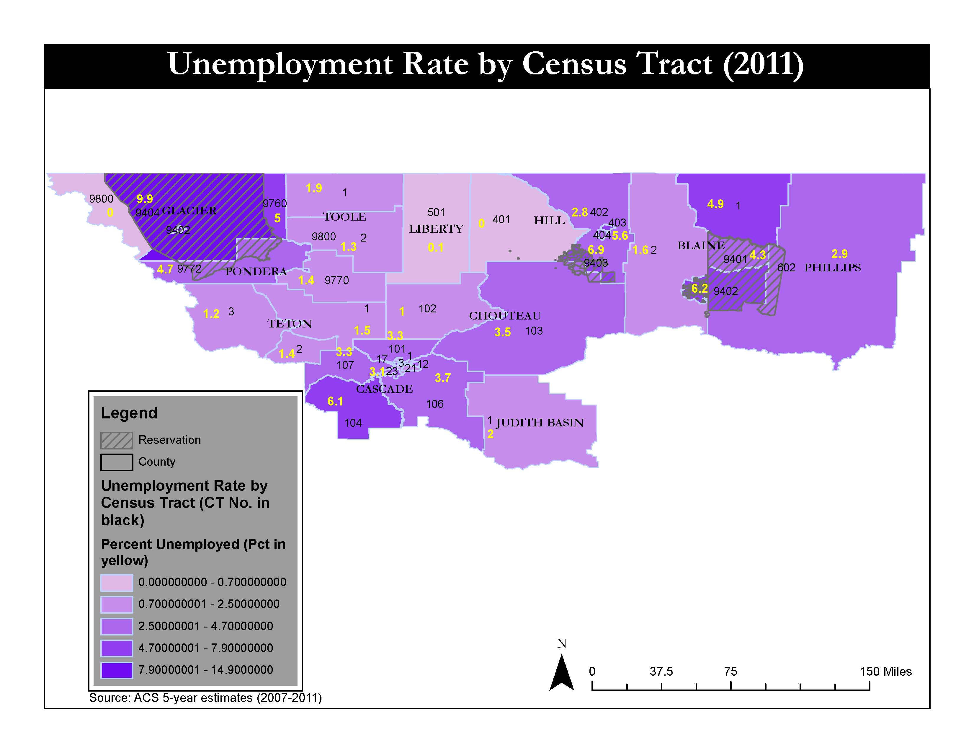
Unemployment Map
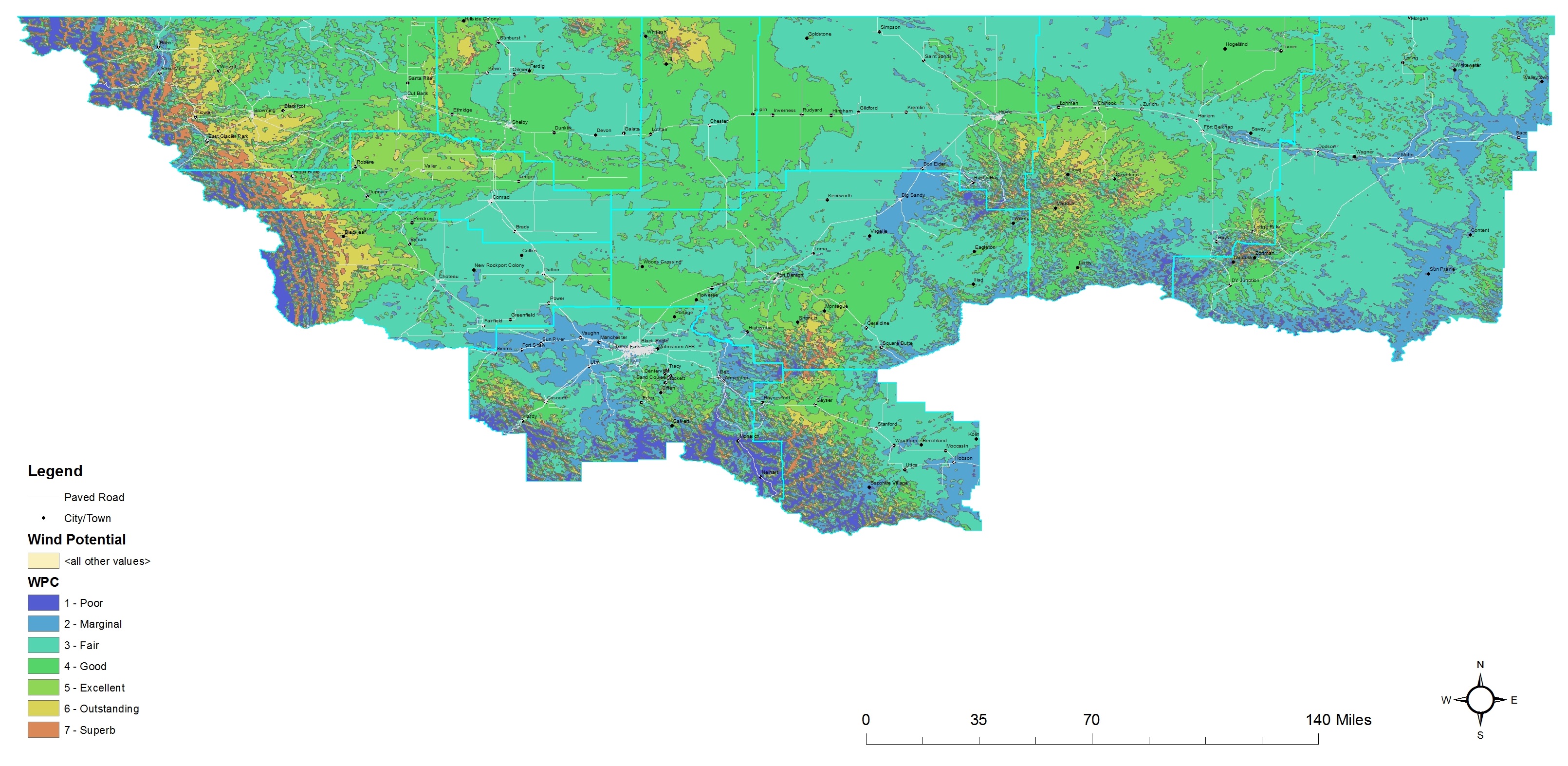
Wind Potential
Wired Broadband
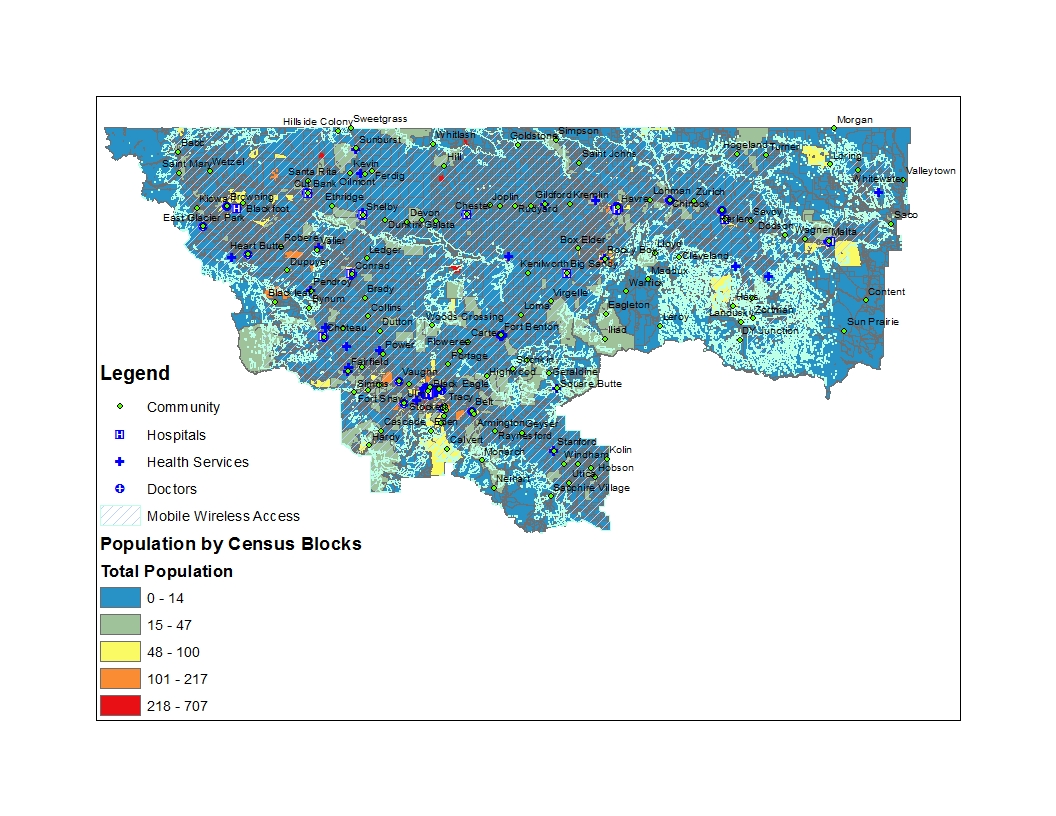
Wireless Broadband

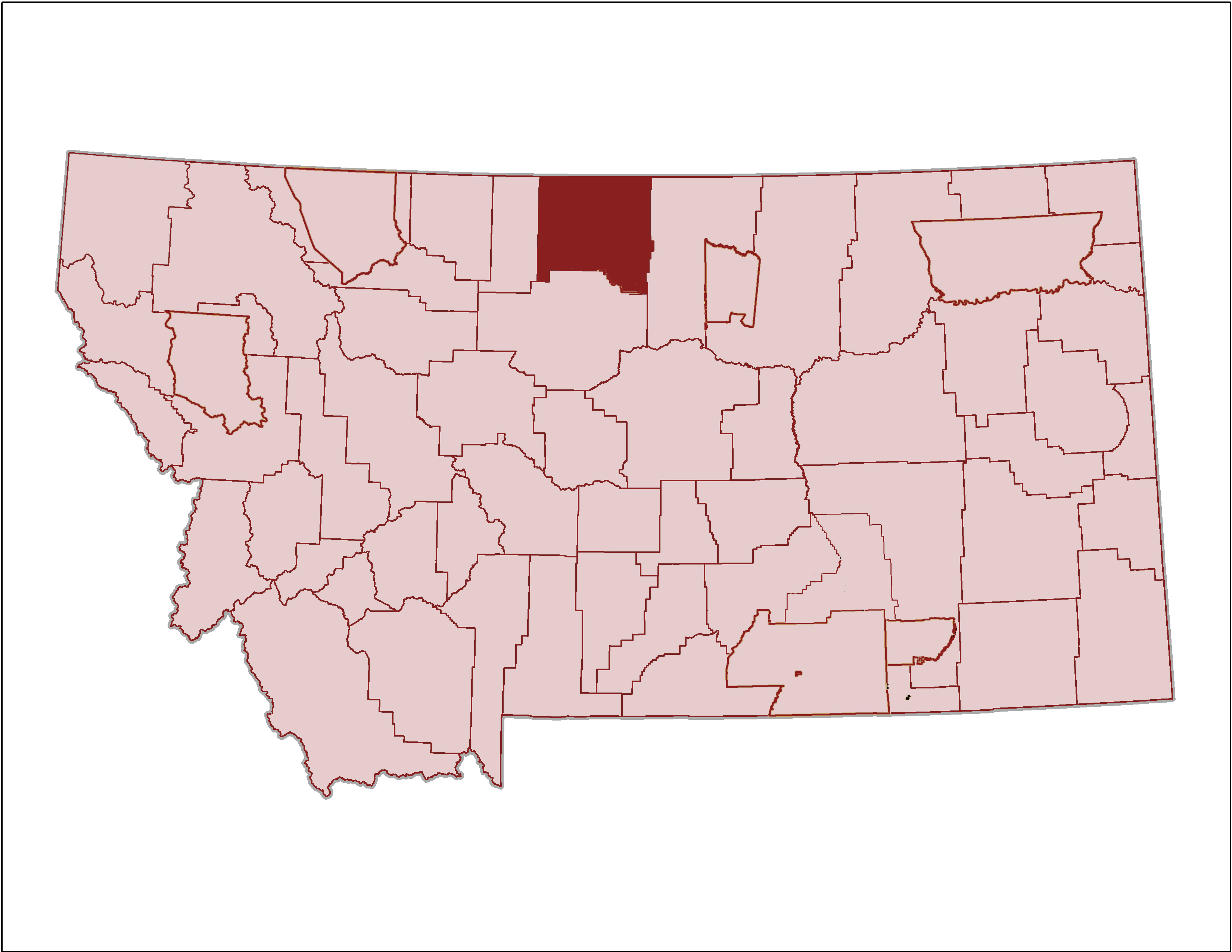
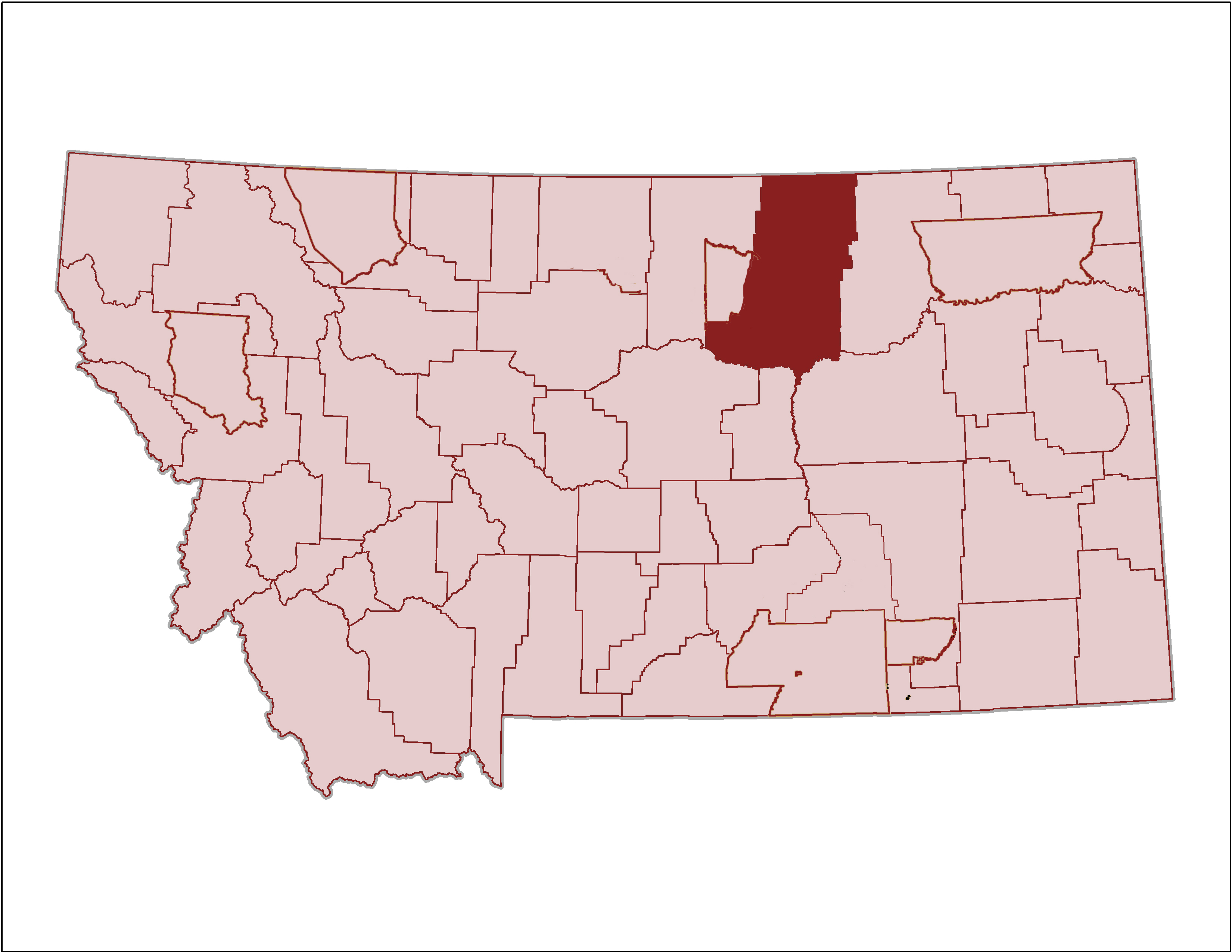
Blaine
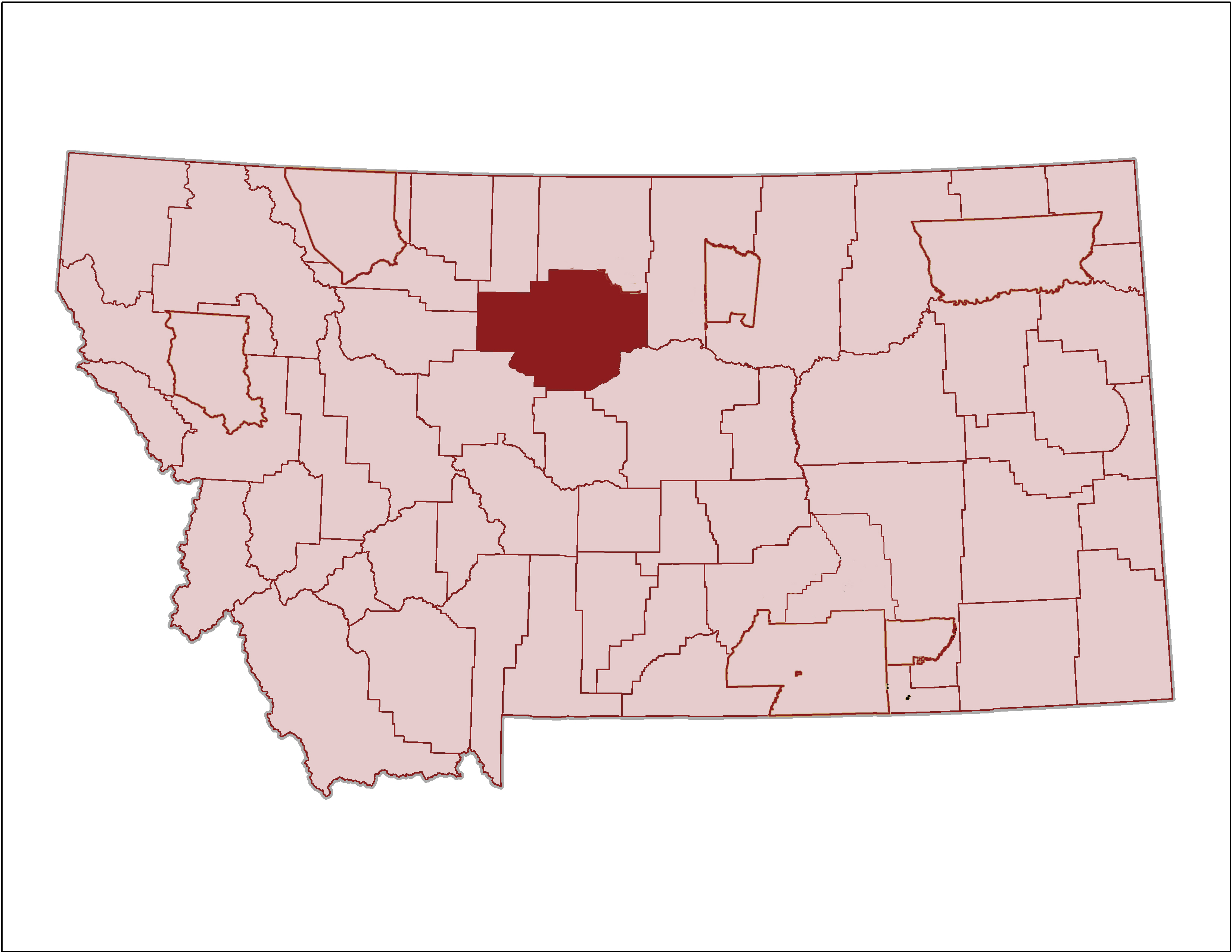
Cascade
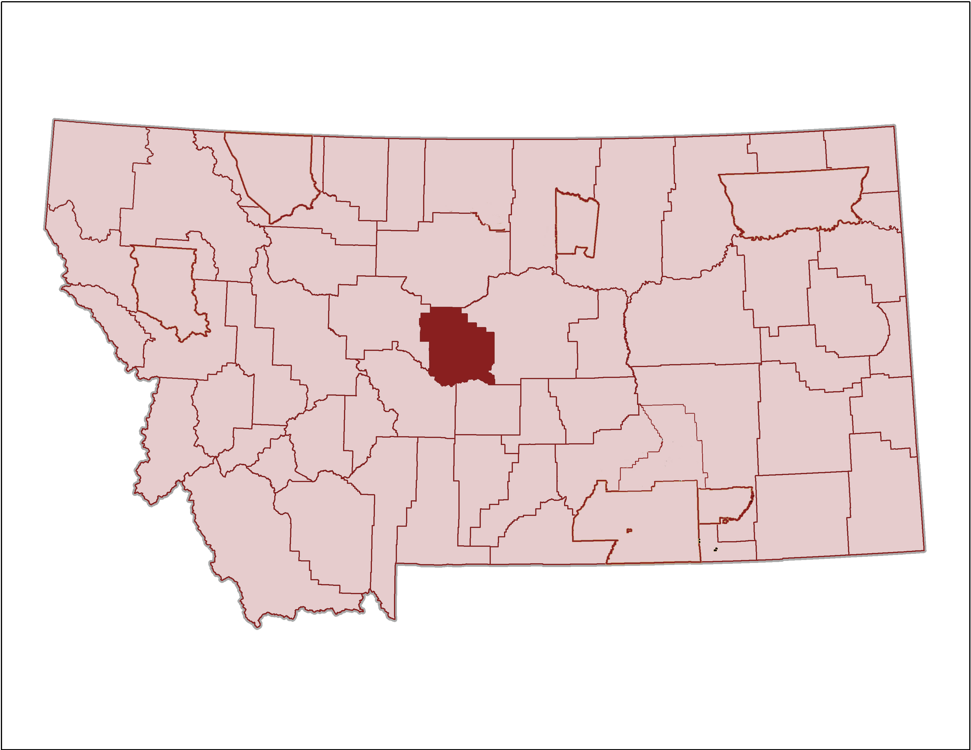
Choteau
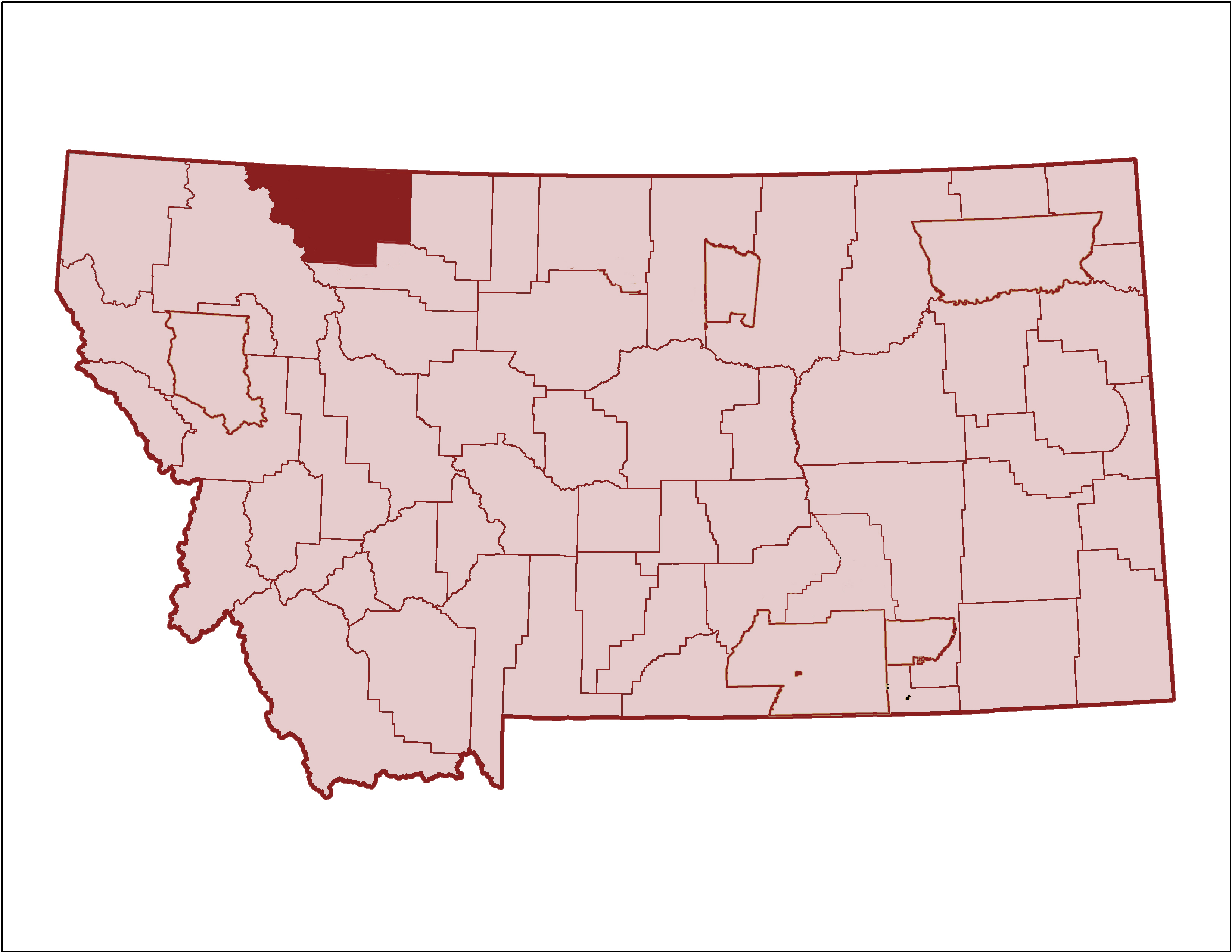
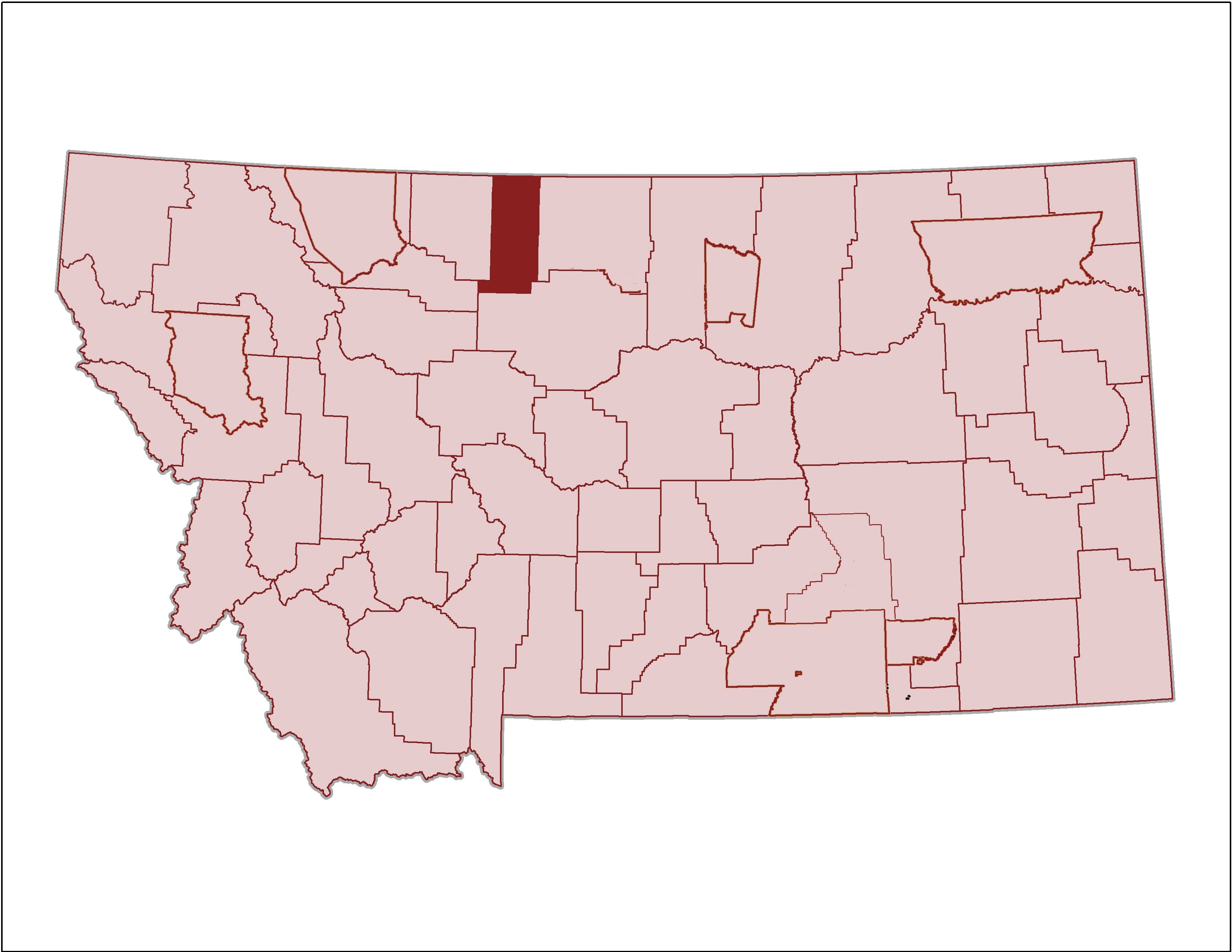
Glacier
Hill County Maps
Judith Basin County Maps
Phillips County Maps
Liberty County Maps
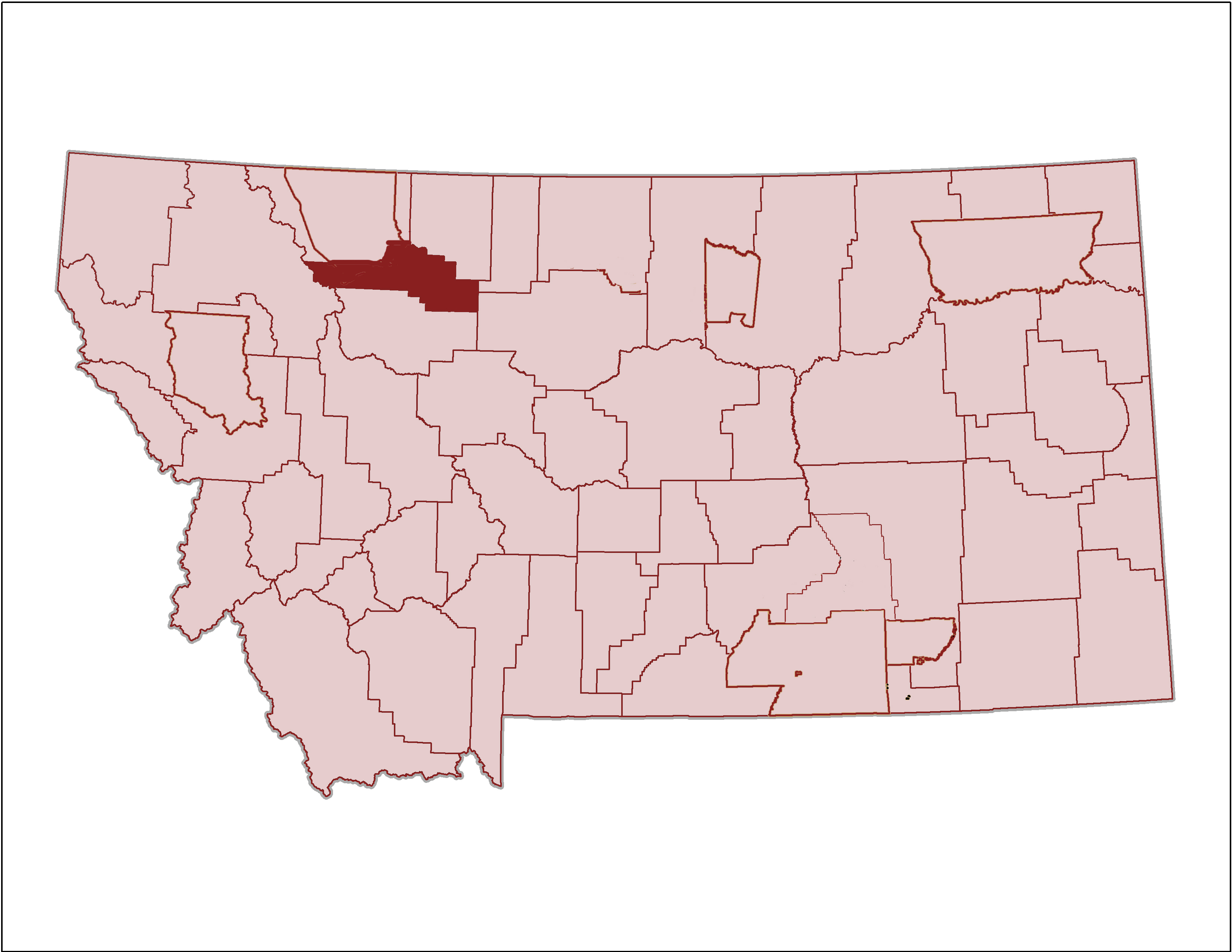
Pondera County Maps
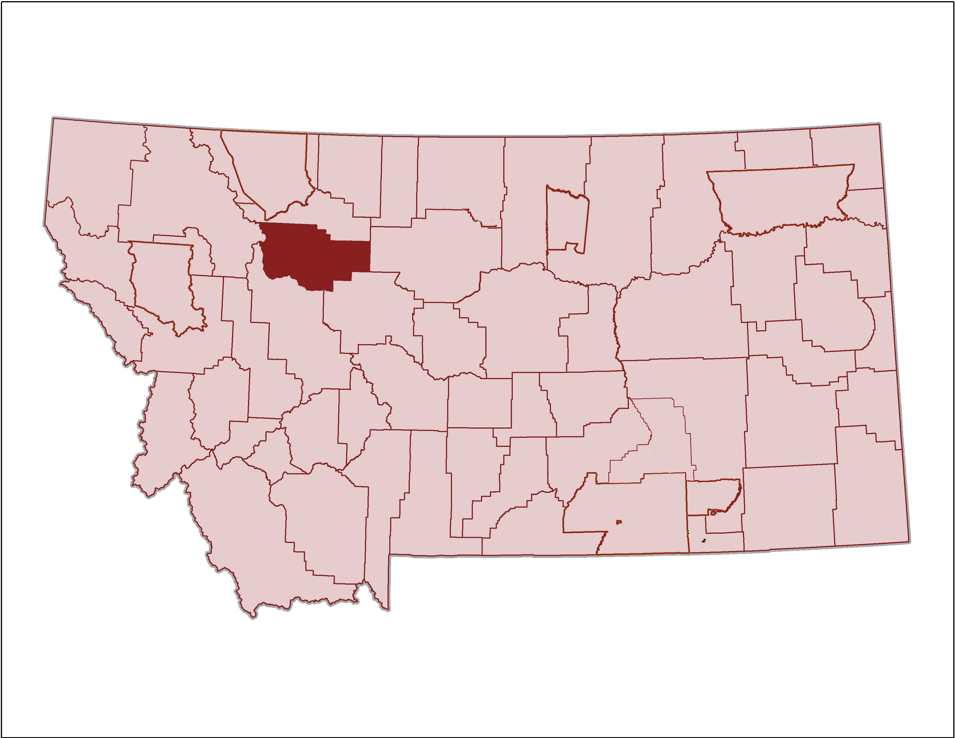
Teton County Maps
Toole County Maps
Tags: Blackfeet, Blaine, cascade, Chouteau, Fort Belknap, glacier, Hill, Judith Basin, Liberty, Northcentral Montana, Phillips, Pondera, Regional, Rocky Boy, Rocky Boy's, Teton, Toole