Phillips County Maps
Below are all of the Phillips County data maps that were used in the Vibrant Futures Regional Plan. You can also download the PDF version of all maps. Housing Condition maps are also available below the data maps and the PDF version can be downloaded as well.
Data Maps
-
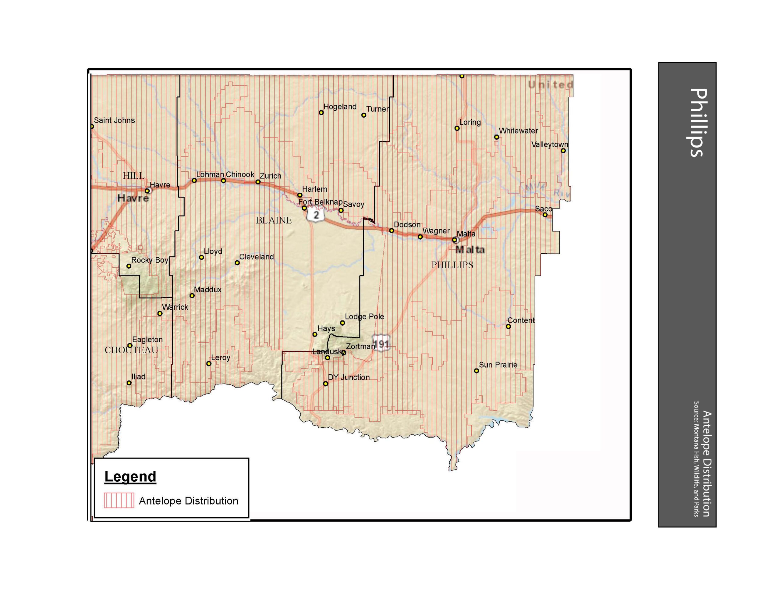
- Antelope Distribution Phillips County
-
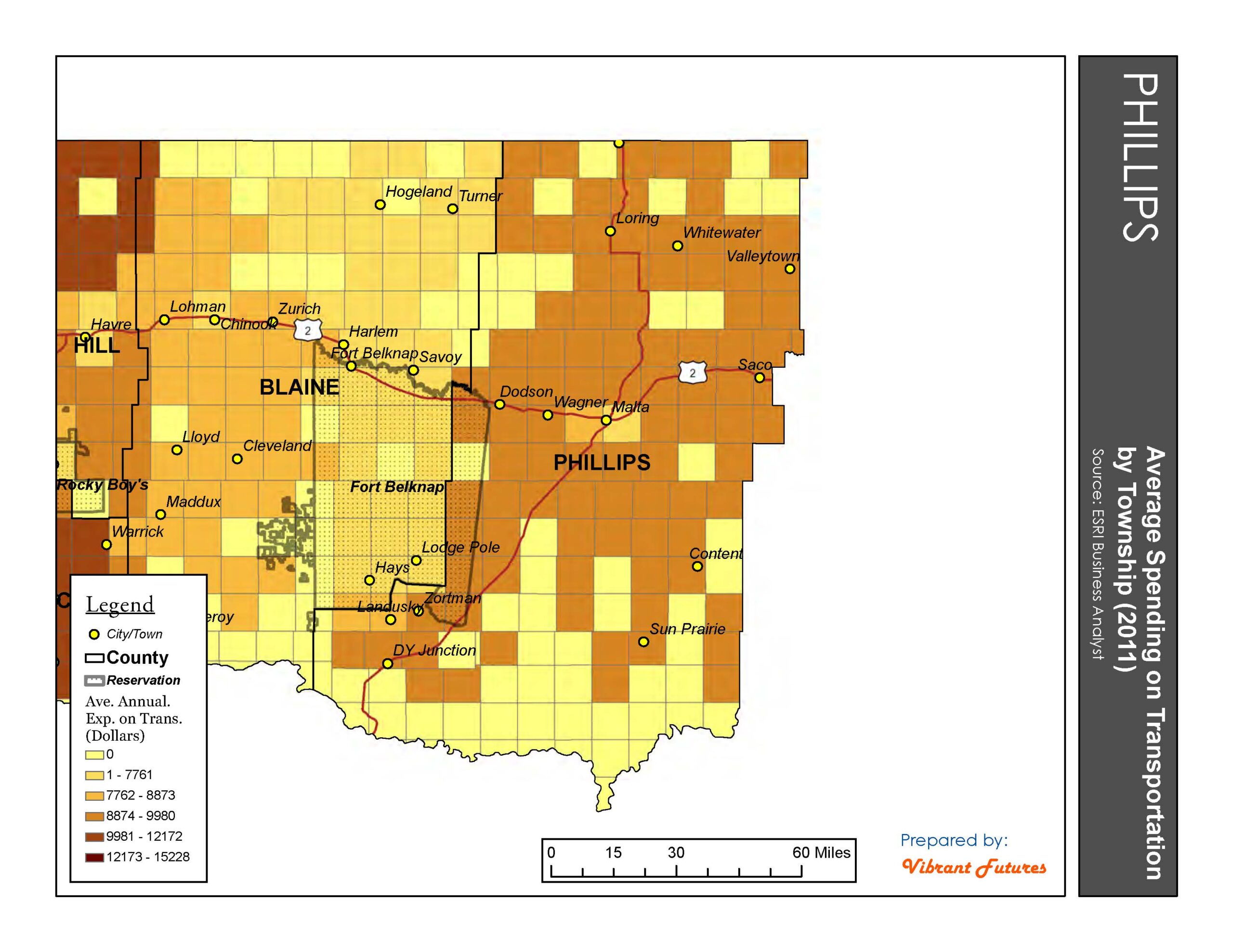
- Average Expenditure on Transportation Phillips County
-
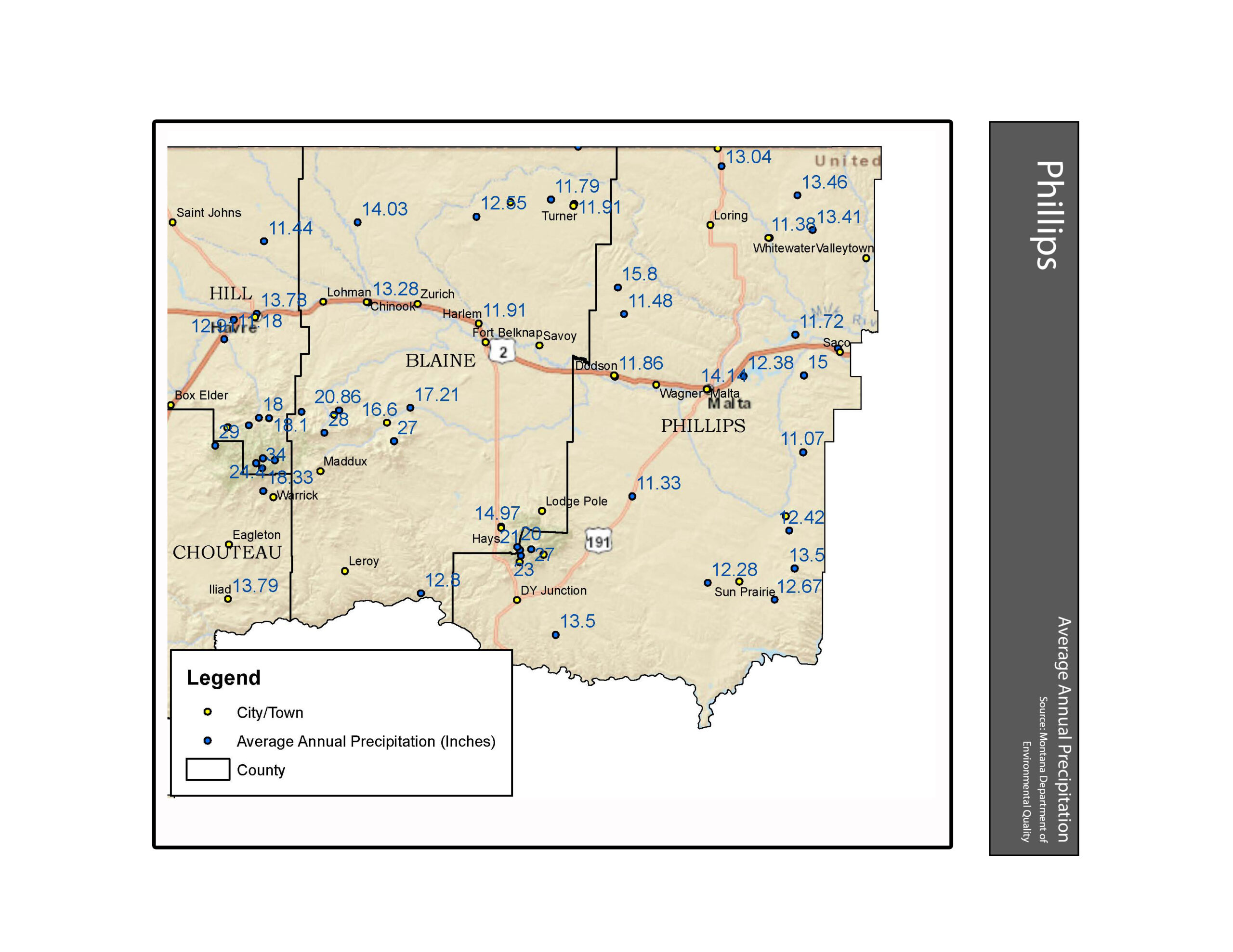
- Average Annual Precipitation Phillips County
-
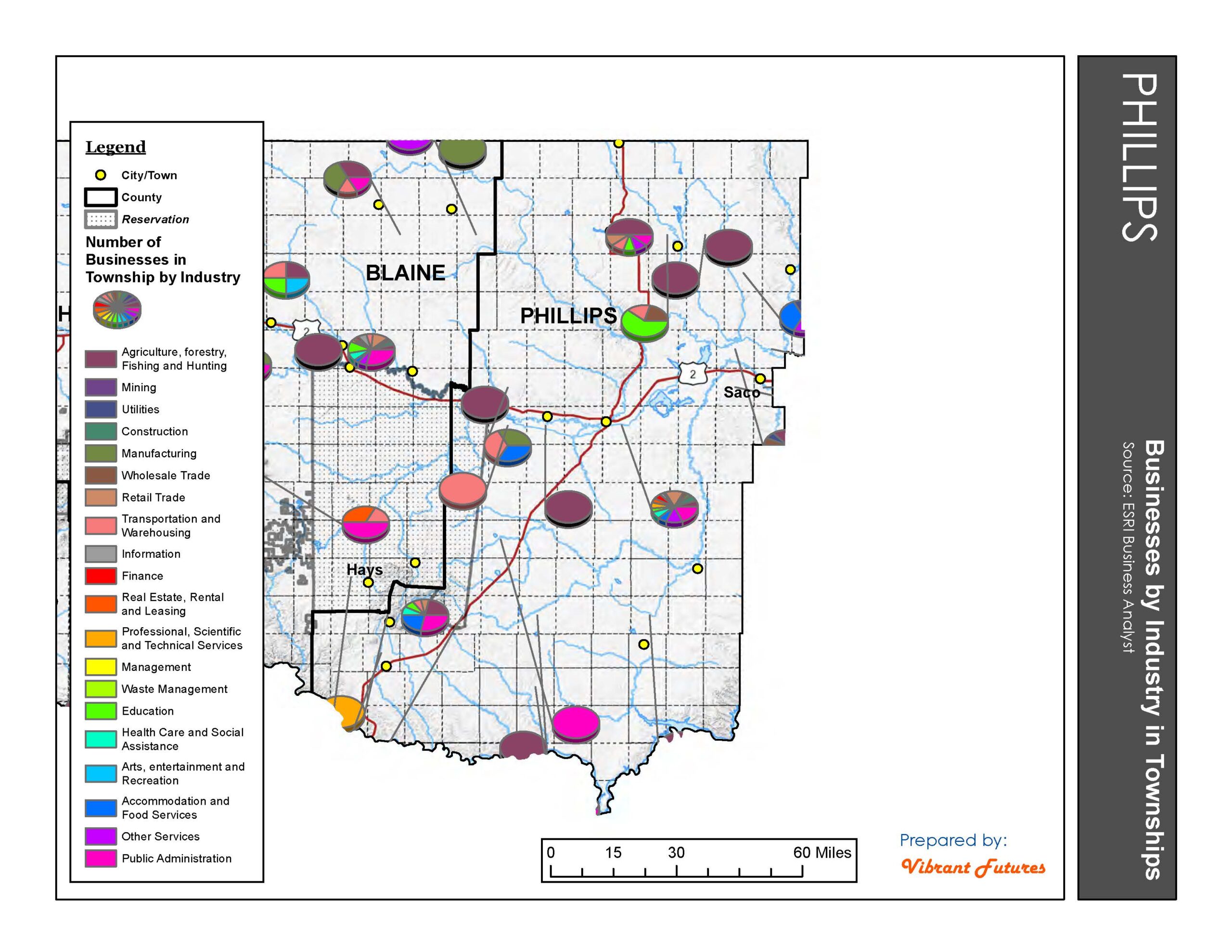
- Businesses by Industry in Townships Phillips County
-
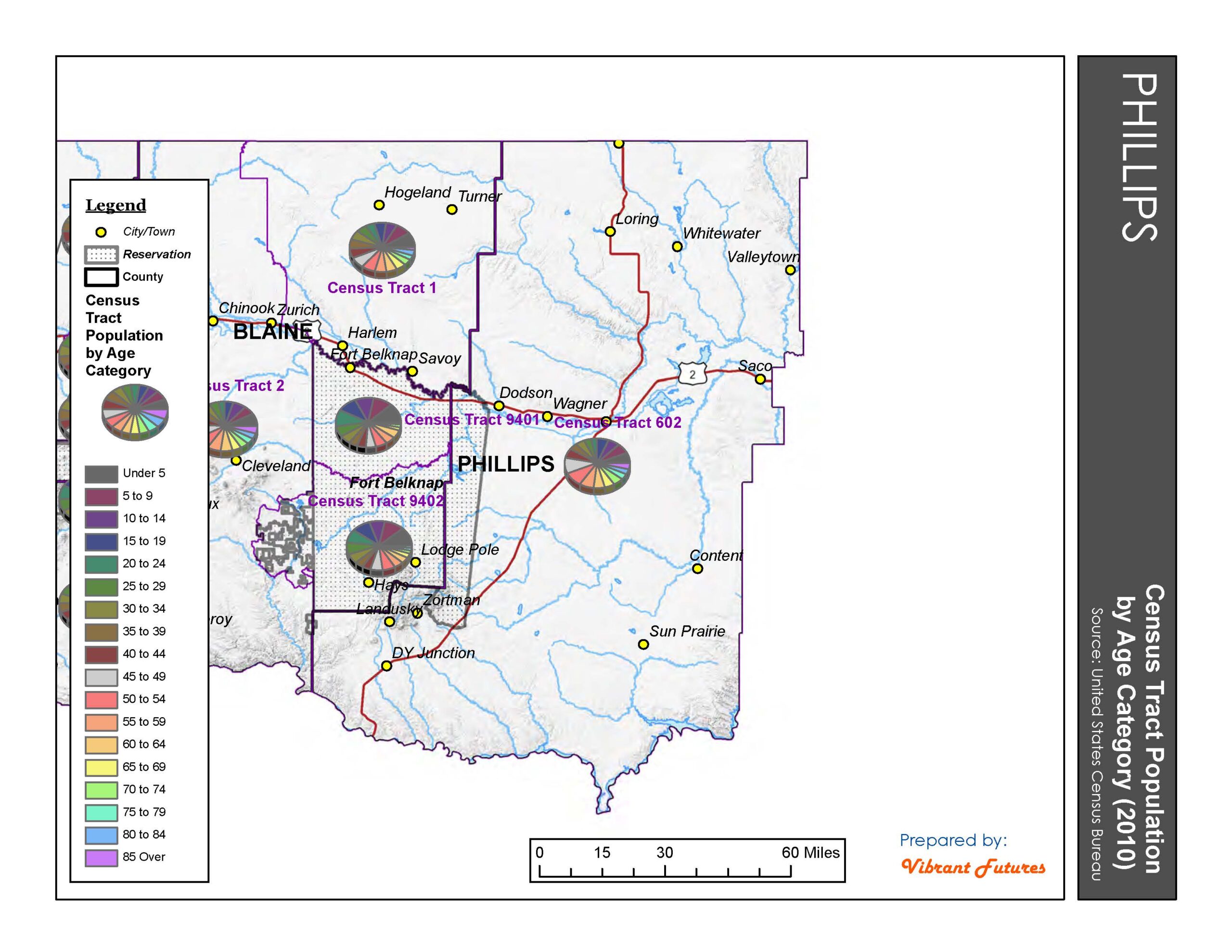
- Census Tract Population by Age Category (2010) Phillips County
-

- Conservation Easements Phillips County
-

- County Population by Age Category (2010) Phillips County
-
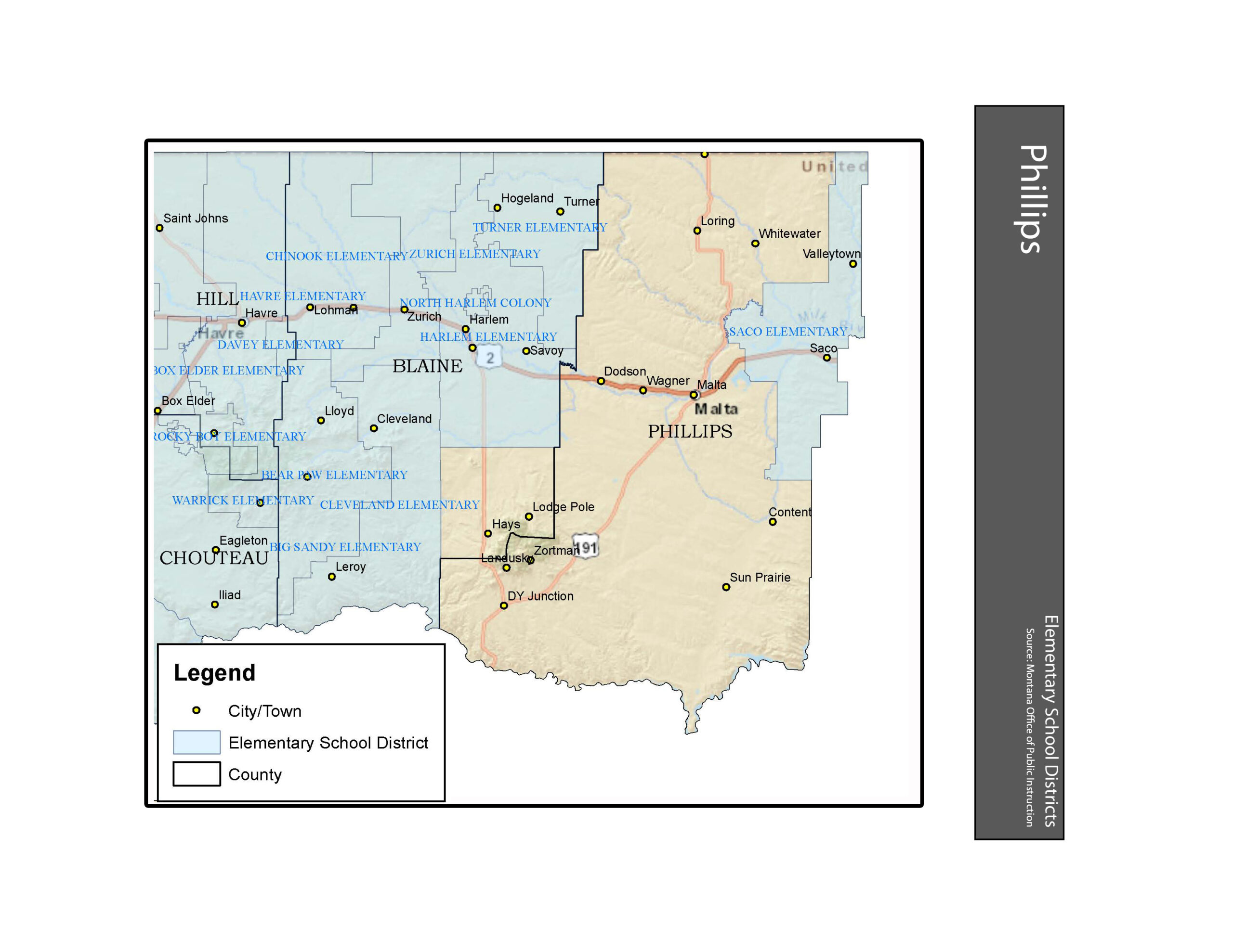
- Elementary School Districts Phillips County
-
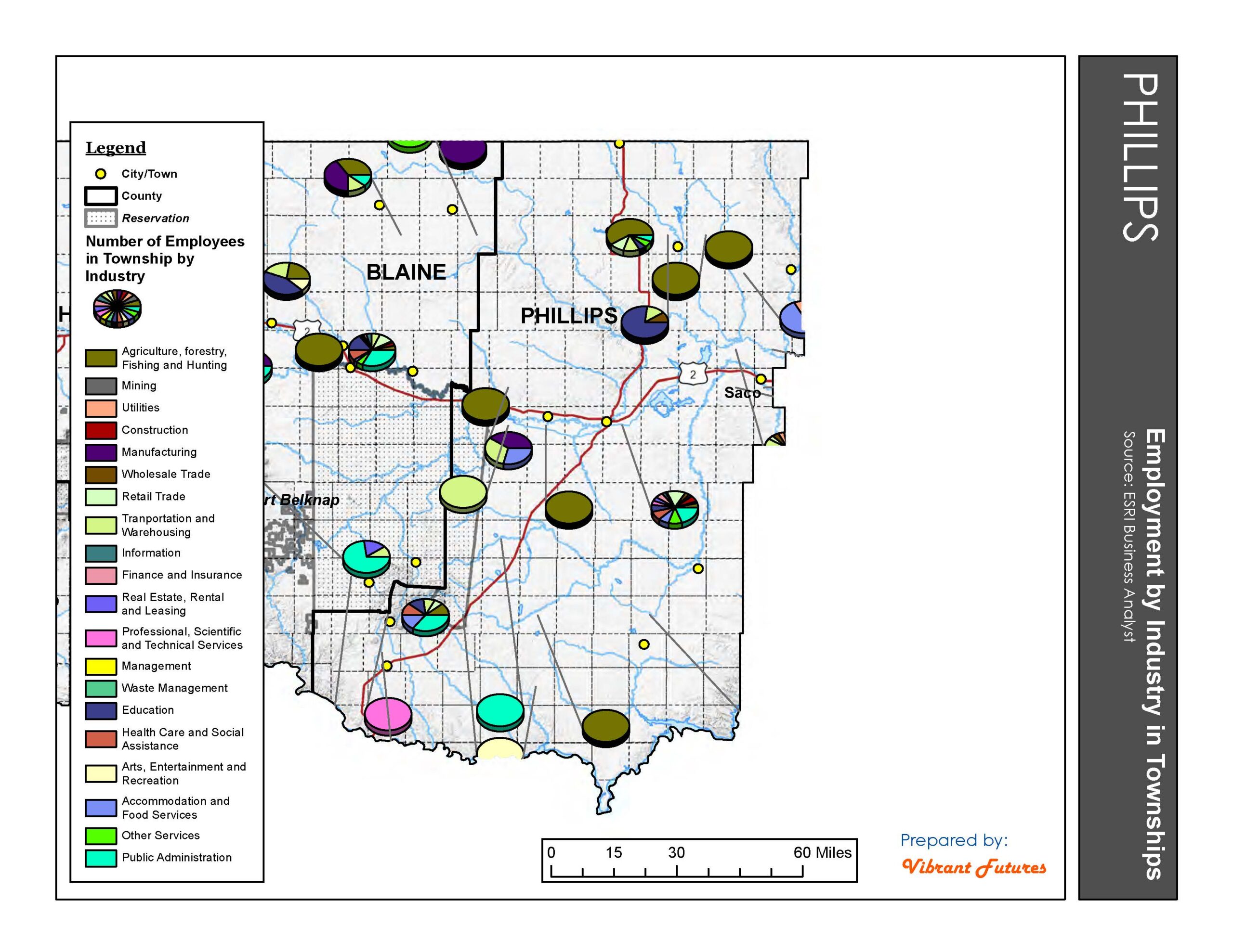
- Employment by Industry in Townships Phillips County
-
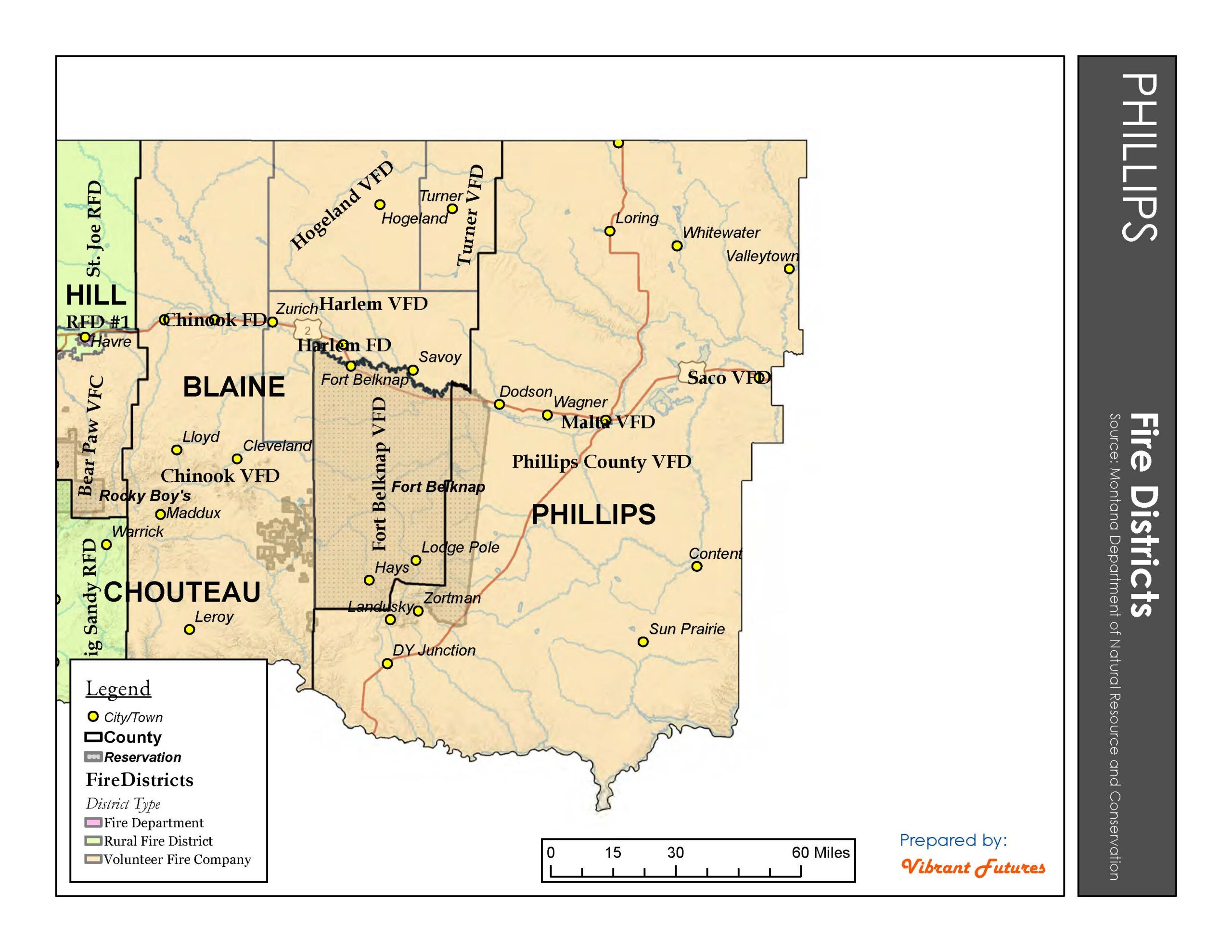
- Fire Districts Phillips County
-
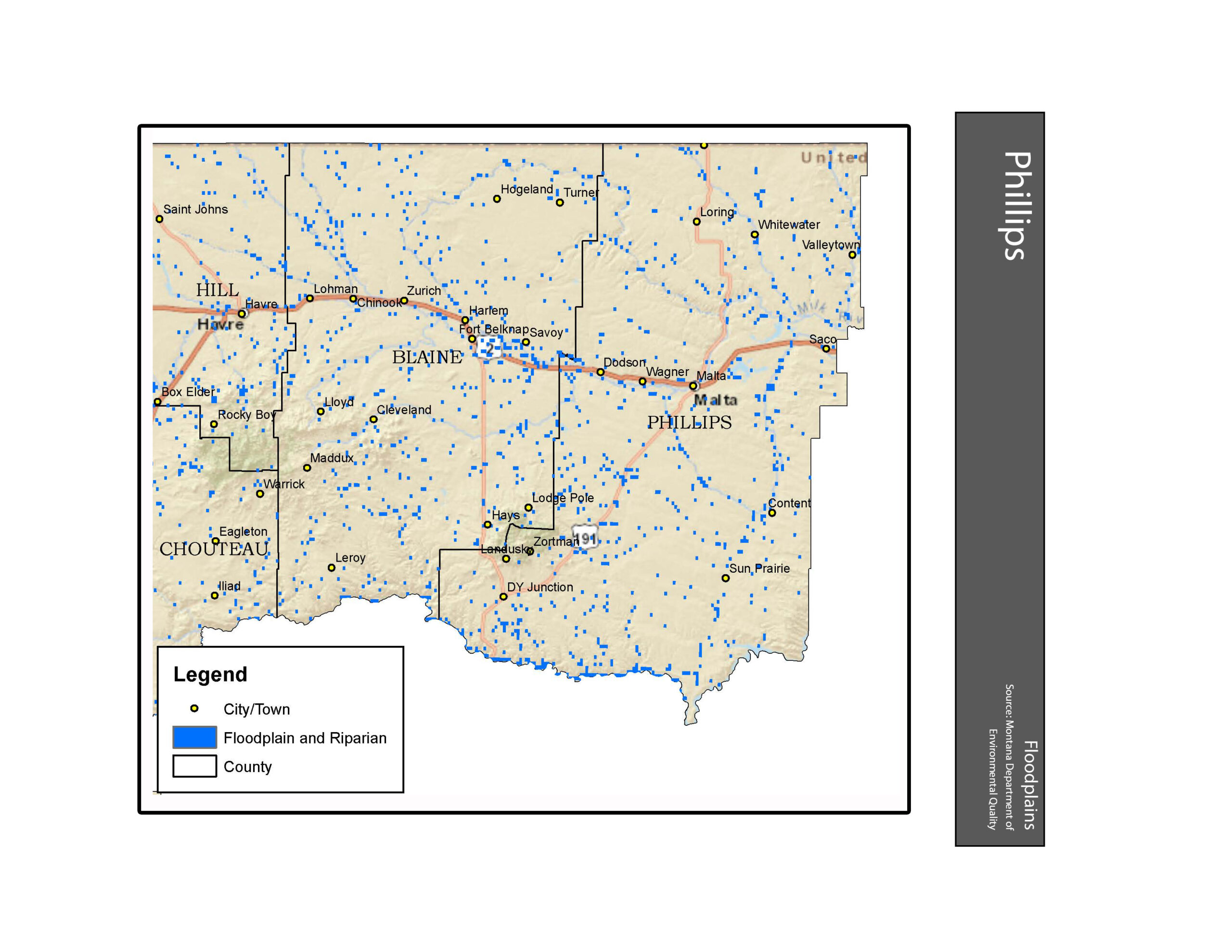
- Floodplains Phillips County
-
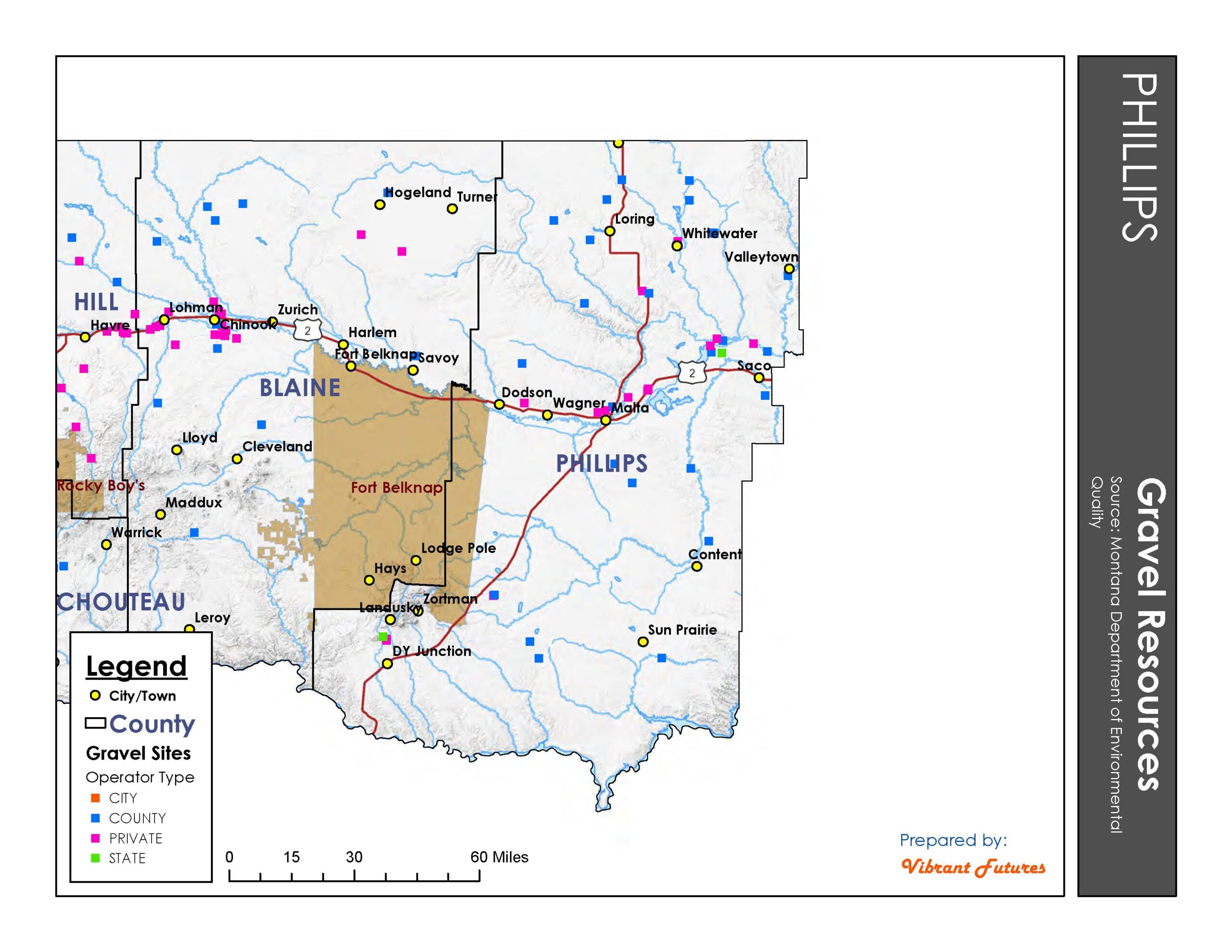
- Gravel Resources Phillips County
-

- Gray Wolf Distribution Phillips County
-
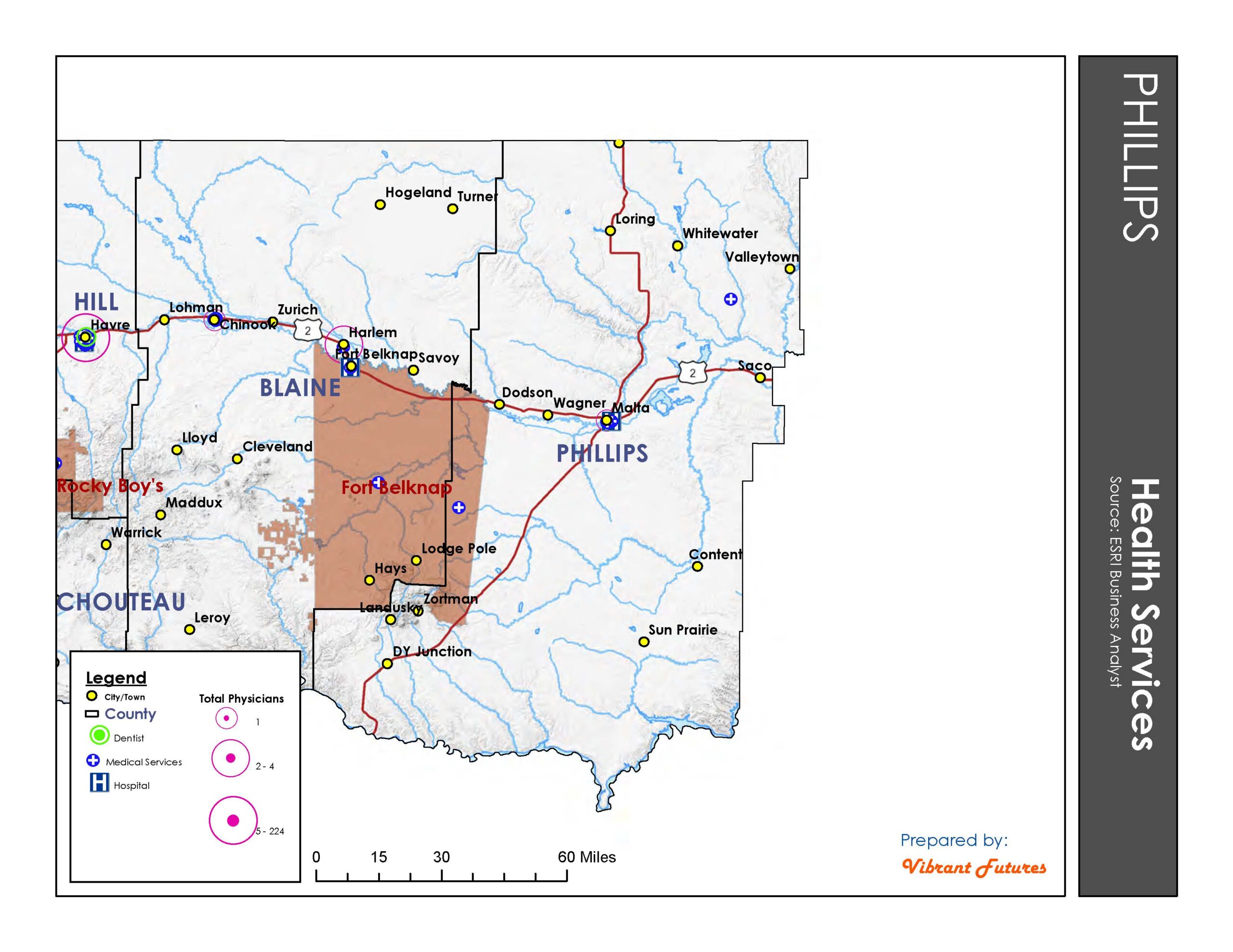
- Health Services Phillips County
-
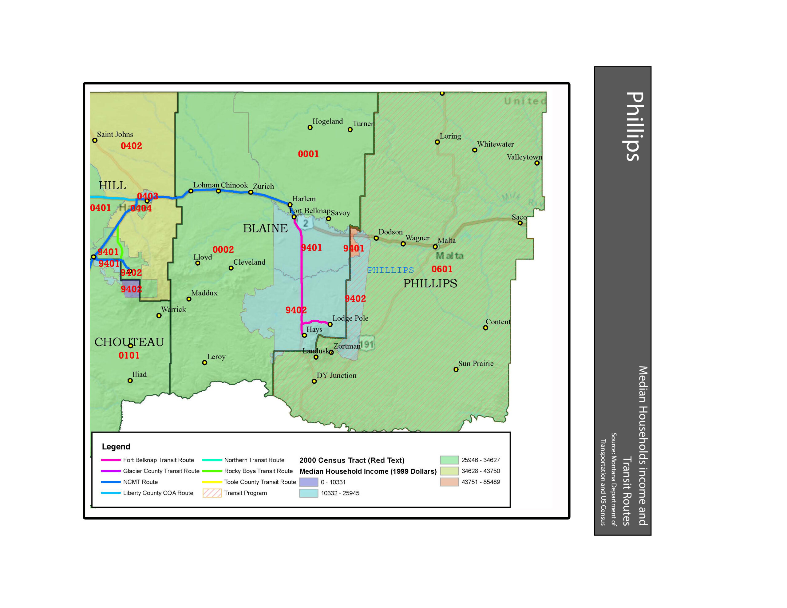
- Income and Transit Phillips County
-
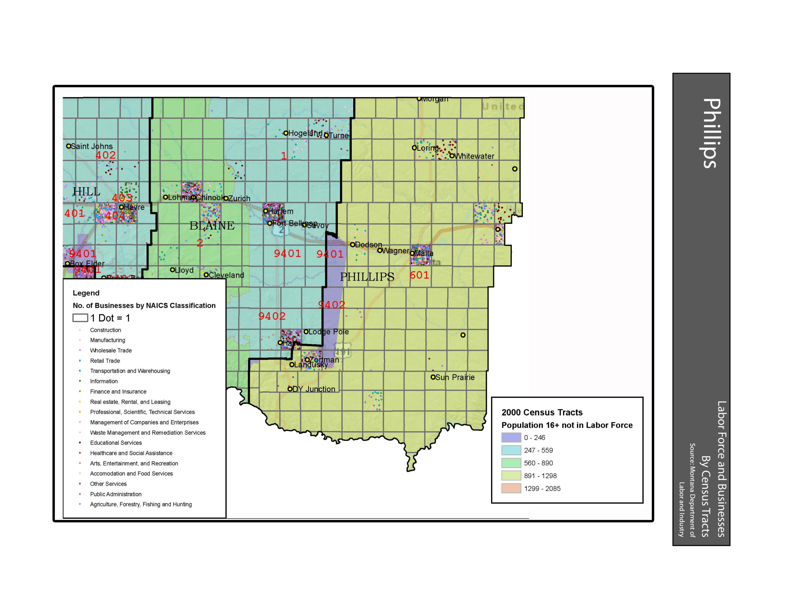
- Labor Force and Businesses Phillips County
-
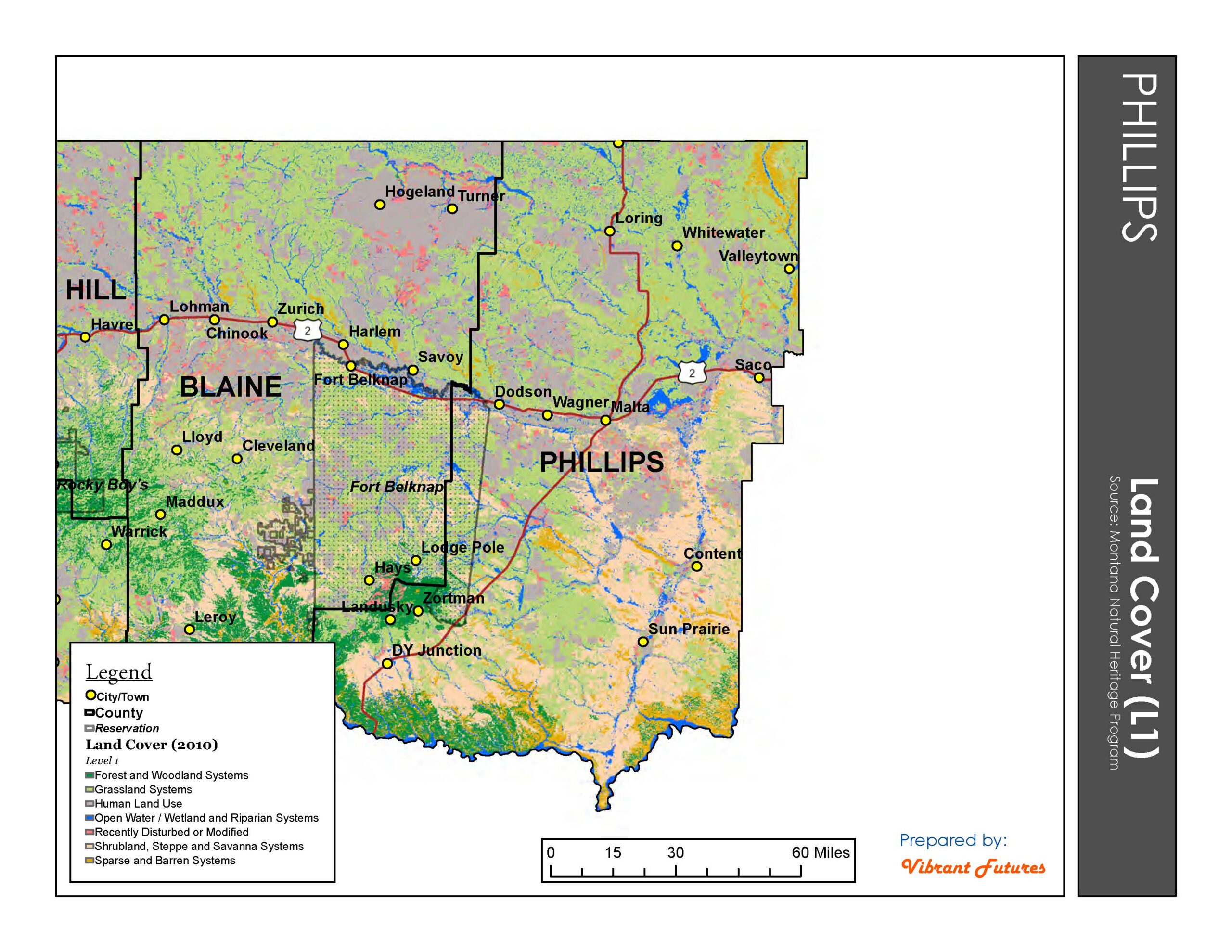
- Land Cover Phillips County
-
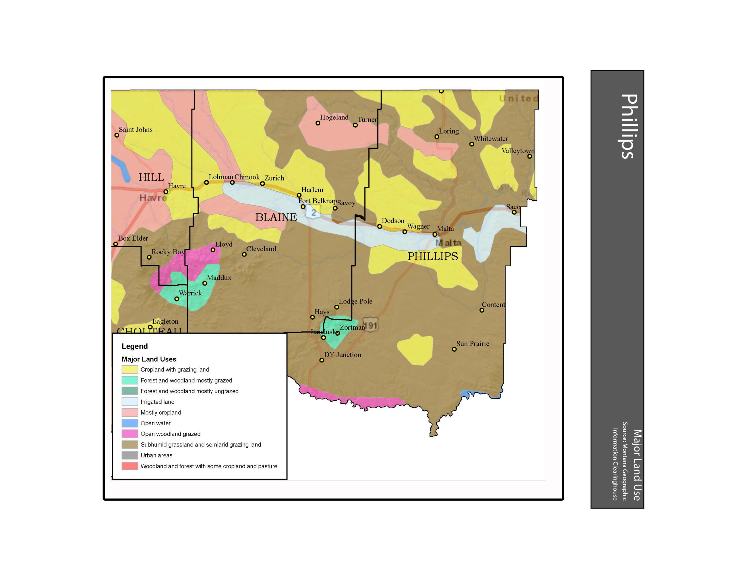
- Major Land Use Phillips County
-
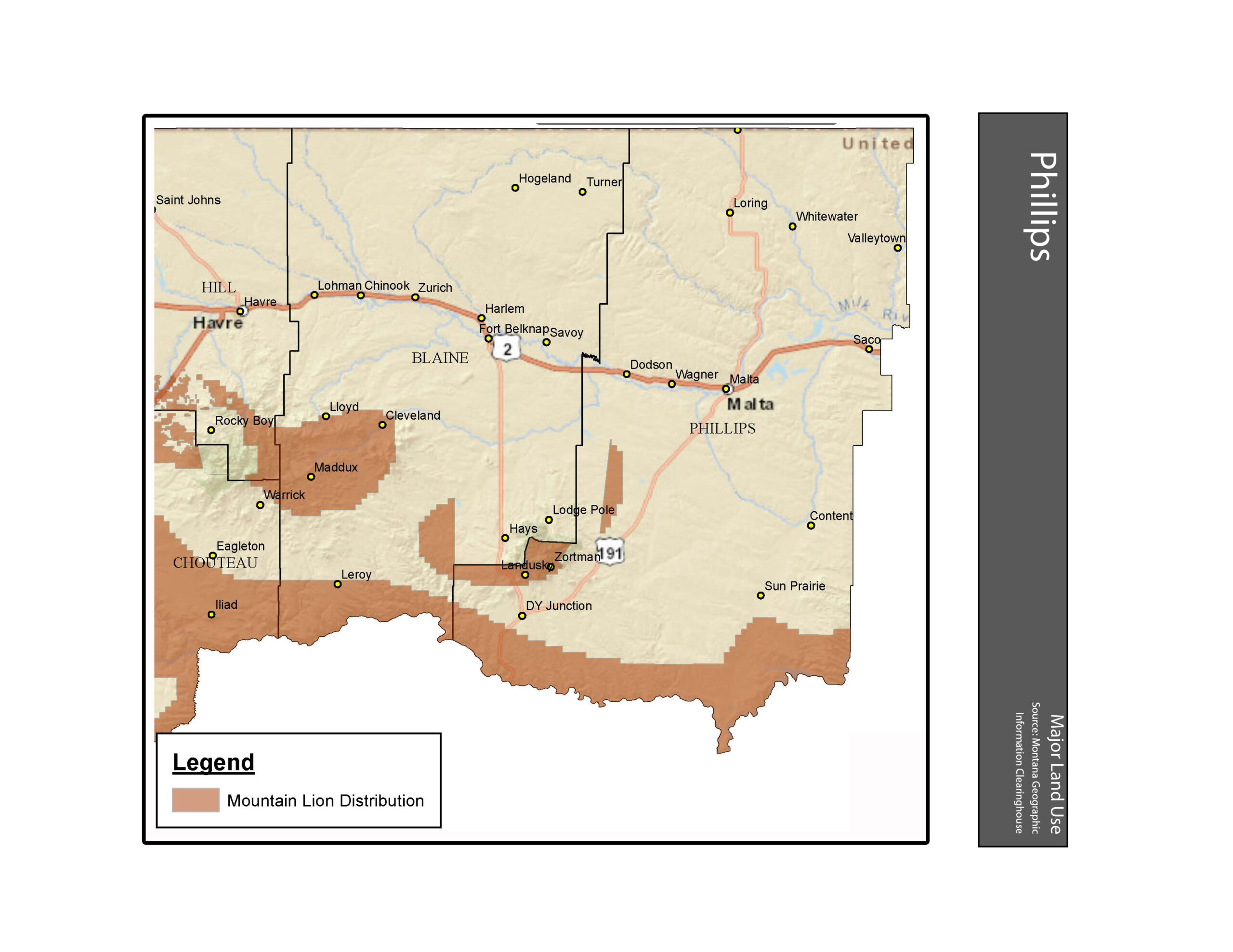
- Mountain Lion Distribution Phillips County
-
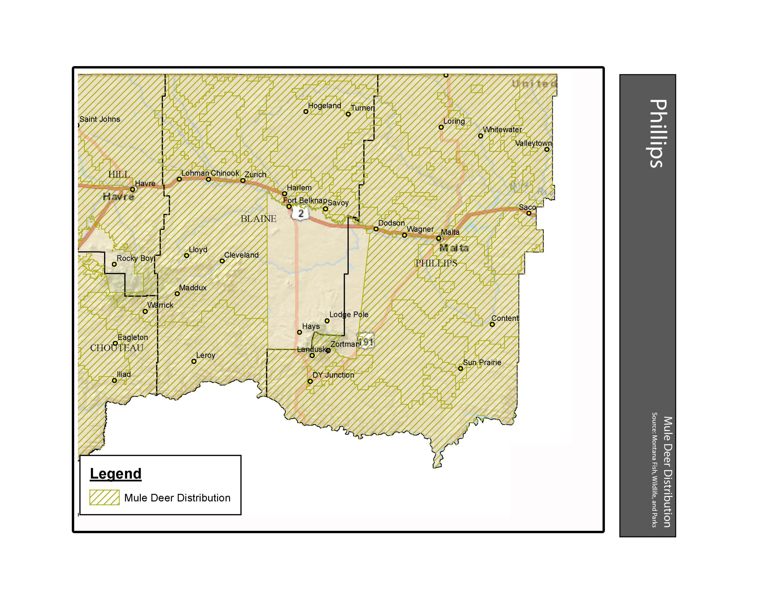
- Mule Deer Distribution Phillips County
-
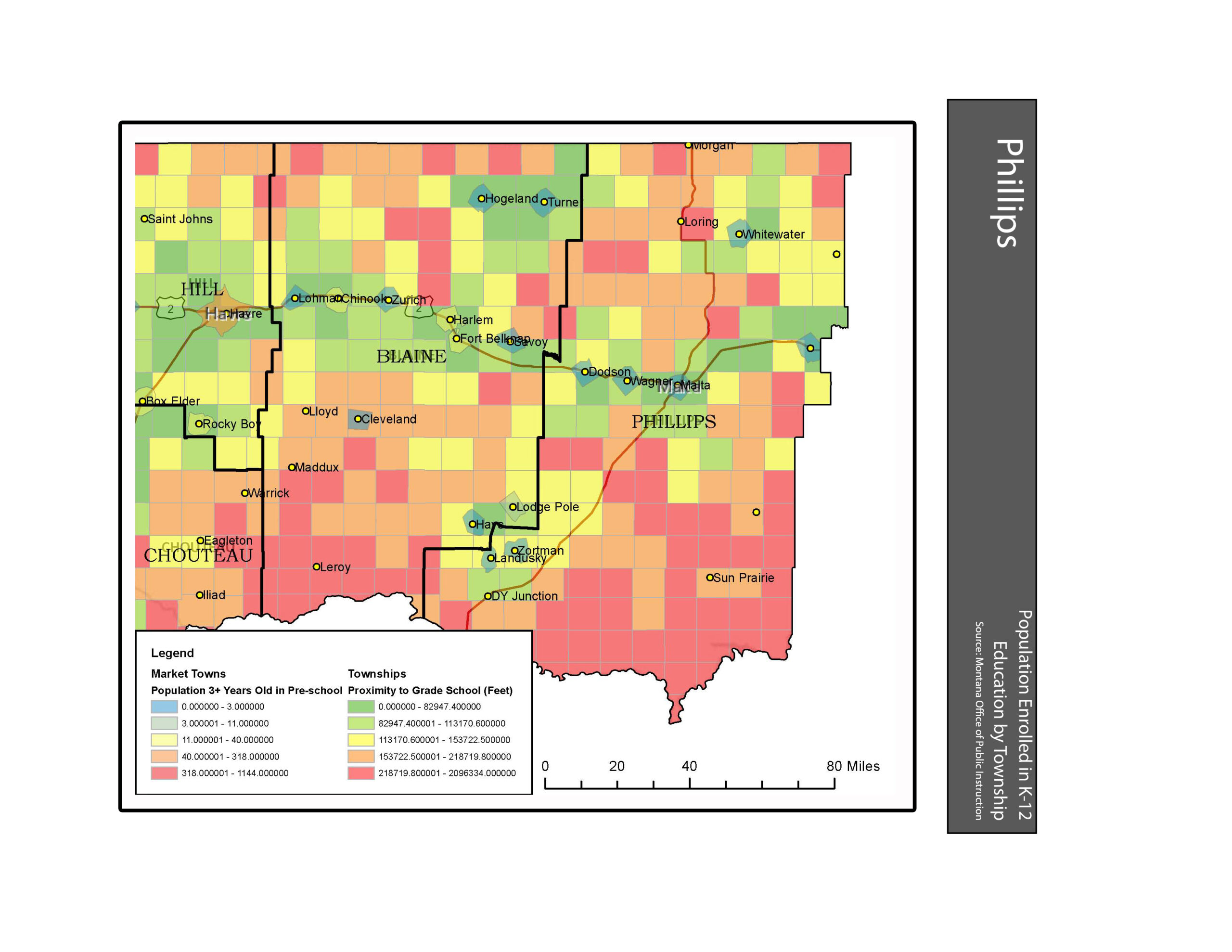
- Population enrolled in Grades K12 Phillips County
-
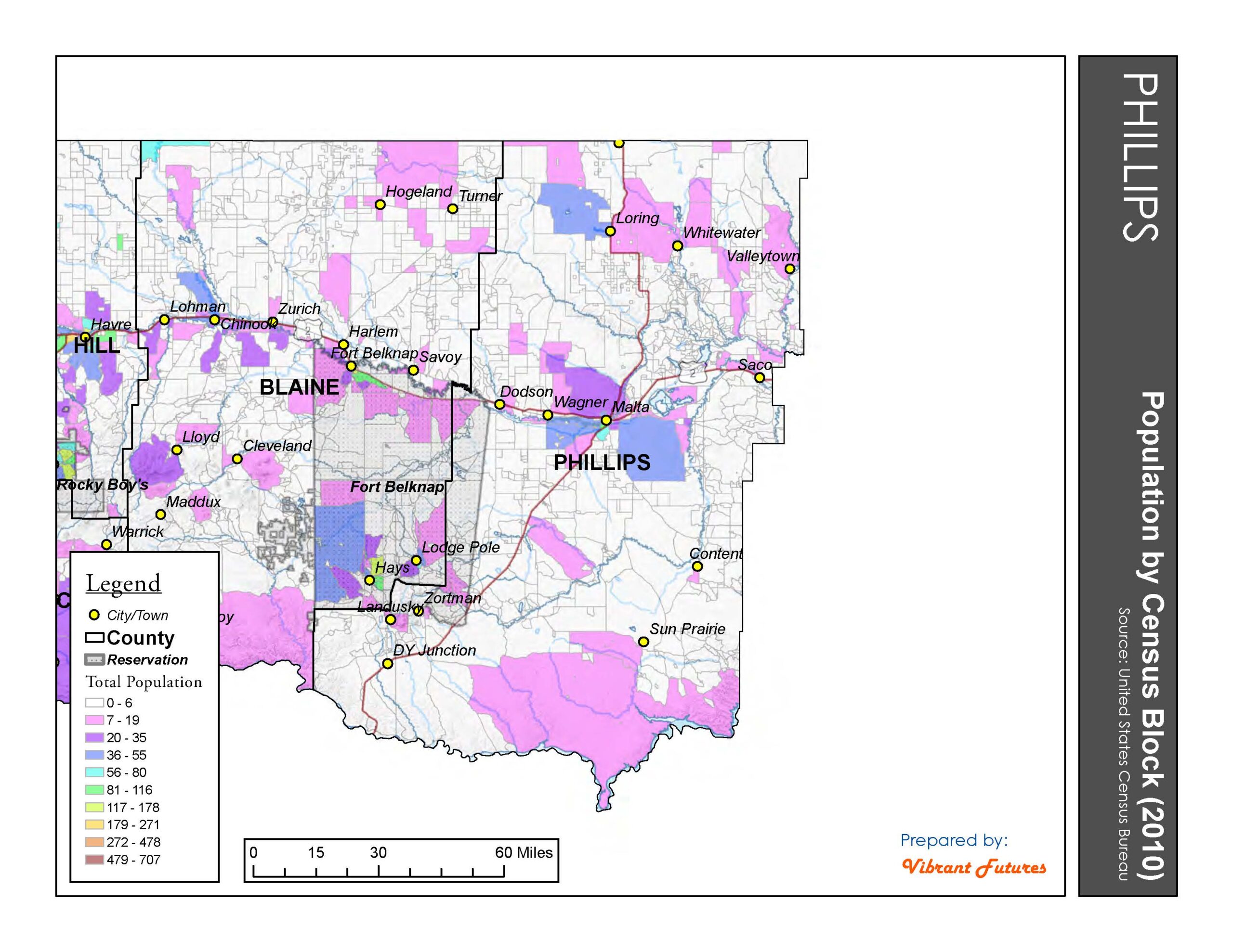
- Population by Census Block 2010 Phillips County
-
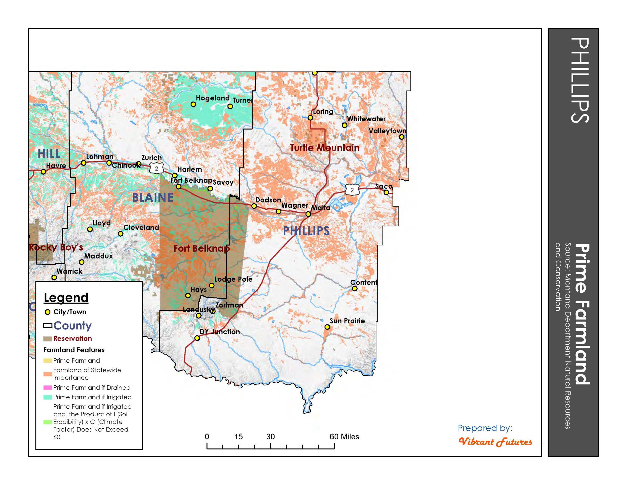
- Prime Farmland Phillips County
-
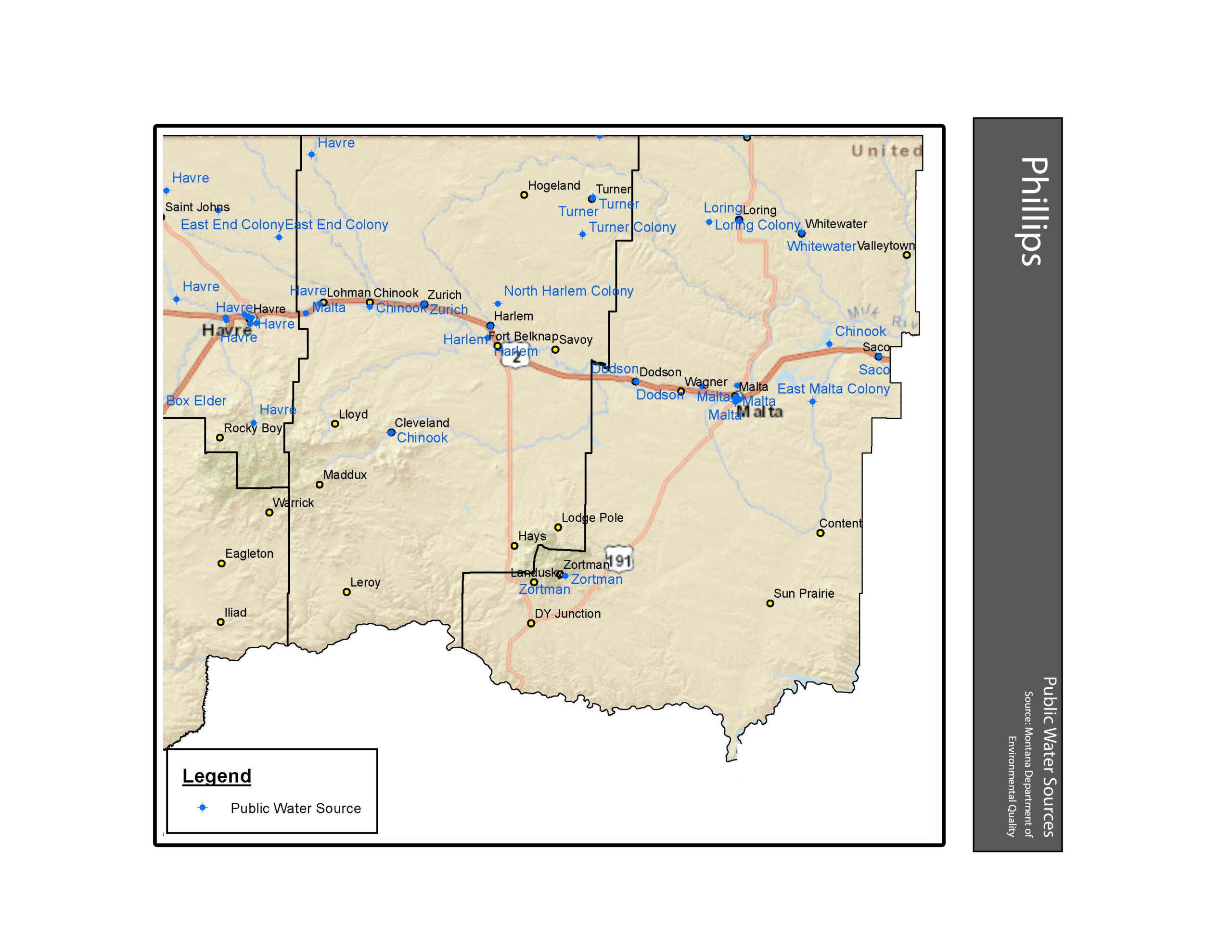
- Public Water Sources Phillips County
-
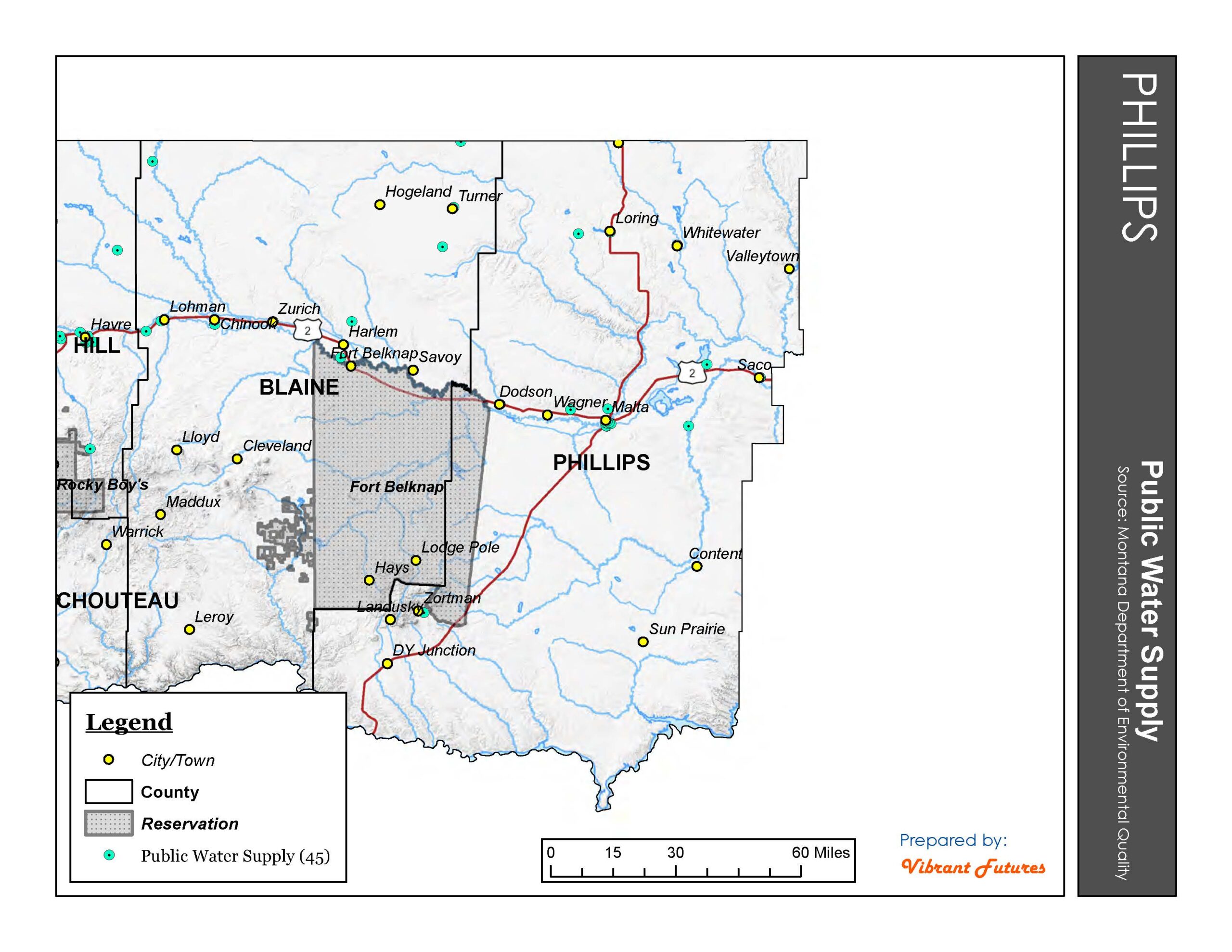
- Public Water Supply Phillips County
-
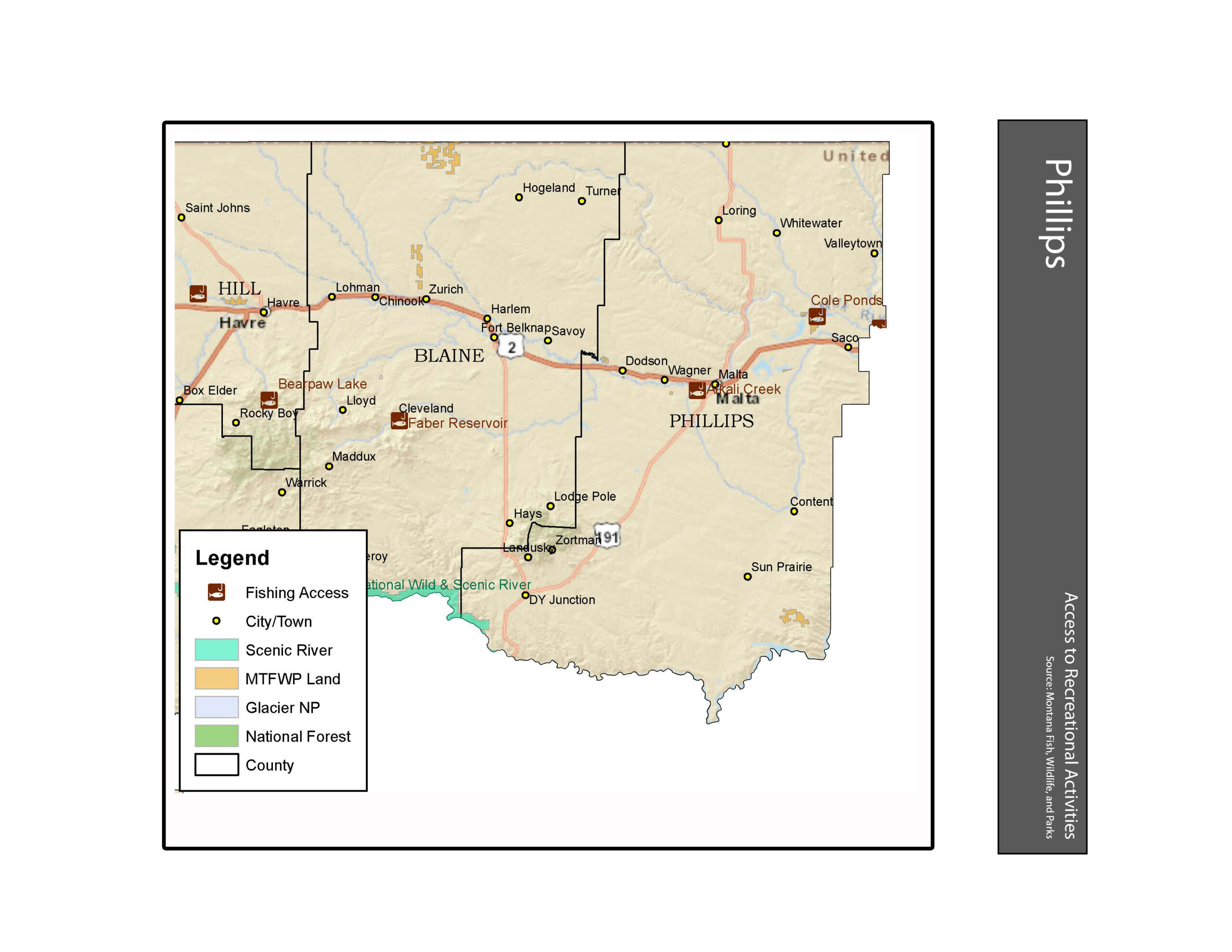
- Recreation Phillips County
-
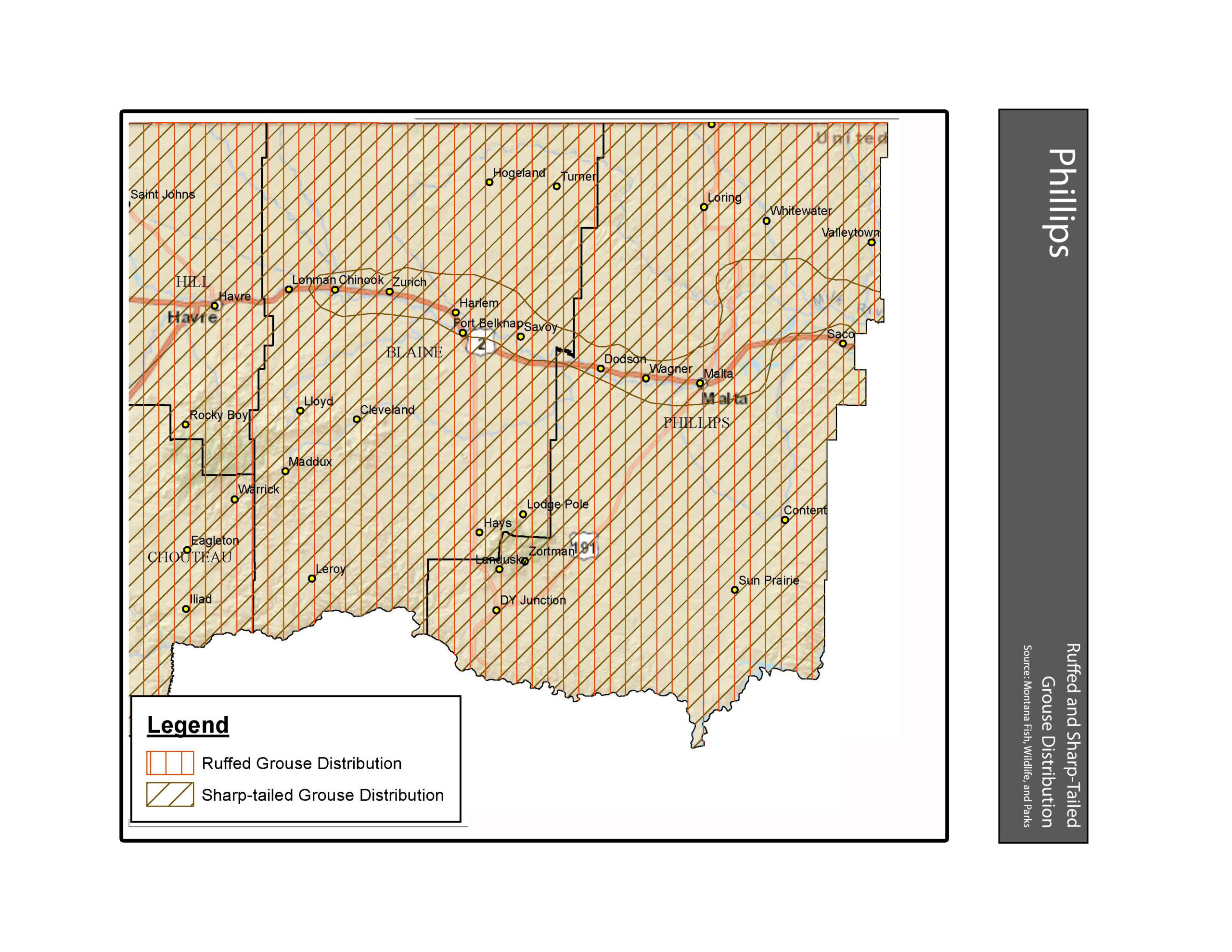
- Ruffed and Sharp-tailed Grouse Distribution Phillips County
-
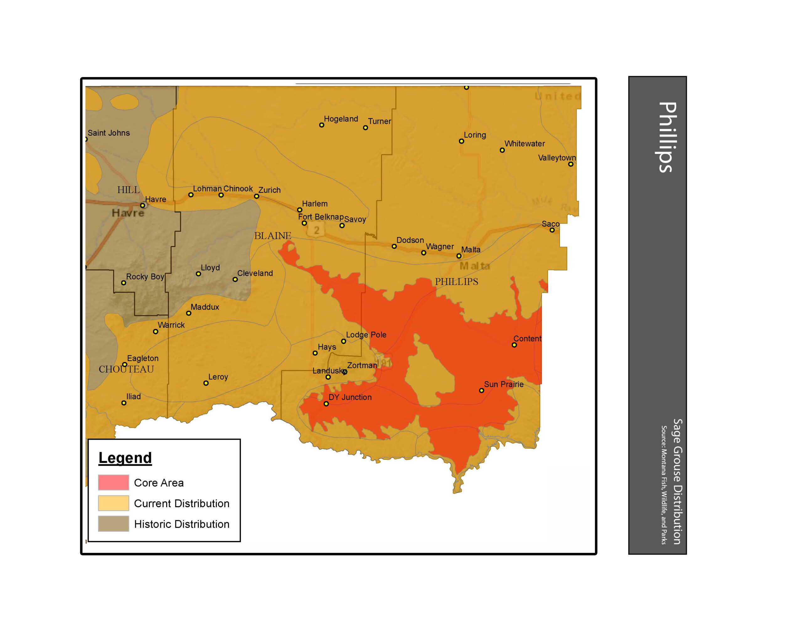
- Sage Grouse Habitat and Distribution Phillips County
-
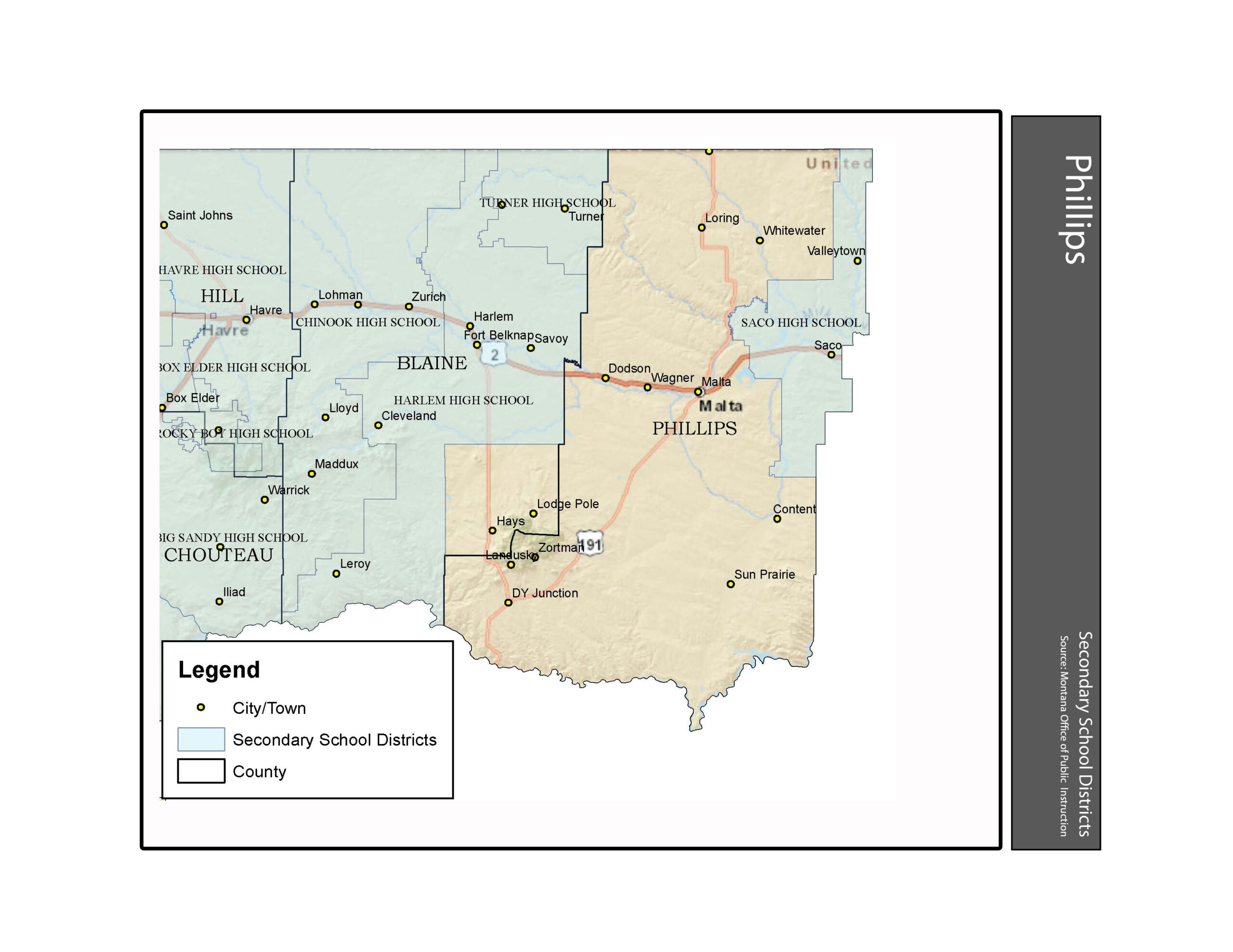
- Secondary School Districts Phillips County
-
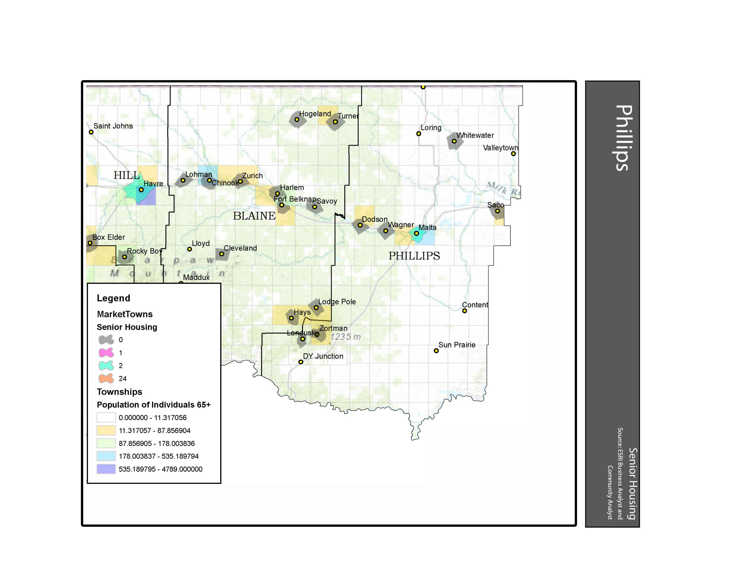
- Senior Housing Phillips County
-
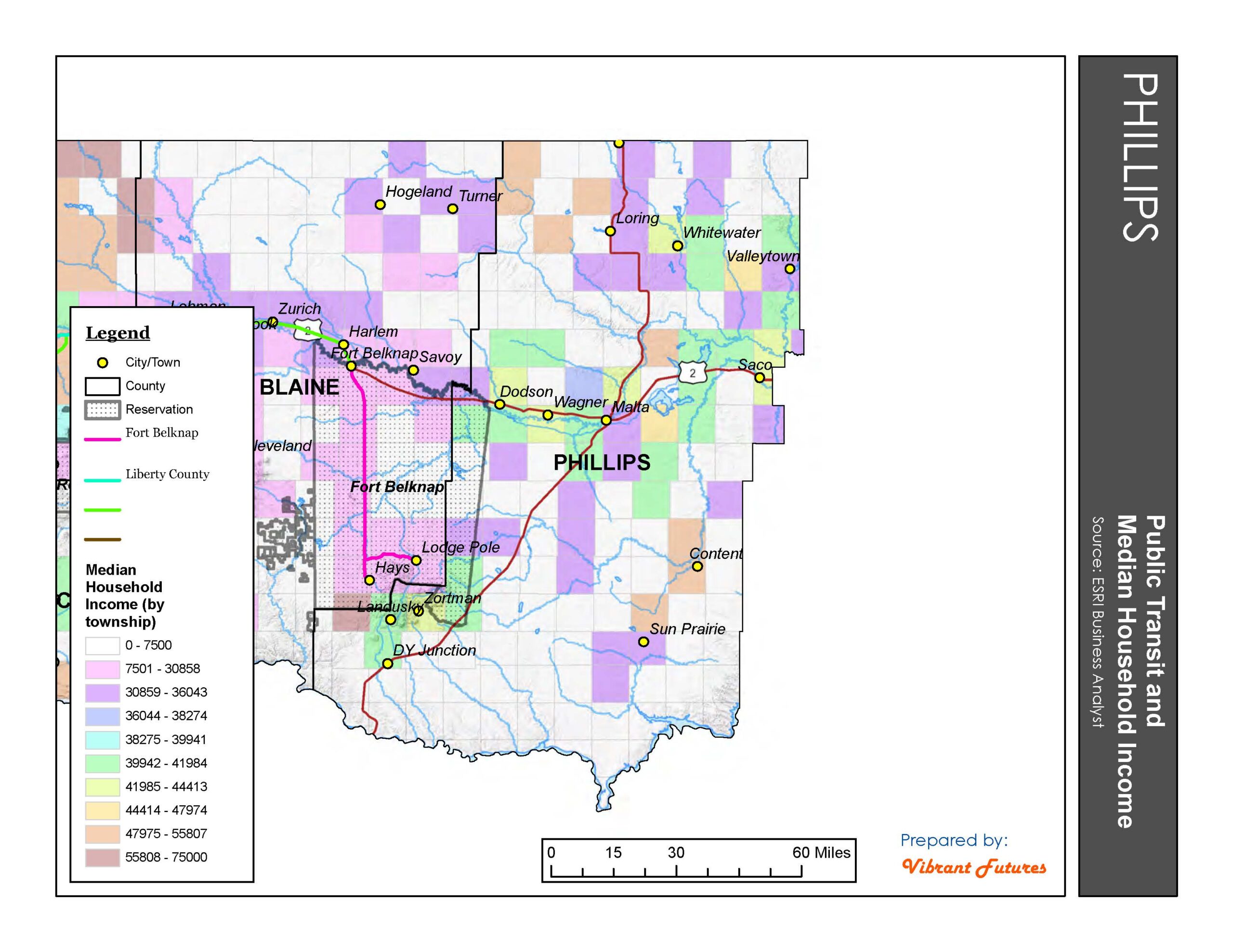
- Transit and Income (by Township) Phillips County
-
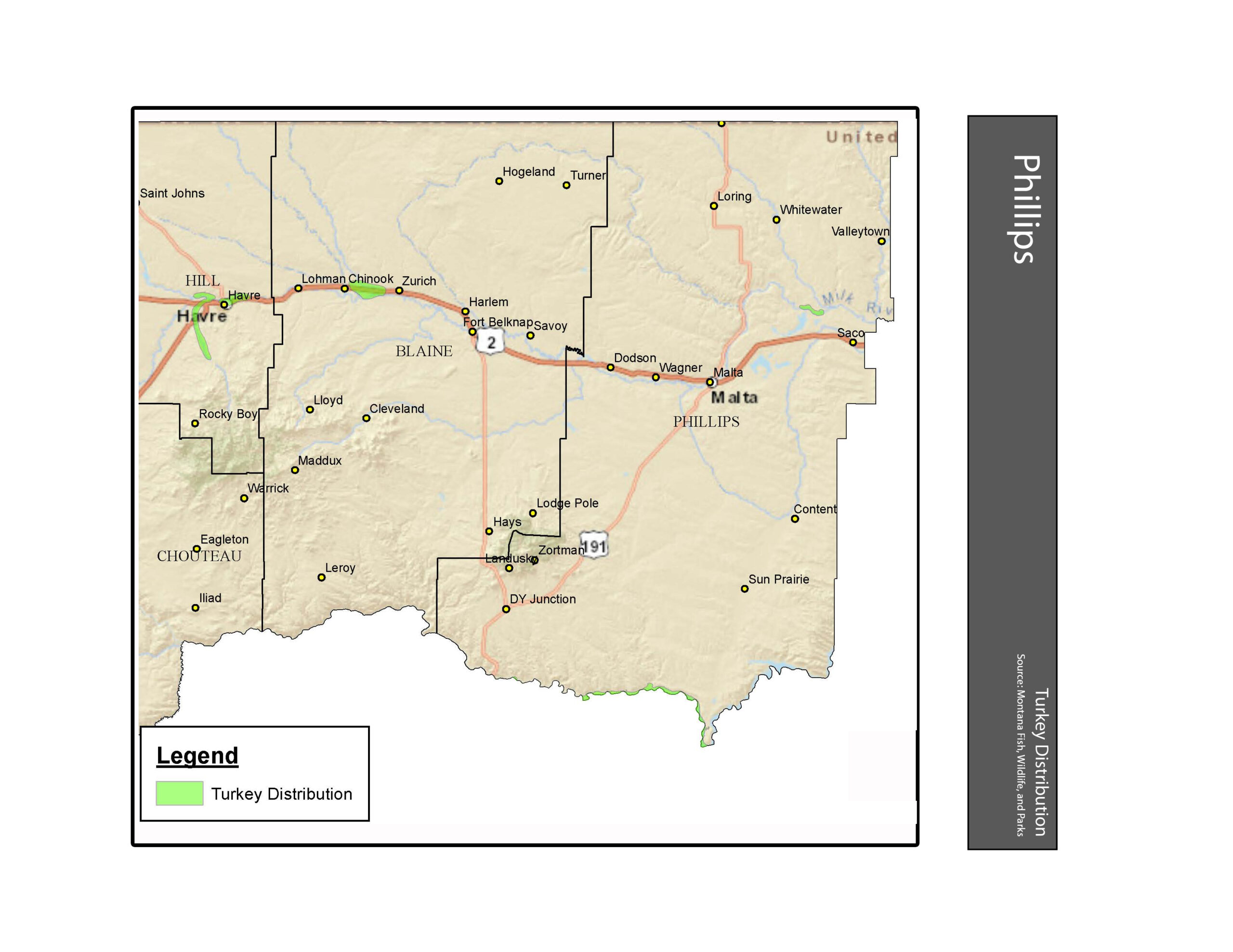
- Turkey Distribution Phillips County
-

- Unified School Districts Phillips County
-
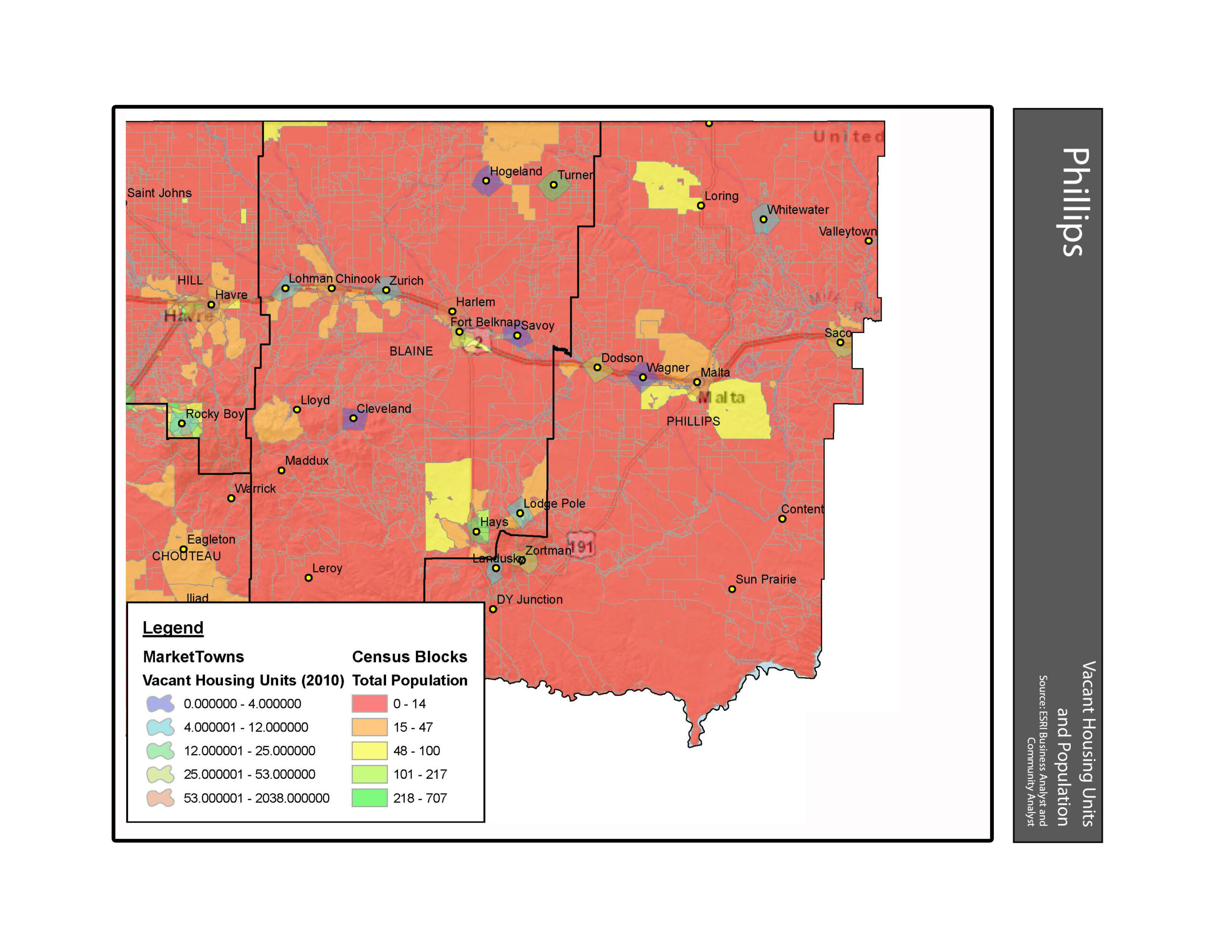
- Vacant Housing and Population Phillips County
-
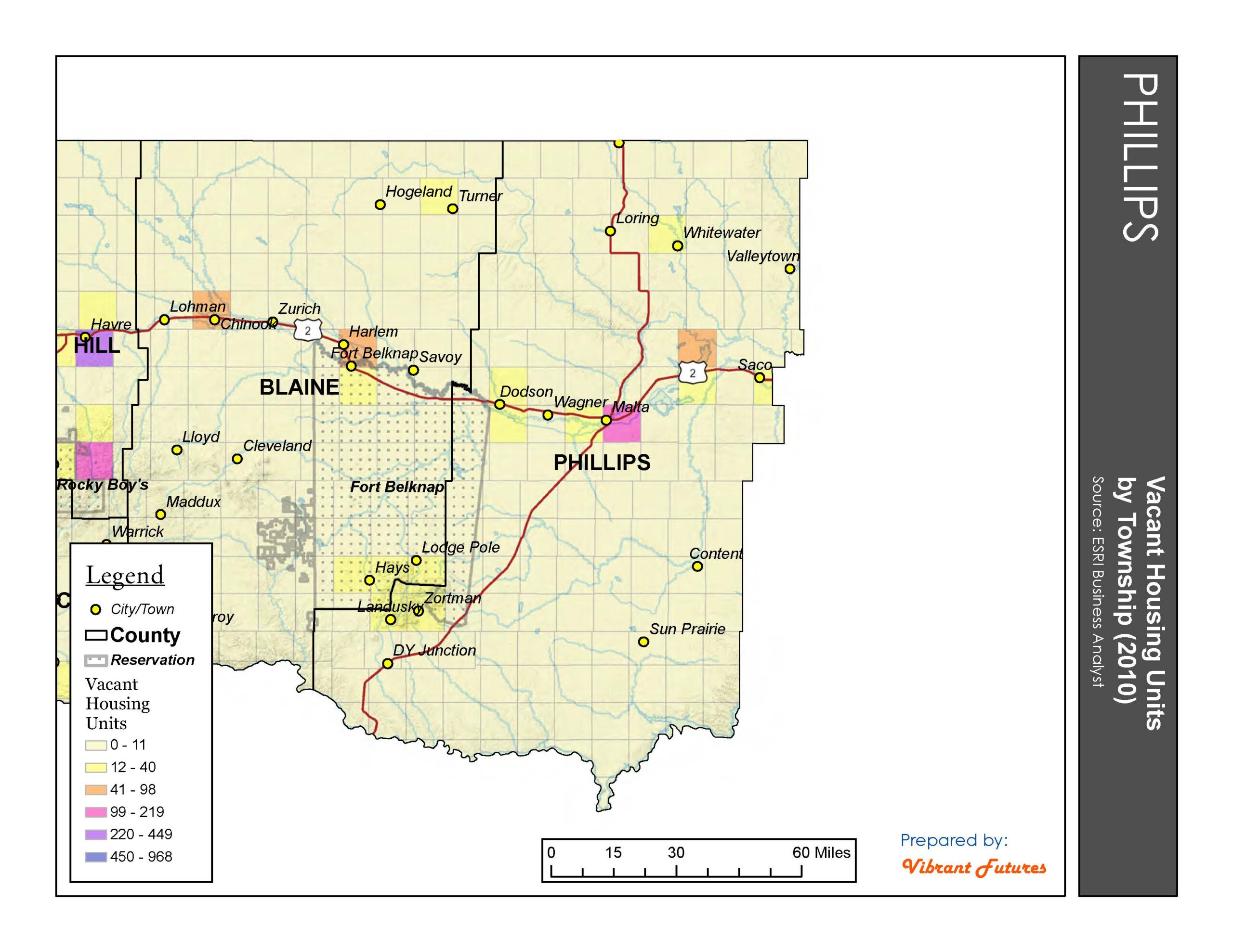
- Vacant Housing Units Phillips County
-
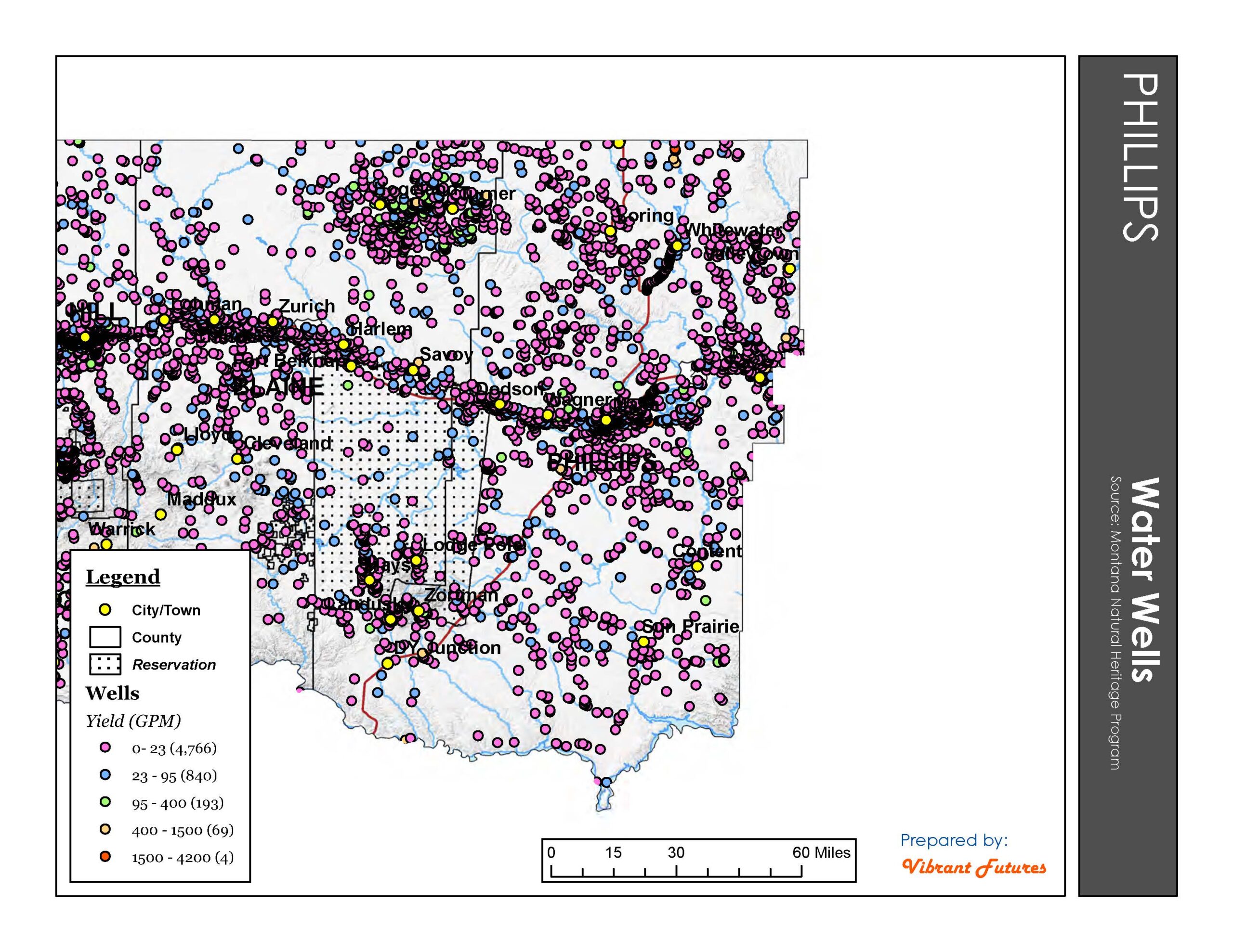
- Water Wells Phillips County
-
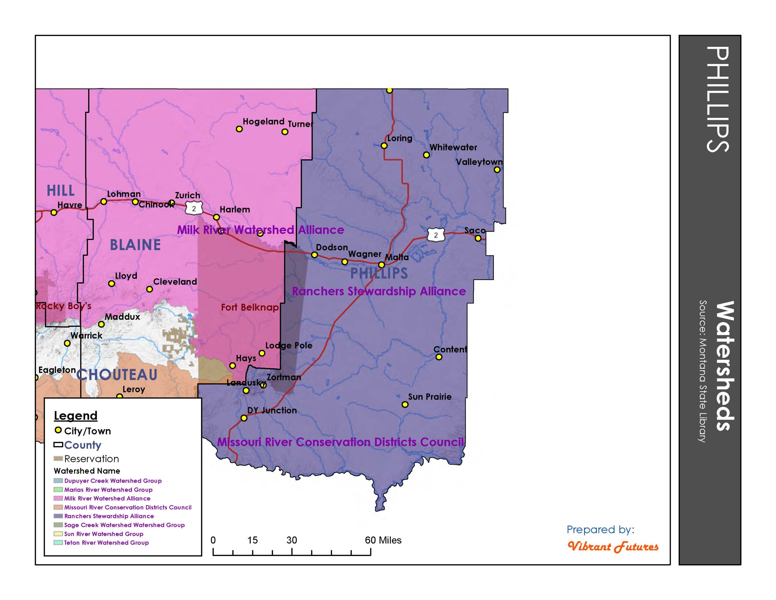
- Watersheds Phillips County
-
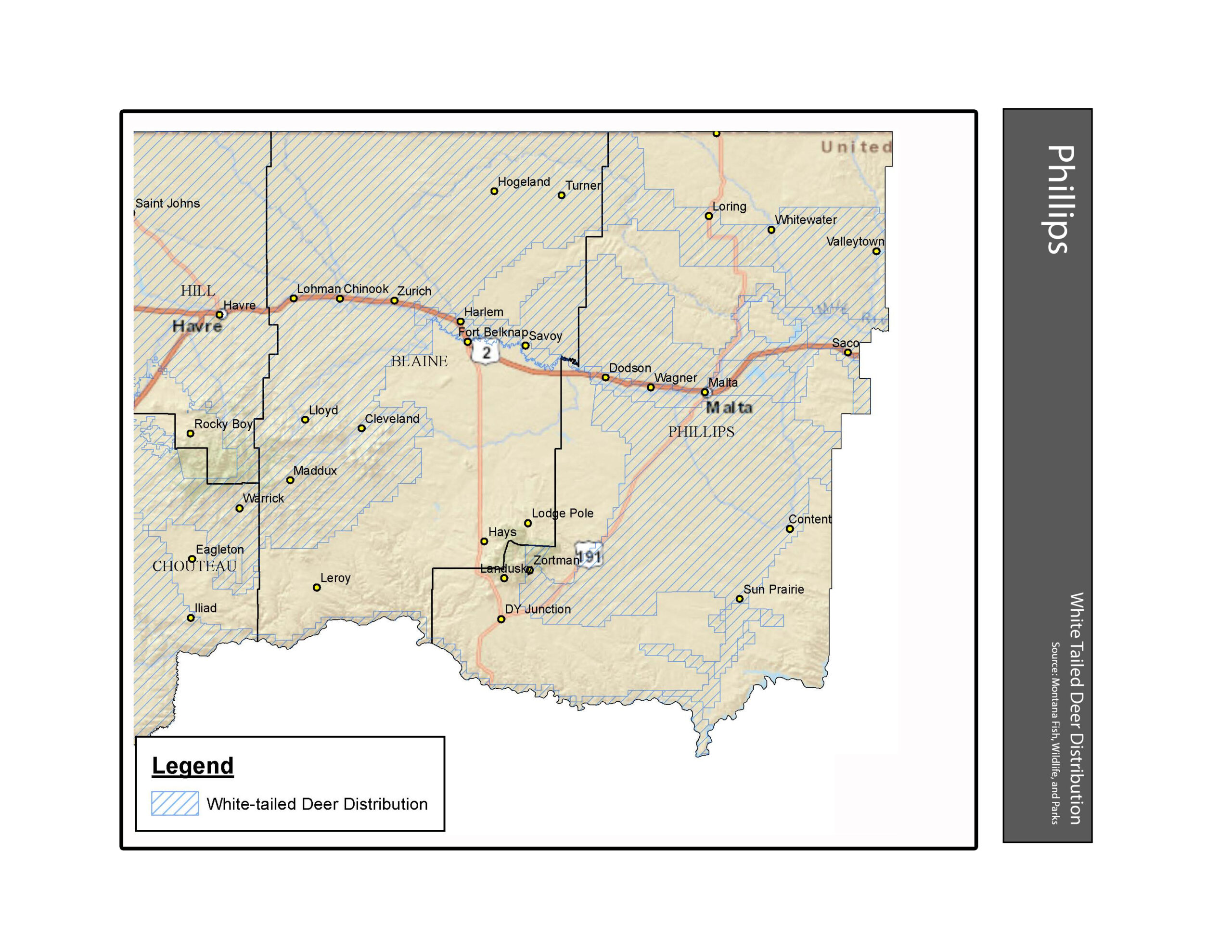
- White-tailed Deer Distribution Phillips County
-

- Wildland Urban Interface Phillips County
-
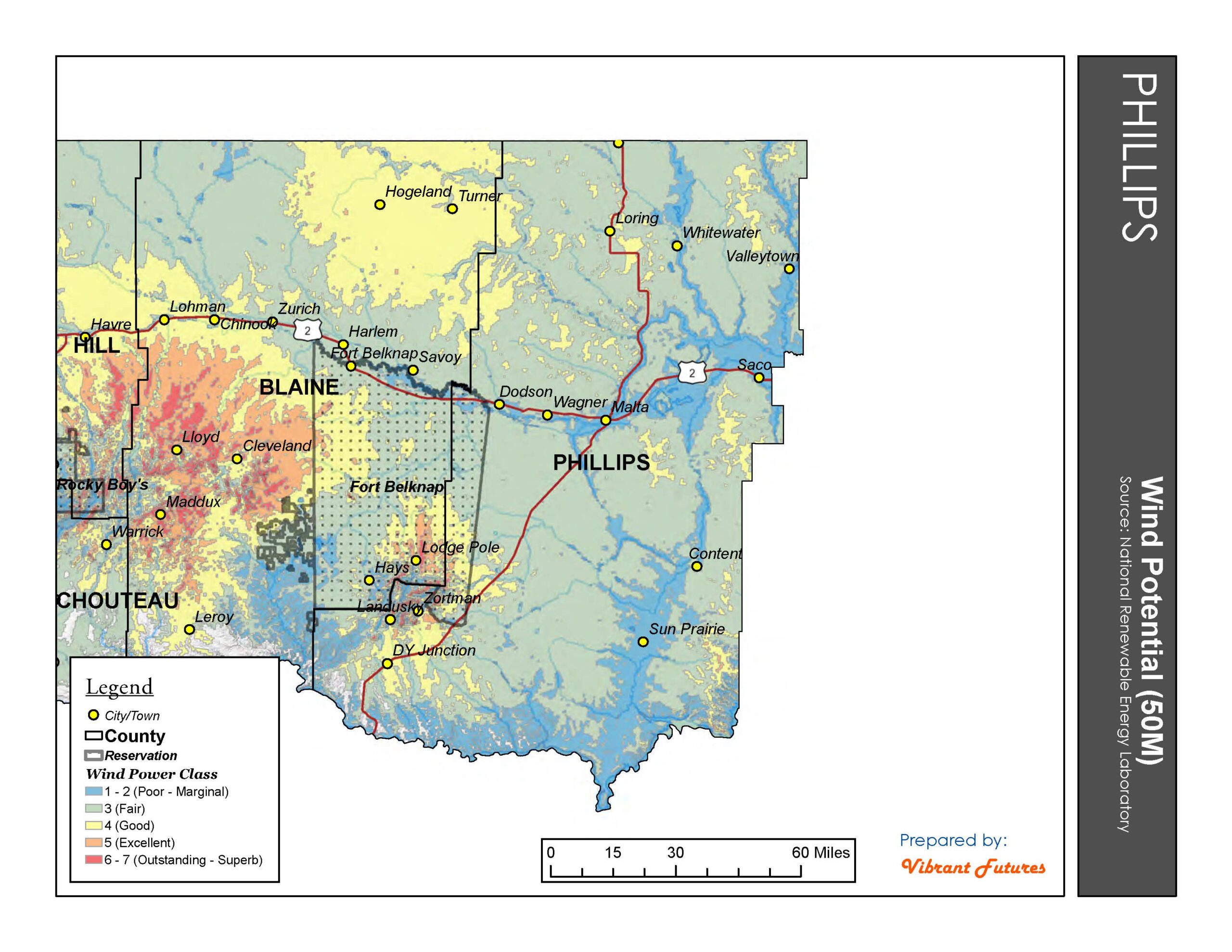
- Wind Potential Phillips County
-
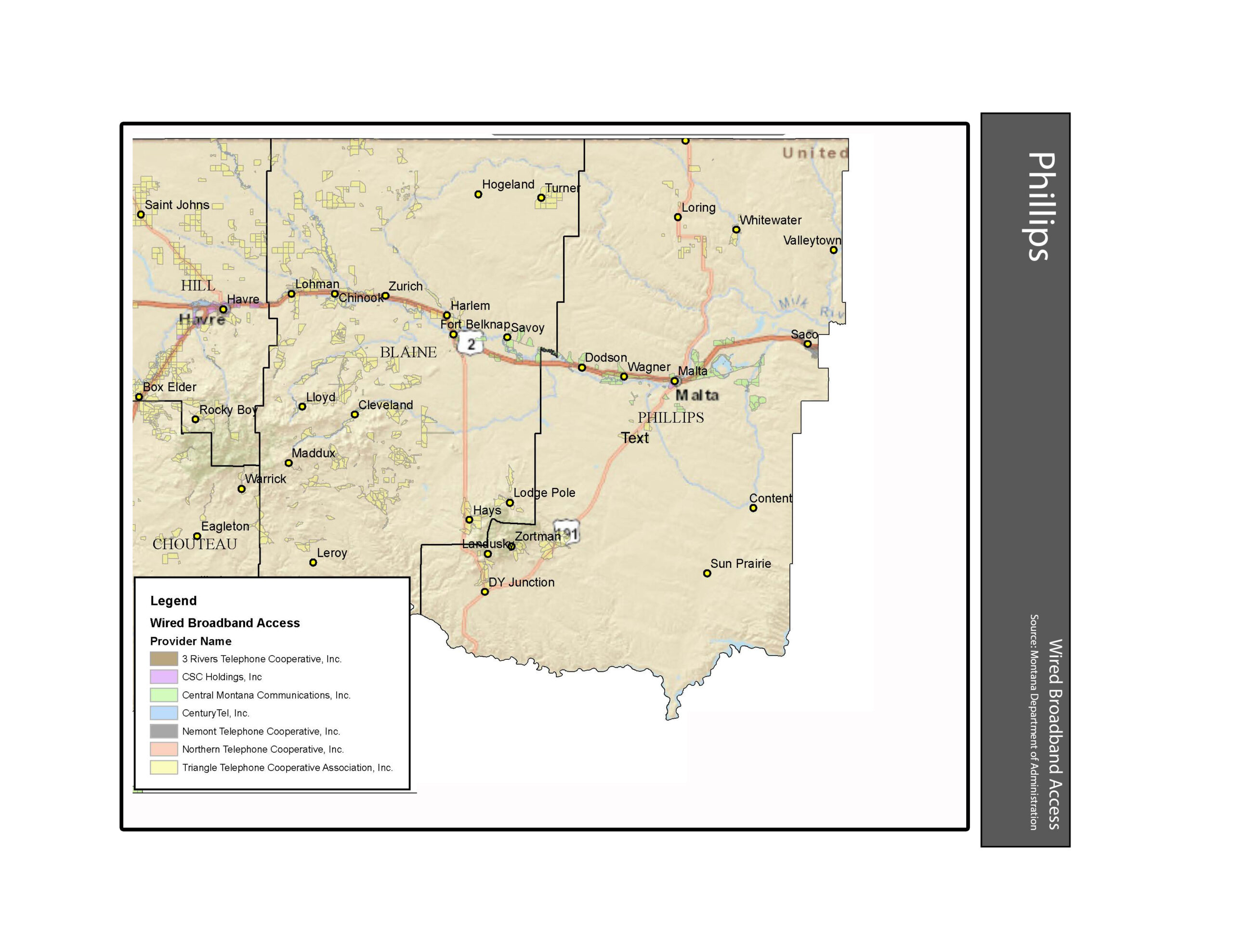
- Wired Broadband Access Phillips County
-
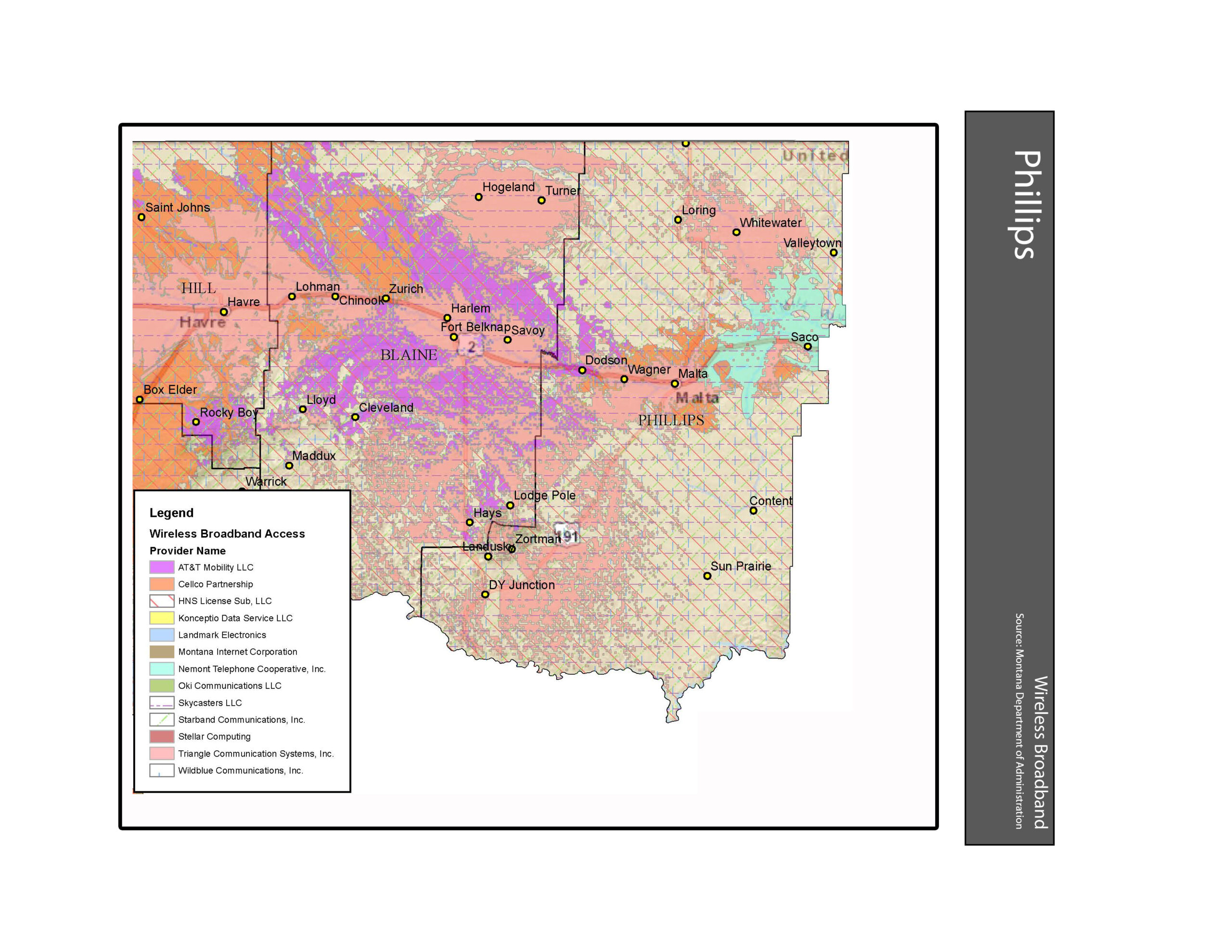
- Wireless Broadband Access Phillips County
Housing Condition Maps
-

- Content Housing Conditions
-
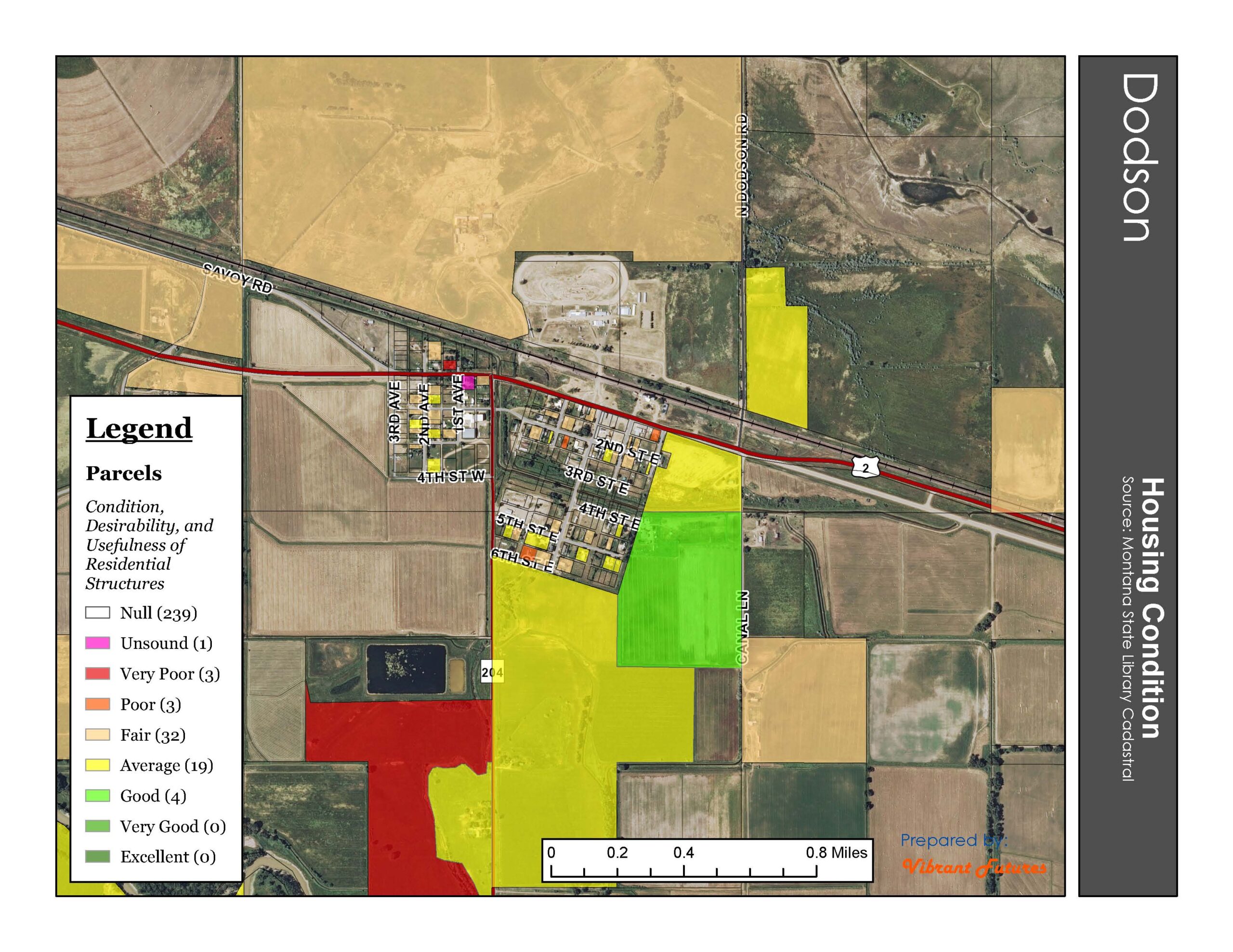
- Dodson Housing Conditions
-
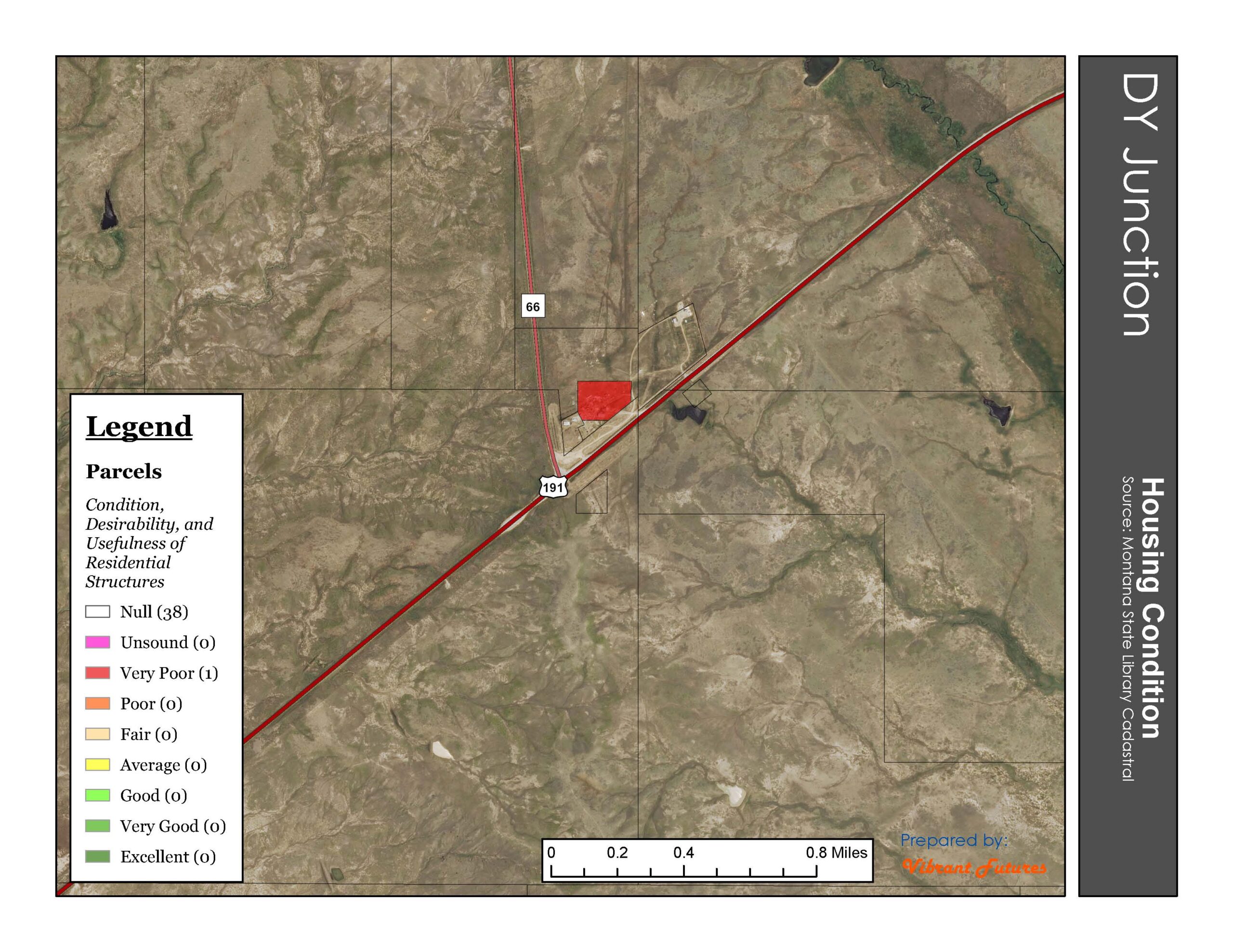
- DY Junction Housing Conditions
-
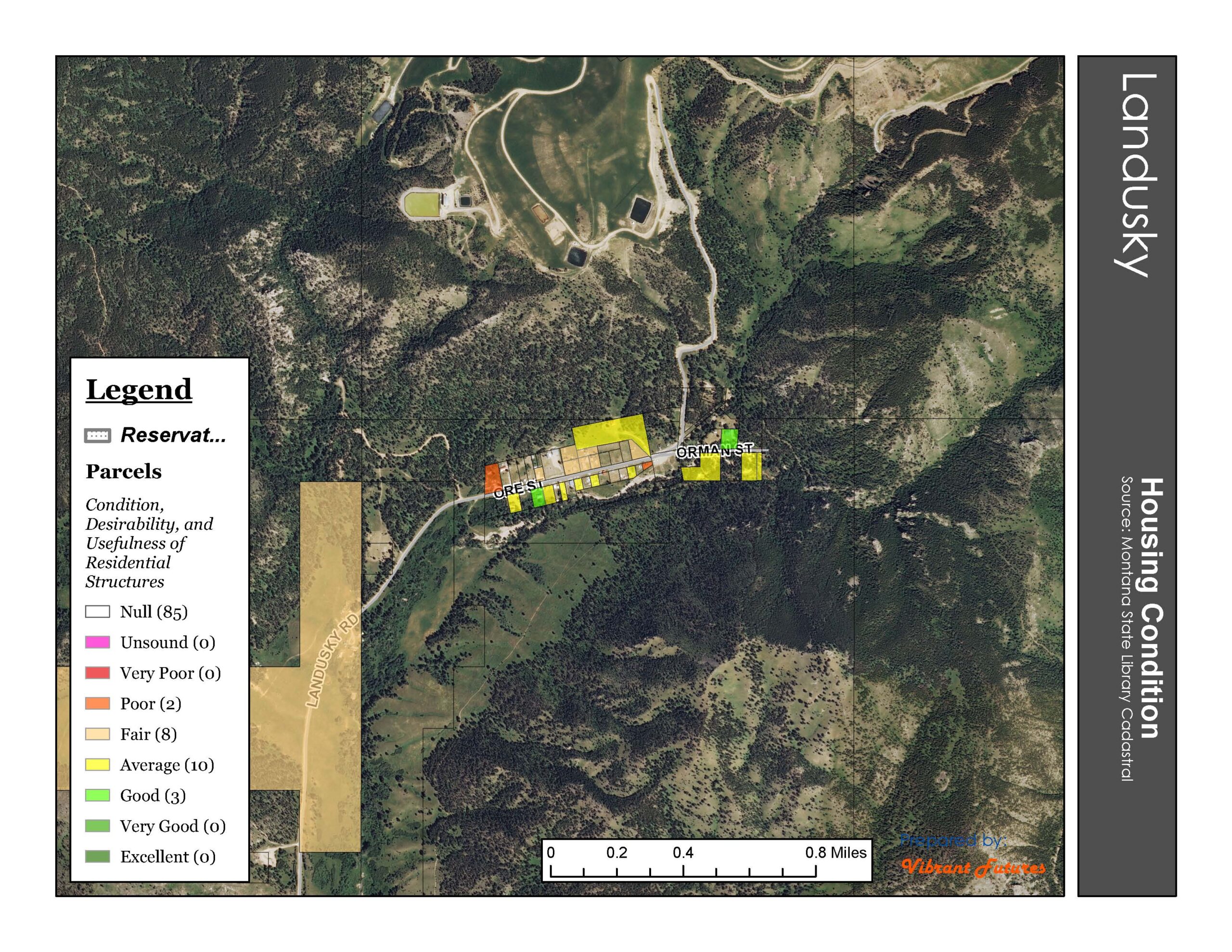
- Landusky Housing Conditions
-
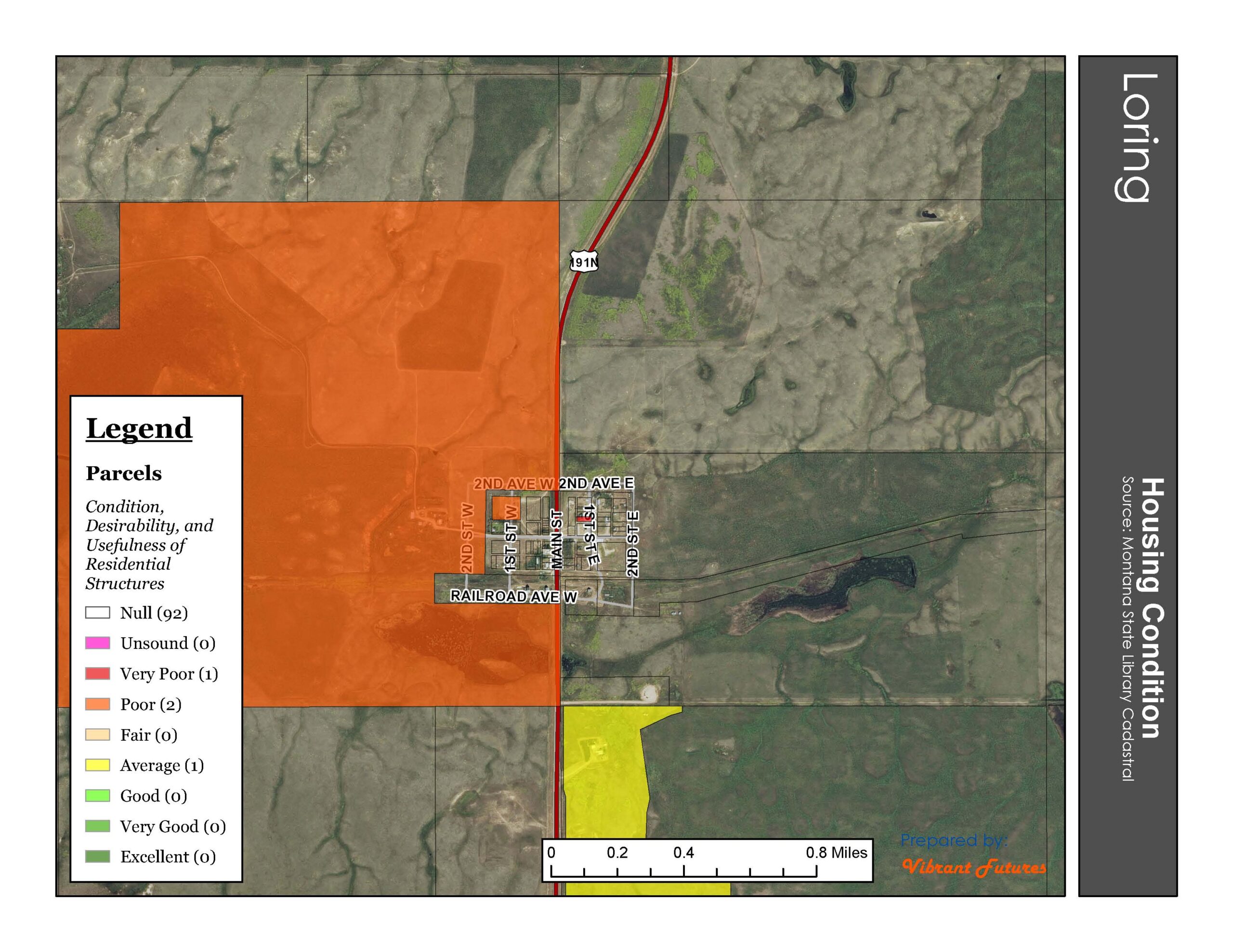
- Loring Housing Conditions
-
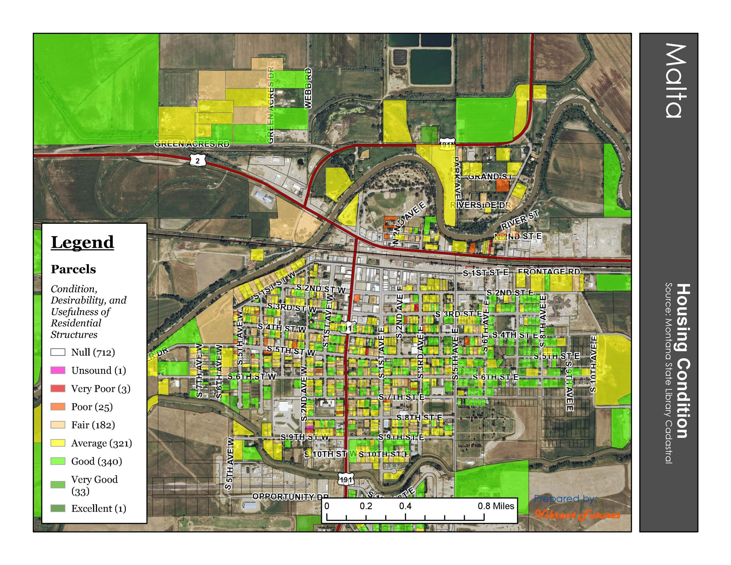
- Malta Housing Conditions
-
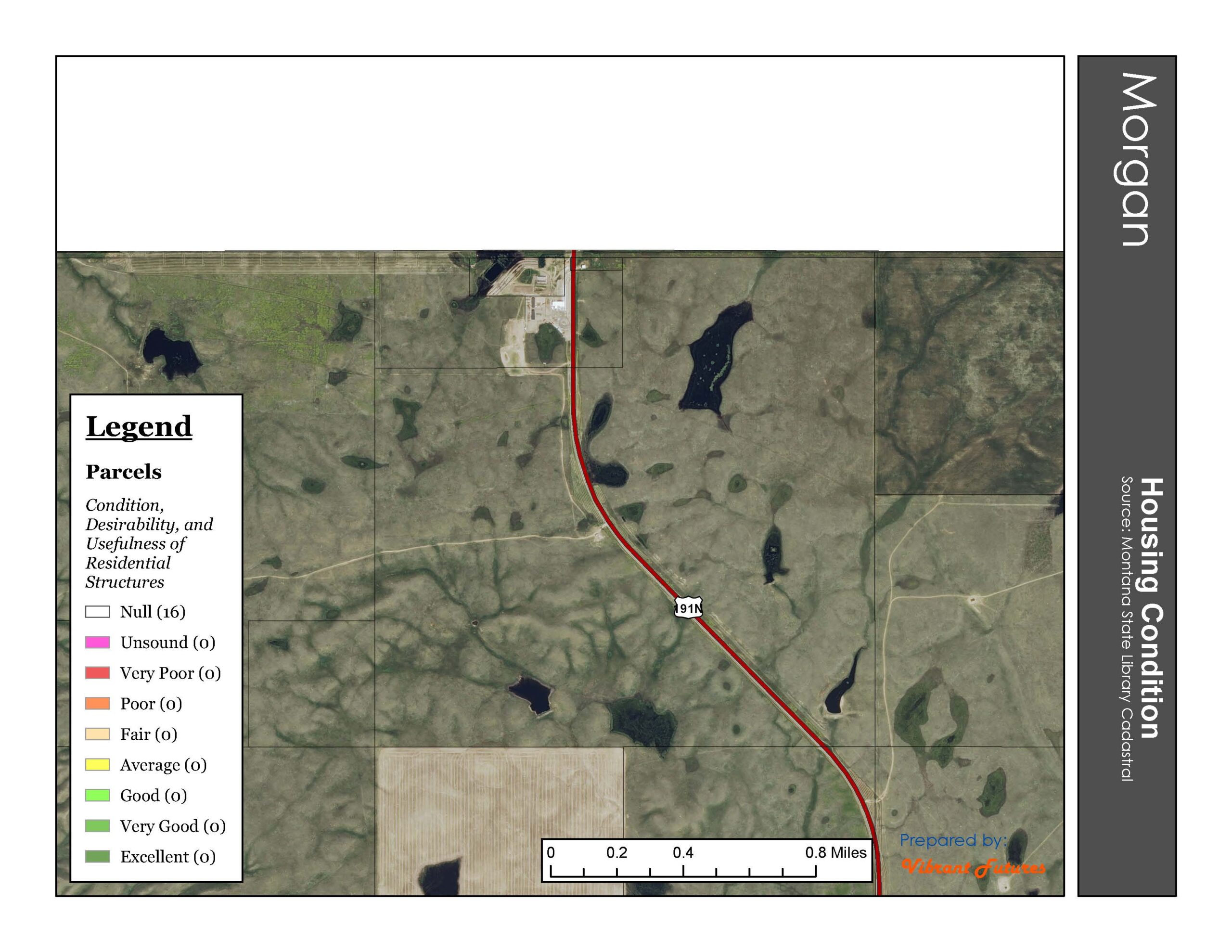
- Morgan Housing Conditions
-
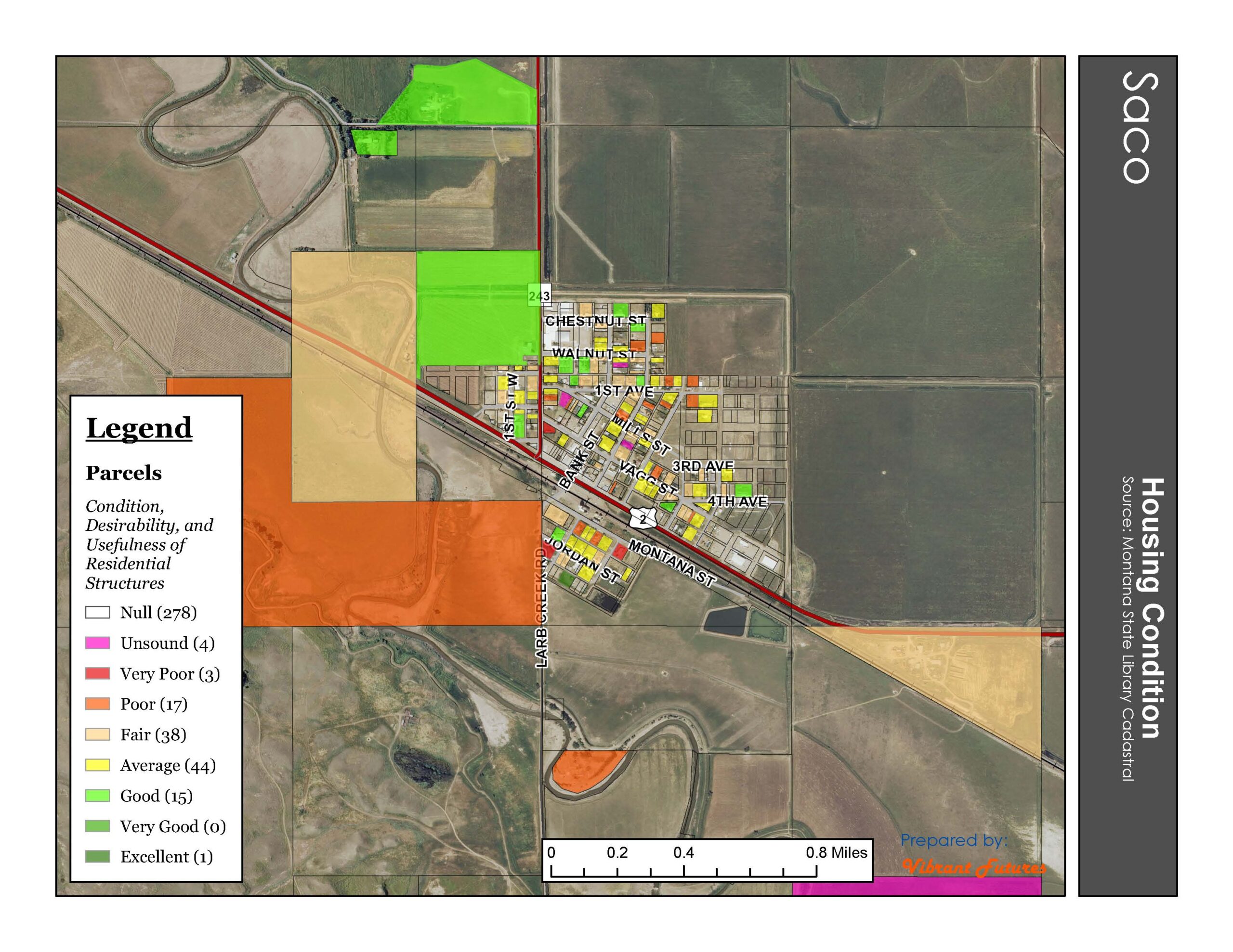
- Saco Housing Conditions
-
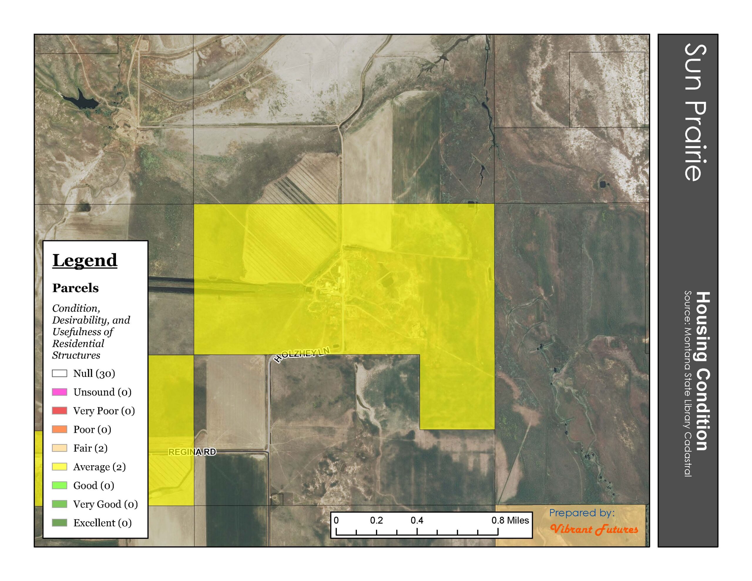
- Sun Prairie Housing Conditions
-
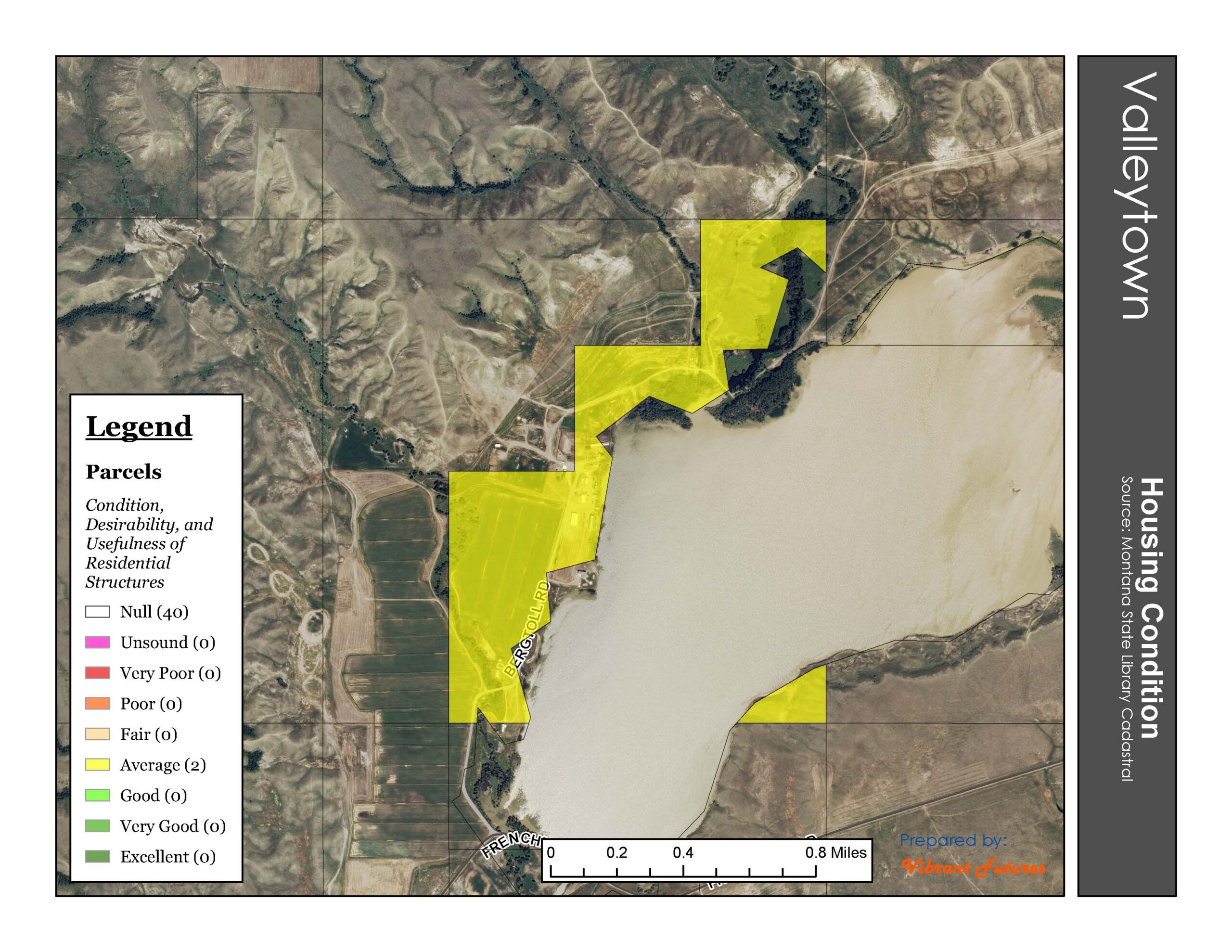
- Valleytown Housing Conditions
-
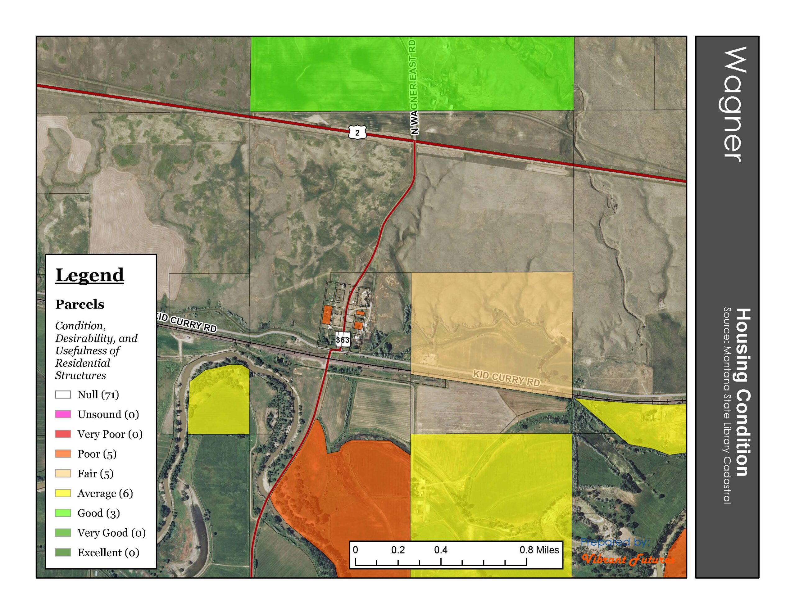
- Wagner Housing Conditions
-
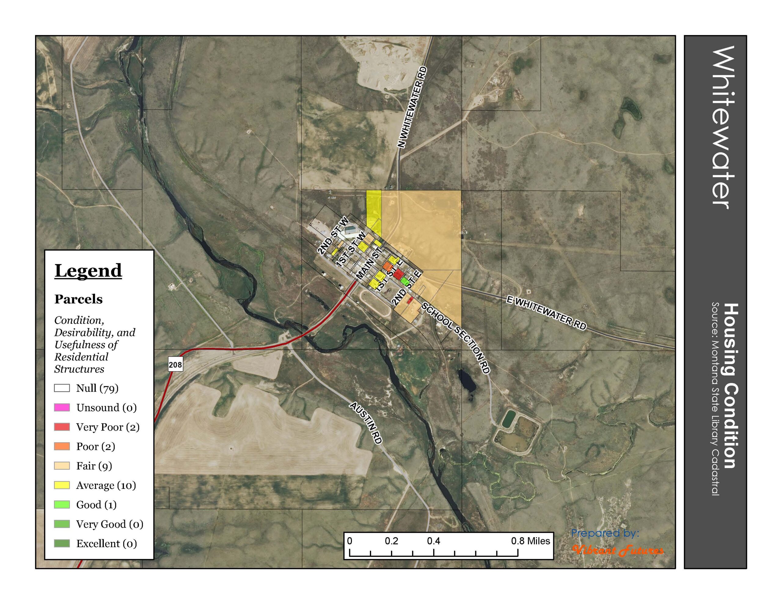
- Whitewater Housing Conditions
-
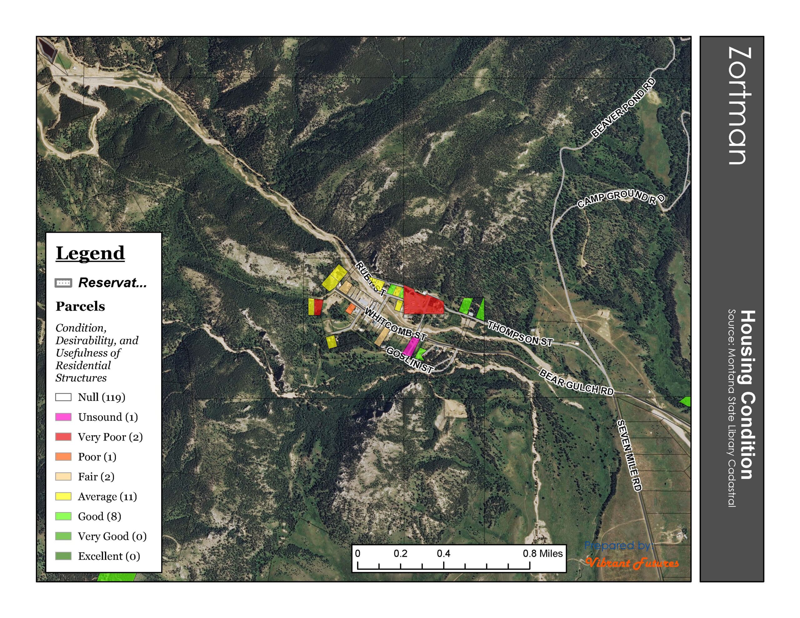
- Zortman Housing Conditions
Tags: Content, Dodson, DY Junction, Landusky, Loring, Malta, map, Morgan, Phillips County, Sace, Sun Prairie, Valleytown, Wagner, Whitewater, Zortman